It’s been a cold, windy couple of days across North Georgia. We’ll see some rapid warming over the next couple days.
First up, dry weather will continue on Friday with partly to mostly cloudy skies at times. Winds will finally turn much lighter, although they could still gust to 10-15MPH, especially during the afternoon. An isolated shower is possible on Friday night, but chances for any one location are low.
Saturday will be by far the nicest day of the weekend. Some clouds are possible, mainly early morning and then late afternoon. However, flow from the southwest will allow temperatures to soar into the upper-60s/low-70s. Winds will once again increase on Saturday with gusts of 20-25MPH.
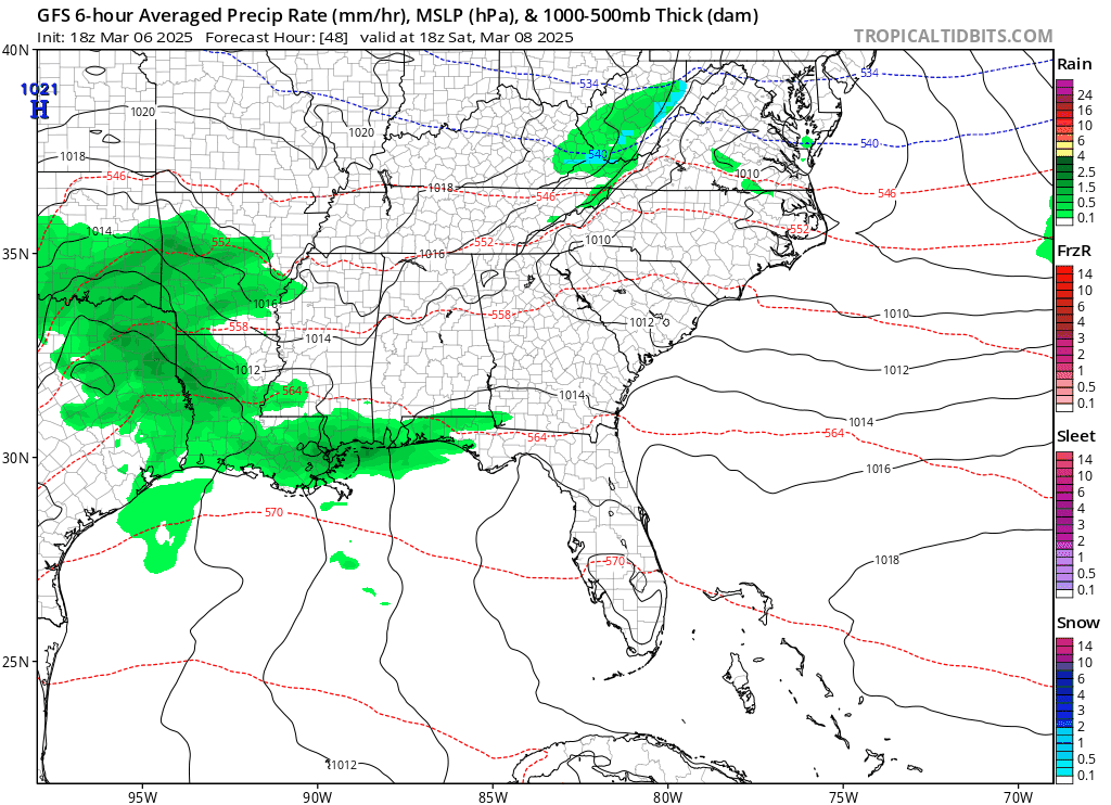
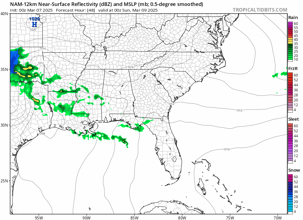
A low pressure system will move across the southeast on Sunday. Showers are likely early Sunday morning with more isolated showers through the afternoon. You can see both the GFS and NAM models below. The GFS shows a bit more widespread precipitation than the NAM does. Regardless, the rain shouldn’t be heavy. An upper level low could enhance precip on Sunday night into Monday morning before we dry out for the middle of next week. Have a great weekend!