
A Tornado Watch is in effect for parts of North Georgia as strong to severe storms move in from the west.
A Tornado Watch is in effect for Bartow, Catoosa, Chattooga, Cherokee, Dade, Dawson, Fannin, Floyd, Forsyth, Gilmer, Gordon, Lumpkin, Murray, Pickens, Union, Walker, and Whitfield Counties until 2AM Wednesday morning.
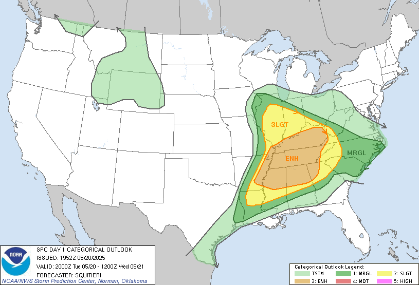
An Enhanced Risk (level 3/5) is in effect for much of the western part of the state, with a Slight Risk (level 2/5) for the rest of the region. Tornadoes, damaging winds and large hail are all possible as this line of storms moves through overnight. The line is expected to be weakening, but may persist further east than originally expected.
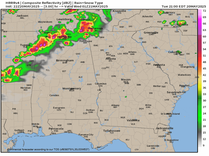
Strong to severe storms have been producing tornadoes and damaging winds to the west over the past several hours, and they will push into Georgia after sunset
The storms are expected to move into North Georgia as early as 9PM, with the bulk of the activity coming from 11PM-4AM. The worst is expected locally from 1-4AM across Northeast Georgia.
Stay weather aware tonight!


