
Strong storms and gusty winds are expected to impact North Georgia from Tuesday into early Wednesday morning. Some snow showers are possible behind the front.
Wind Advisory
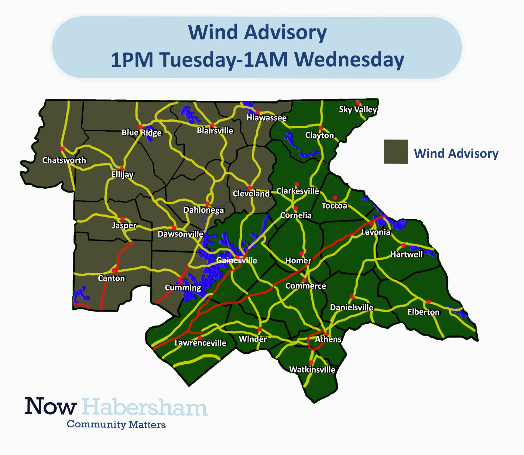
First up, a Wind Advisory is in effect for much of North Georgia on Tuesday into Tuesday night ahead of a strong storm system. Winds will pick up through the day Tuesday with gusts of 20-25MPH possible through the afternoon. Winds will turn stronger overnight as the front approaches with the higher elevations possibly seeing gusts up to 40-45MPH and the rest of the region seeing gusts of 30-40MPH. The advisory is currently in effect for the counties highlighted below from 1PM Tuesday to 1AM Wednesday, although I wouldn’t be surprised to see this extended.
The strongest winds through the day Tuesday will come along and north of the higher elevations, mainly over the advisory area. Outside the advisory area wind gusts of 20-25MPH are still expected. The strongest winds across the region as a whole are expected to come from 6PM Tuesday through 5-6AM Wednesday when the line of storms moves through. Regardless of any severe storms, a combination of strong gradient winds along the front and a small amount of instability will allow wind gusts of 40-50MPH to be possible region-wide as the heaviest rains push through early Wednesday morning from 3-6AM.
Strong storms
The Storm Prediction Center has placed all of North and Central Georgia under a marginal (level 1/5) risk for severe storms on Tuesday night.
A line of strong to severe storms is expected to develop early Tuesday and push east overnight. Fortunately for us, the timing of the line will significantly limit the potential for any severe storms. Weather models currently depict the line weakening as it moves through North Georgia from 3-6AM on Wednesday morning. Despite weakening, heavy rains and strong winds will still be possible. Total rainfall amounts of of 1/2-1″ will in just a few hour span Wednesday morning. Wind gusts of 40-50MPH will be possible even outside any surviving severe storms.
High elevation snow
As with any strong March storm, we will see a vast swing in temperature behind the front on Wednesday. As we move into Wednesday evening and overnight, snow showers are expected to kick off at the higher elevations. Areas like Sky Valley and Suches could see as much as 1″ before things taper off quickly after sunrise on Thursday. The best time for these snow showers will be from 7PM Wednesday to 7AM Thursday. No widespread problems are expected but higher elevation passes could become slick early Thursday so use caution if traveling at high elevation.
Stay tuned for the latest updates on this dynamic storm system.


