Hurricane Florence is expected to reach the southeastern seaboard late Thursday and forecasters are issuing dire warnings ahead of the storm.
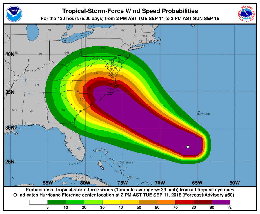
The National Hurricane Center issued a hurricane warning for the coast from Duck, North Carolina, and the Albemarle and Pamlico Sounds, to the South Santee River in South Carolina. The warning area includes Charleston, South Carolina.
“This will be a storm that creates and causes massive damage to our country,” Federal Emergency Management Agency associate administrator Jeff Byard said Tuesday. “This is not going to be a storm that we recover from in days.”
More than 1 million people are under mandatory evacuation orders in Virginia, South and North Carolina. Despite that, some are choosing to stay.
Forecasters warn of potentially catastrophic flooding and destructive winds in the Carolinas and Applachians. With the storm’s changing trajectory, there’s concern now it could impact our area.
“It’s a very, very powerful storm. The strongest we’ve seen in the Atlantic definitely this year and certainly in the past several,” says Now Habersham forecaster Tyler Penland.
“The weather models have taken a turn for the worse across North Georgia,” Penland says. “For the next several days Florence will continue to move west northwest. Once it gets to the coast this hurricane is not going to be driven anywhere, it’s going to just sit there and spin.” He says where it makes landfall and how it turns inland will determine how significant an impact Florence will have on Northeast Georgia.
As of late Tuesday
Current models indicate the extreme northeast part of the state could see up to a foot of rain of rain and possible wind gusts in the 40-50 mph range. “(Even) gusts of 30 mph could cause some pretty serious problems with how wet the ground is and with all the leaves on the trees,” Penland says.
Still, he cautions there are a lot of unknowns and things could change. He says the local impact of Florence depends on where she makes landfall. Some current weather models suggest the storm will hit slightly farther north on the coast and follow a more northerly direction as it moves inland. Other models suggest it will hit farther south in Carolinas and move in a westerly direction up into Tennessee.
Depending on those slight variations, Northeast Georgians could see anywhere from 2 inches to a foot of rain. “It’s a big window,” he says, “but be prepared for landslides, flooding and strong winds.”


