
Editor’s Note: In October, Now Habersham weatherman and outdoor feature reporter Tyler Penland traveled out West to watch and report on the annular Ring of Fire eclipse. Traveling with his father, he witnessed many other amazing sights along the way. This is the second in a series of photo essays Tyler has written about their western adventures.
Leaving Colorado National Monument, we found ourselves quickly exiting the state of Colorado. Utah would become the second state we would visit on our trip out West and it started off very, should we say, fast.
Living in the mountains, we are used to speed limits of 45-55 MPH in most places. Even the interstates max out at 70 MPH. Out in the middle of nowhere, Utah, however, they like to live life in the fast lane. An 80 MPH speed limit made for an exciting drive through the wide open spaces.

You could easily see what seemed like a hundred miles in any direction, with the next major mountain being the La Sal range, which was covered in snow. During the drive, I looked down at one point while not paying much attention and realized I was doing 95 MPH but it certainly seemed like I wasn’t moving very quickly at all. Certainly, a strange experience, and I won’t be driving 95 MPH again anytime soon, anywhere that isn’t on a racetrack.
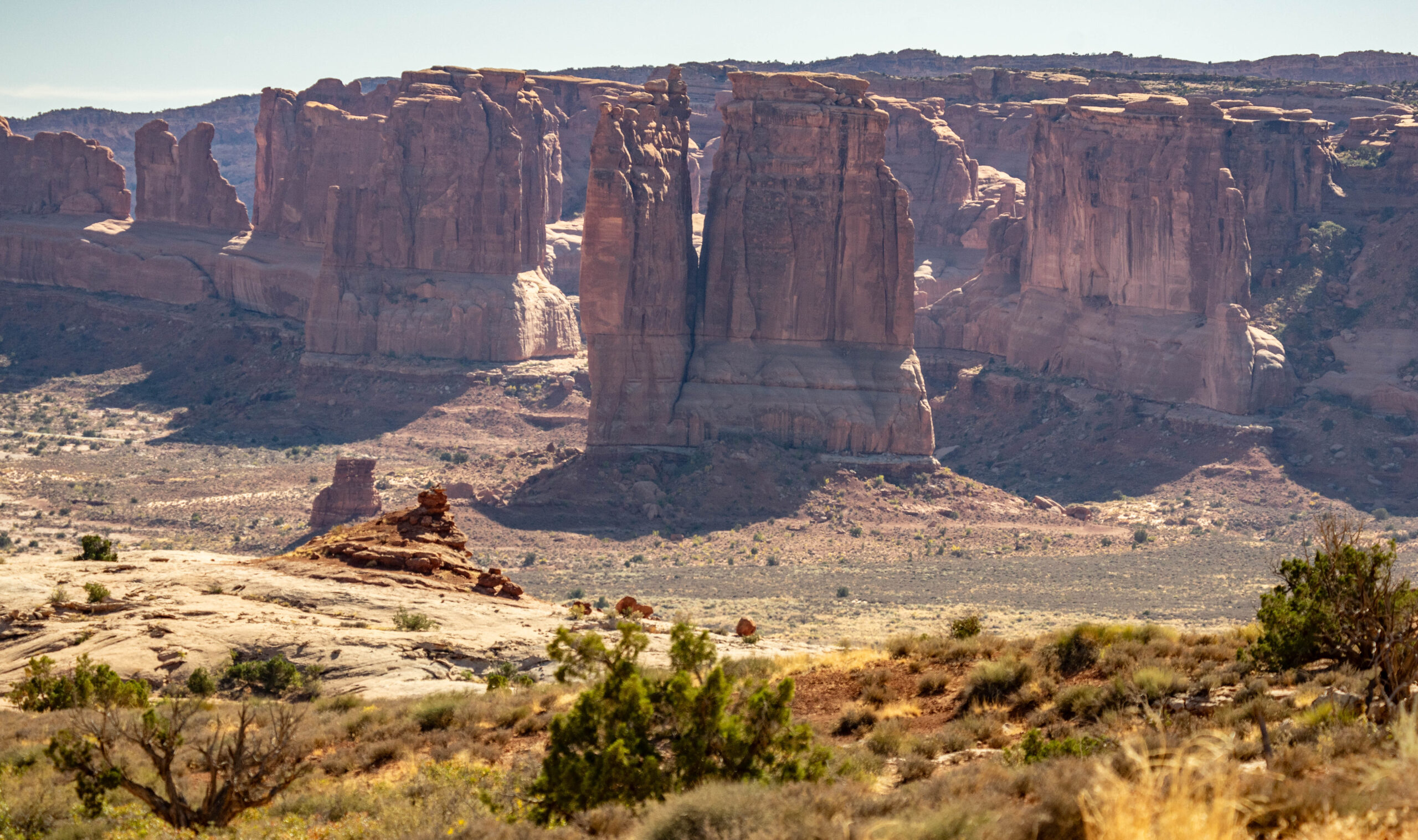
We arrived at our next destination by mid-afternoon at one of the most famous National Parks in the country: Arches National Park. The geography of this region wasn’t wildly dissimilar to the Colorado National Monument we had just left with towering rock faces and spires all around. These spires and outcrops look otherworldly, especially when placed with the towering La Sals in the background.

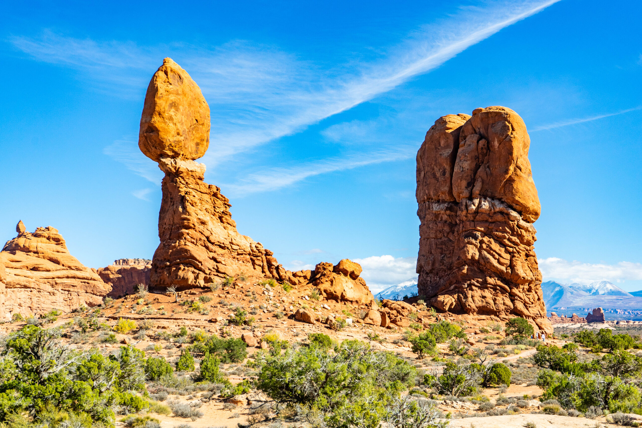
The main road through the park passes by many beautiful spots but we were on a time crunch and had to limit our sightseeing. Our first stop was Balance Rock. This 126-foot tall rock spire appears to have a large boulder balanced on top of it.
In reality, the rock is attached but has just eroded this way because there are two different rock strata. The one on top is much harder than the one beneath, so it erodes slower. Up until 1976, Balance Rock had a smaller sister rock, but it collapsed.
One day, the 3,600-ton rock left standing will also collapse, and it will likely make a big racket when it does.
I got one of my favorite photos of the trip from the trail around this spot. The park is obviously best known for its namesake: Arches. From the Balance Rock trail, you get a wonderful view of a large arch in the distance. On this particular day, it was framed by the snow-covered mountains behind and looked almost fake.

After spending a short time at Balance Rock, we moved on to our main goal for the visit.
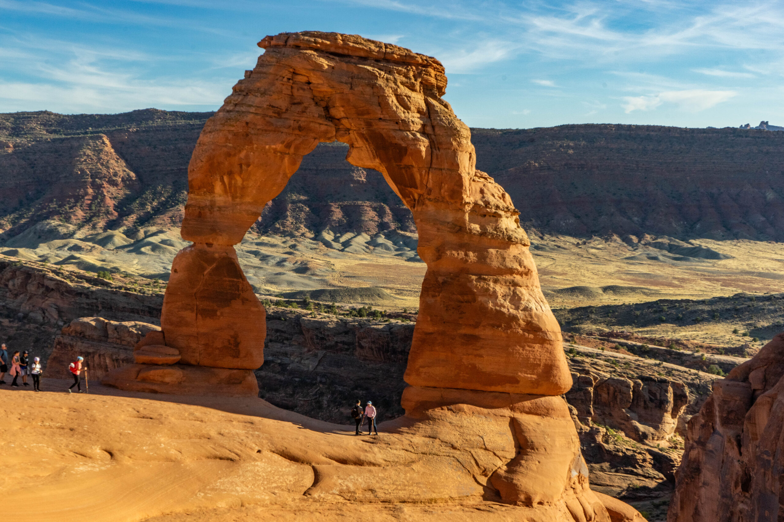
There is one arch in the park that almost everyone has seen a photo of at one point. It is no doubt the most photographed and famous arch in the world and even appears on the Utah license plate.
Known as Delicate Arch, this massive sandstone arch is freestanding and a spectacular 52 feet tall. It is nearly impossible to get a photo of this arch without people in it, but with a little patience, you might get lucky.

In fact, having people in the photo isn’t necessarily a bad thing. It is nearly impossible to accurately capture the scale of the arch without a person in the shot. The below photo gives some idea of just how big it is.
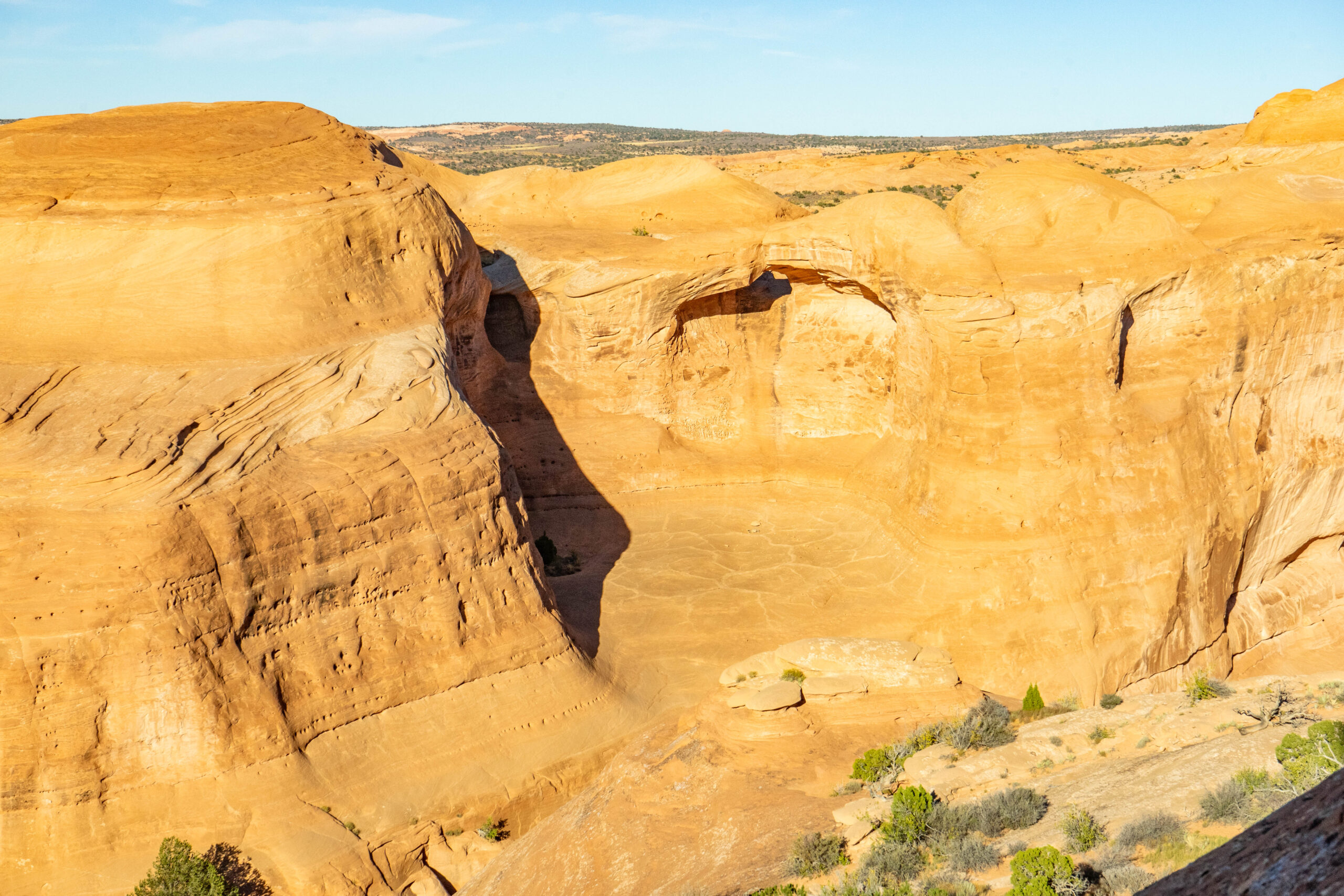
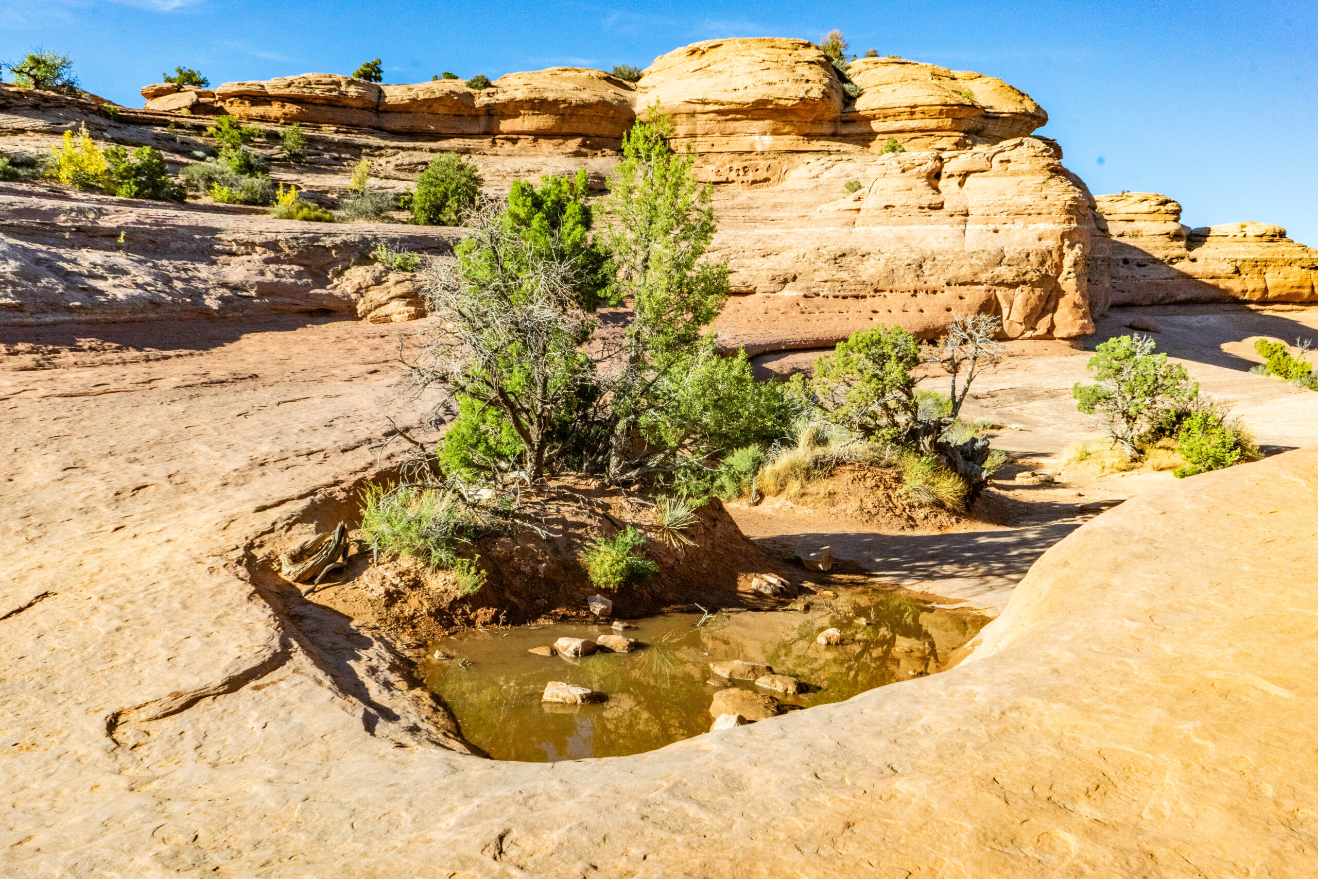
The landscape in the area immediately around Delicate Arch is quite fascinating. The sandstone is worn smoothly in some spots and rough in others. Just behind the arch, you can see a half dome worn into the surrounding cliffside. Beneath it, the cracked sandstone is untouched by humans and looks like it belongs on the moon rather than the Earth.
The hike up to Delicate Arch passes by the only water we saw in our time in the park. A very small pond was giving water to some nearby plants and one of the taller trees we saw this day: quite something considering what we are used to in North Georgia.
After visiting Delicate Arch, it was nearly dark so we made a quick jaunt to a spot I had noticed on the way up to catch the sunset and put an end to our first full day of exploring.
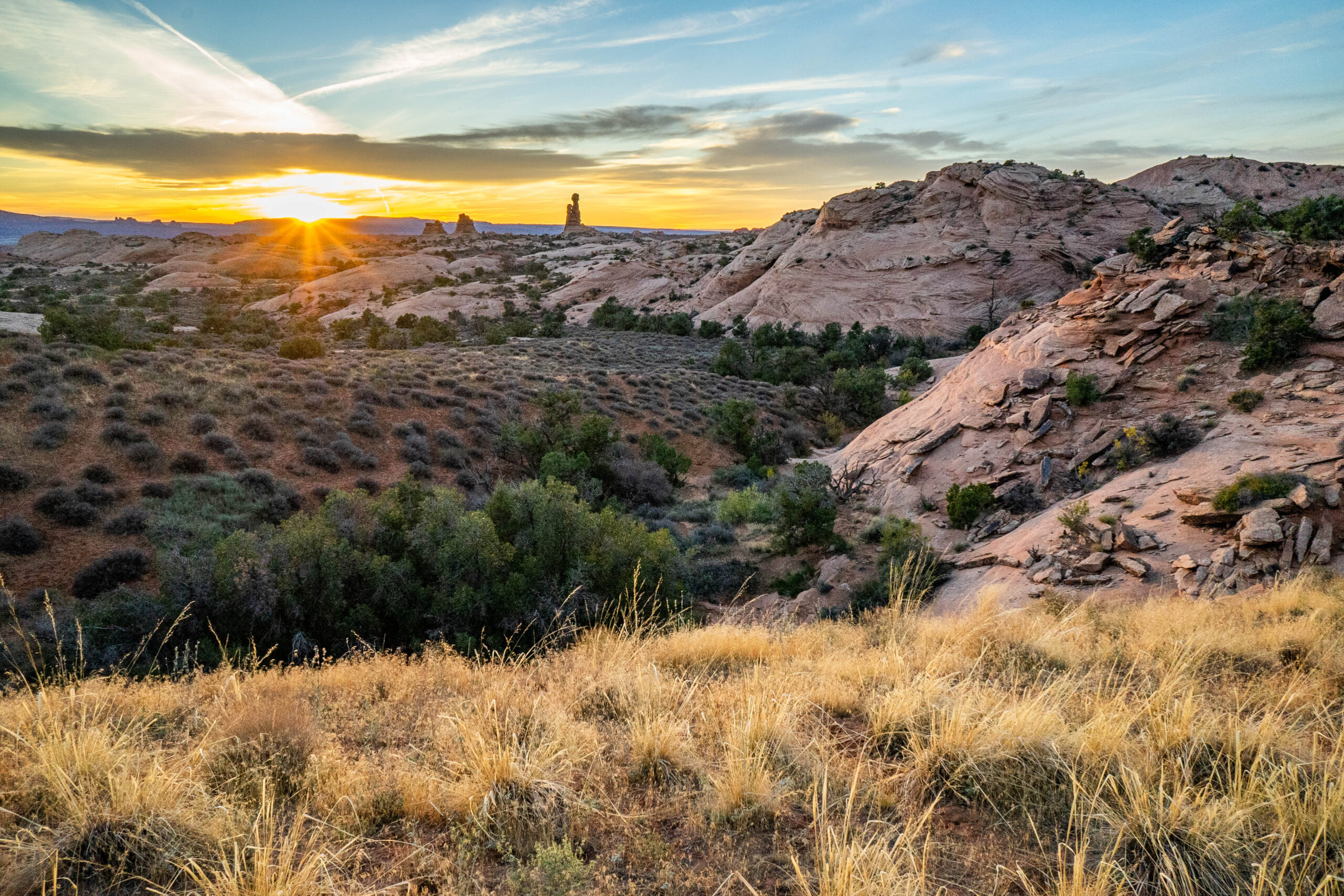
We had a long drive ahead of us to Farmington, New Mexico, where we would see the Ring of Fire eclipse the next morning.
SEE ALSO


