
The phrase “go west, young man” originated in the mid-1800s and has been attributed to many people. While uncertainty in the author remains, there is no doubt the phrase came out of the westward expansion of the United States. As more and more people moved to the country, the East Coast became more crowded, prompting a massive move west for those seeking adventure or prosperity.
“Manifest destiny” was the phrase most of us learned in school.
Having grown up solidly on the East Coast and being mildly obsessed with the outdoors, I had always dreamed of visiting some of the beautiful geography of the western half of the country.
Sometime this past summer, I called my dad and asked if he wanted to go west. The main goal for the trip would be to see the annular Ring of Fire eclipse, but we’d also spend some time seeing the sights.
A few months later, we found ourselves on an airplane heading out of Charlotte, North Carolina, on our way to Denver, Colorado.

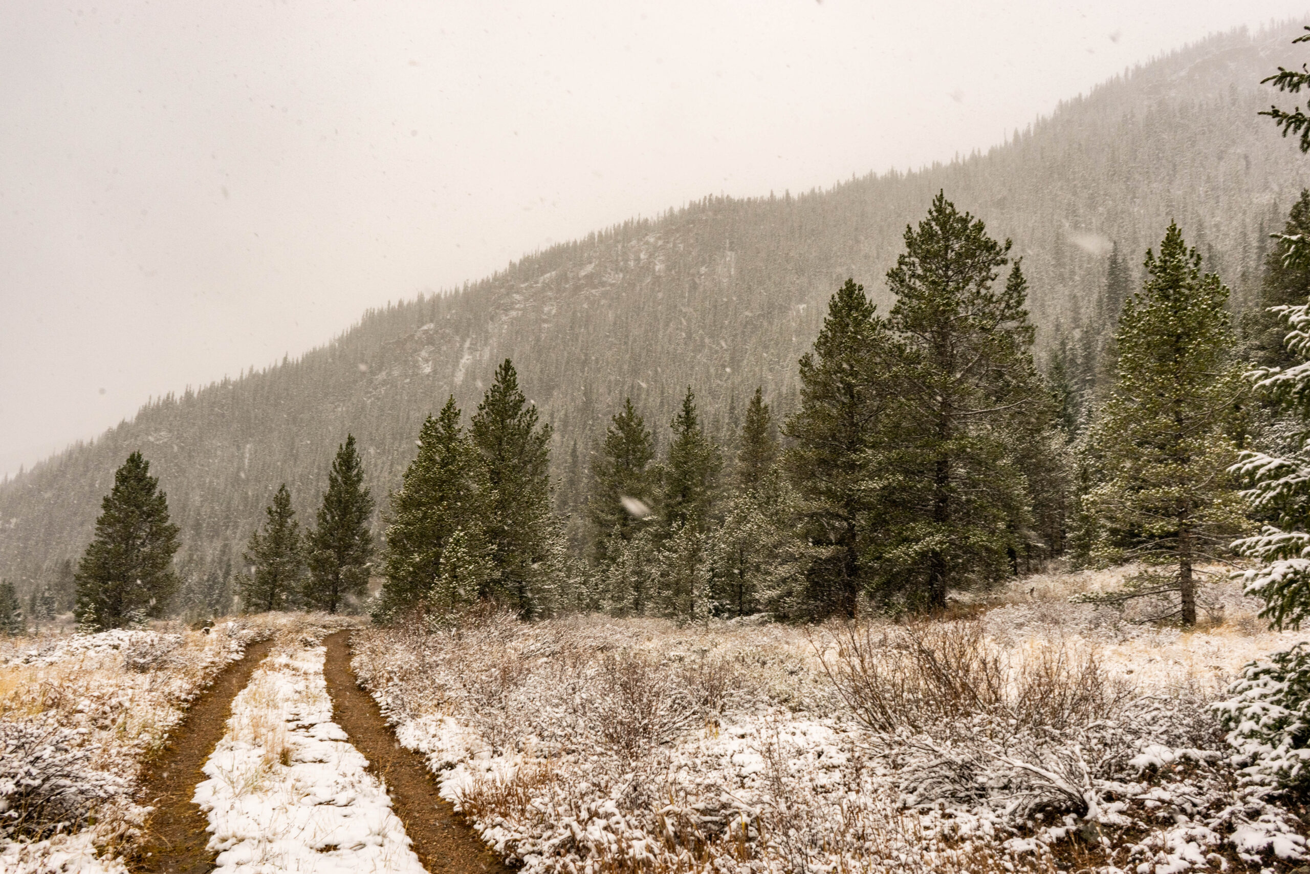
Upon landing, we had a long drive ahead of us on I-70 toward Grand Junction. The highest elevation either of us had been to up to this point was only 6,684ft at the top of Mt. Mitchell, the highest point east of the Mississippi. Our trip this time would take us a bit over 11,000ft. As we climbed, we quickly changed seasons from fall to winter as snow fell across the higher elevations.
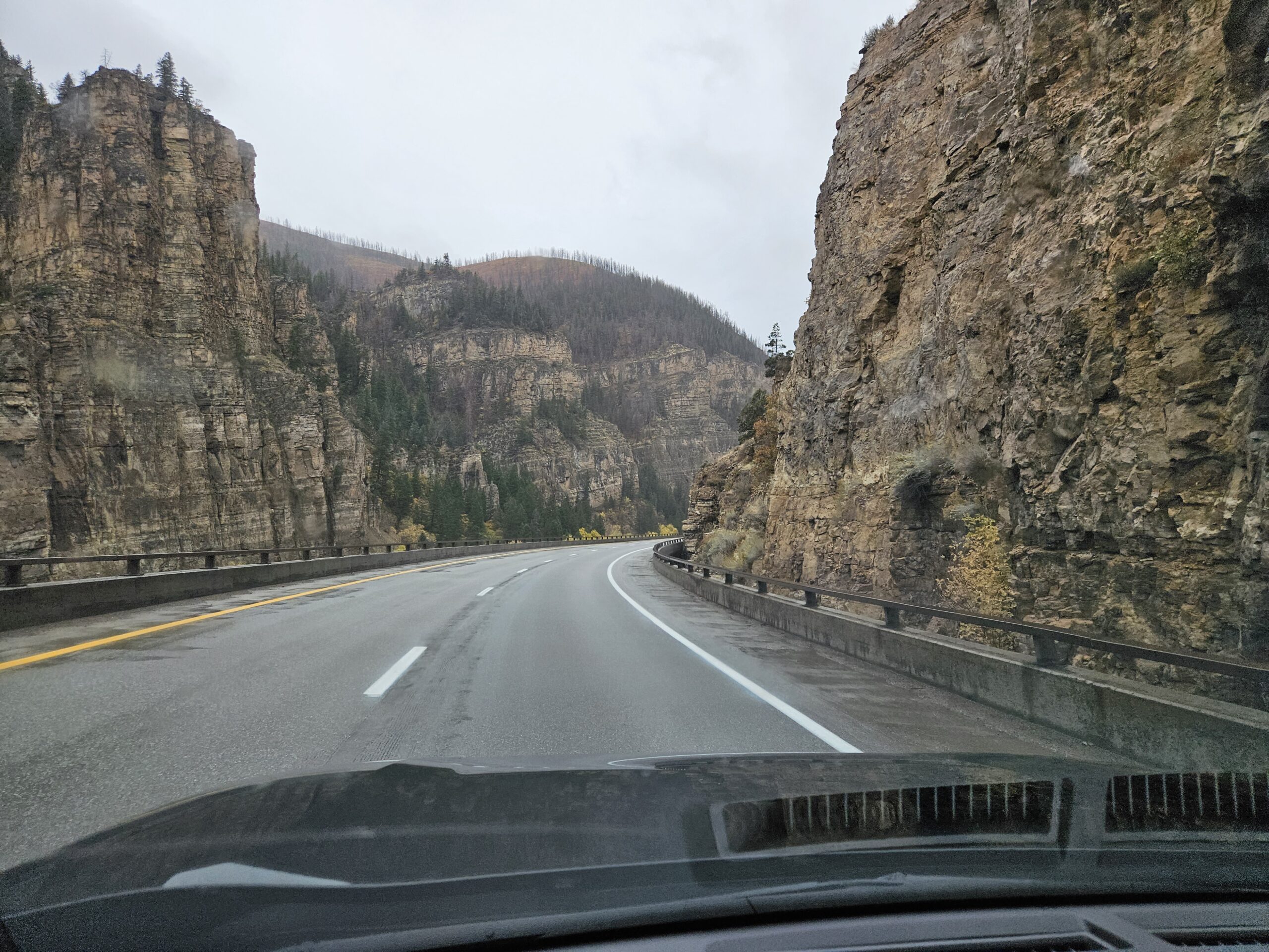
One of the cooler sections of I-70 – and by far the coolest section of road I have ever driven – goes through Glenwood Canyon. Down this section of highway, the road goes through an actual canyon with towering cliffs on either side. It truly is a marvel and wild to see in person.
I can say this about pretty much all of this trip: photos don’t do it justice.
After a quick stop at Walmart for supplies, we pulled into our first stop on the trip – Colorado National Monument.
The monument was designated over 100 years ago in 1911. John Otto can be thanked almost exclusively for creating this monument area. He was the primary person to build trails into these difficult-to-access canyons.
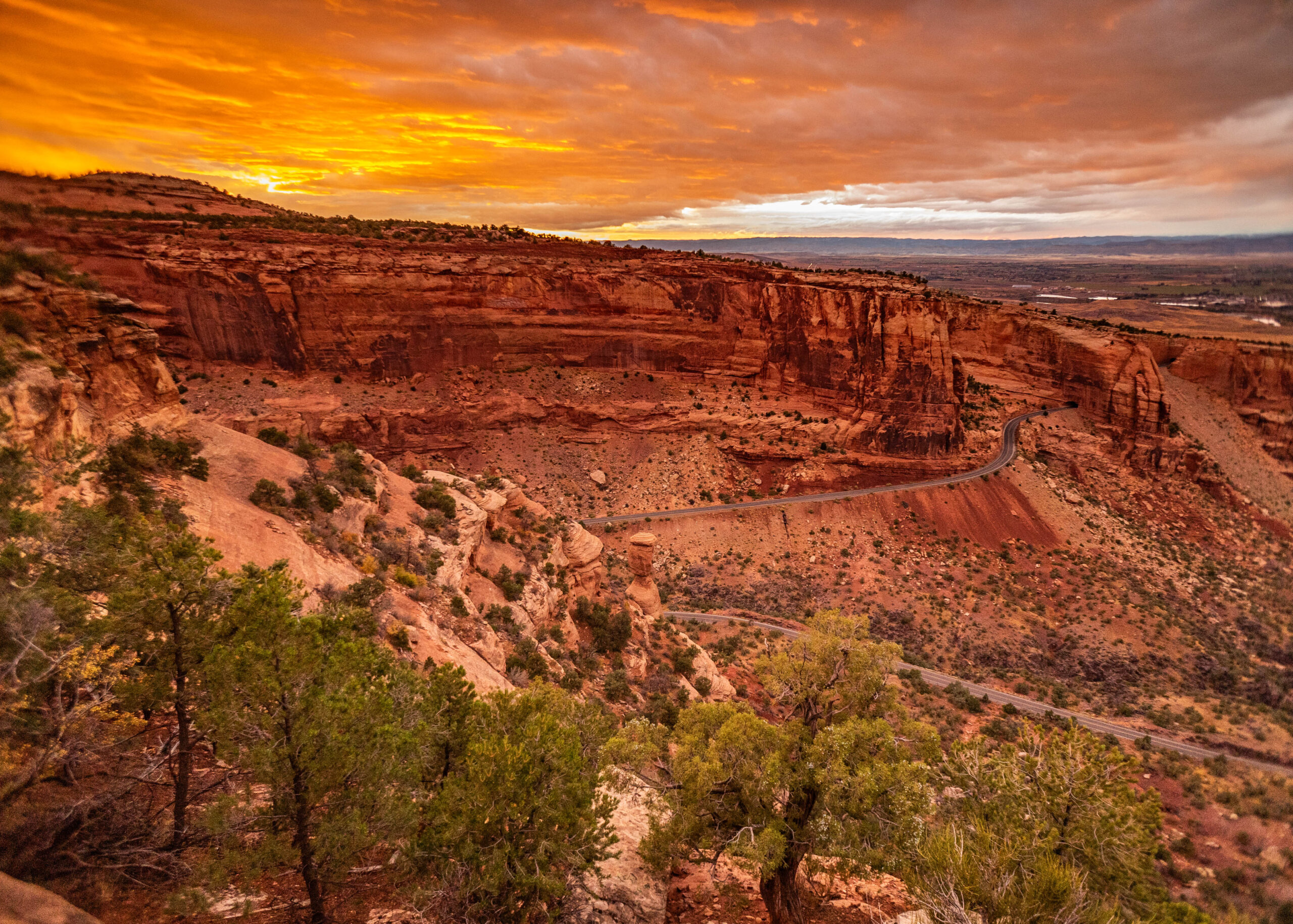
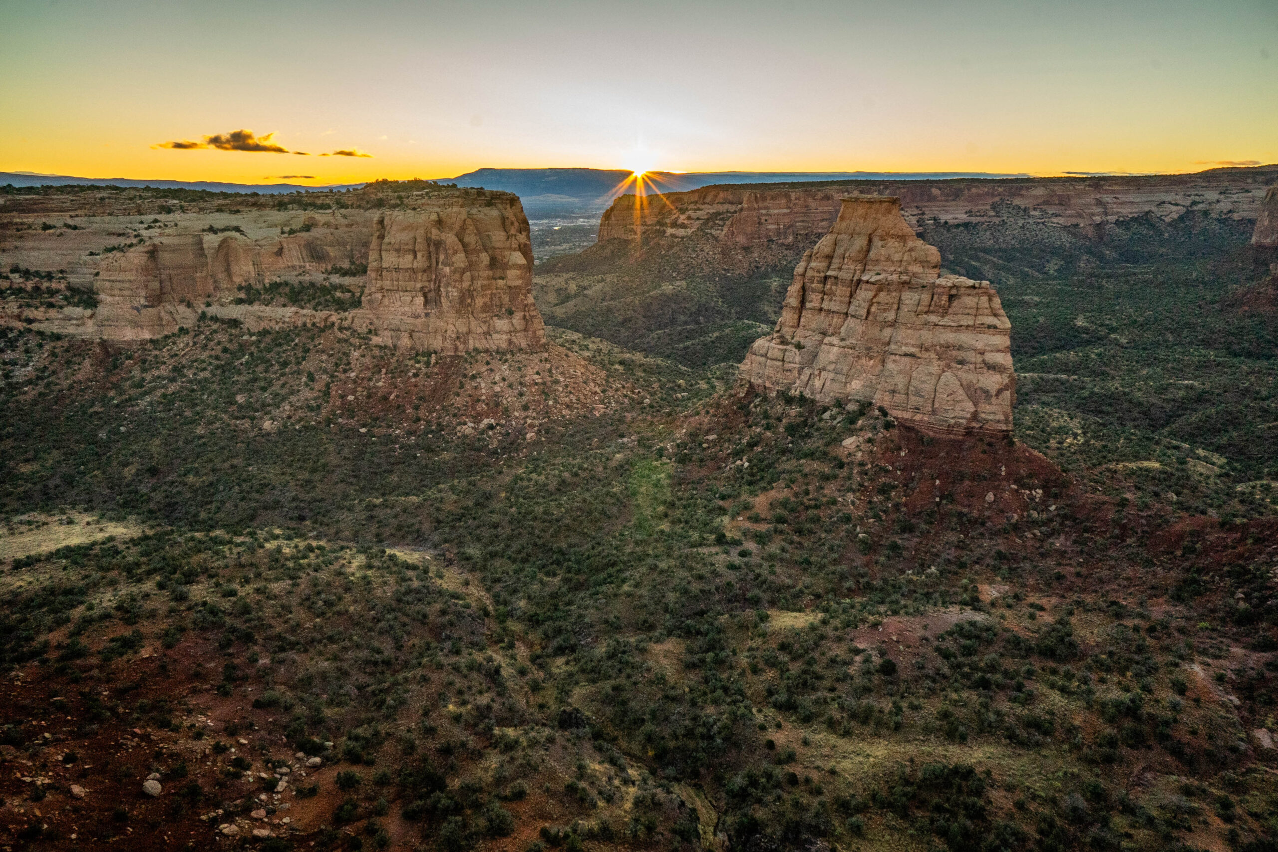
On our first night in Colorado, we stayed in the Saddlehorn Campground and witnessed this absolutely incredible sunset just a few steps away from our tents.
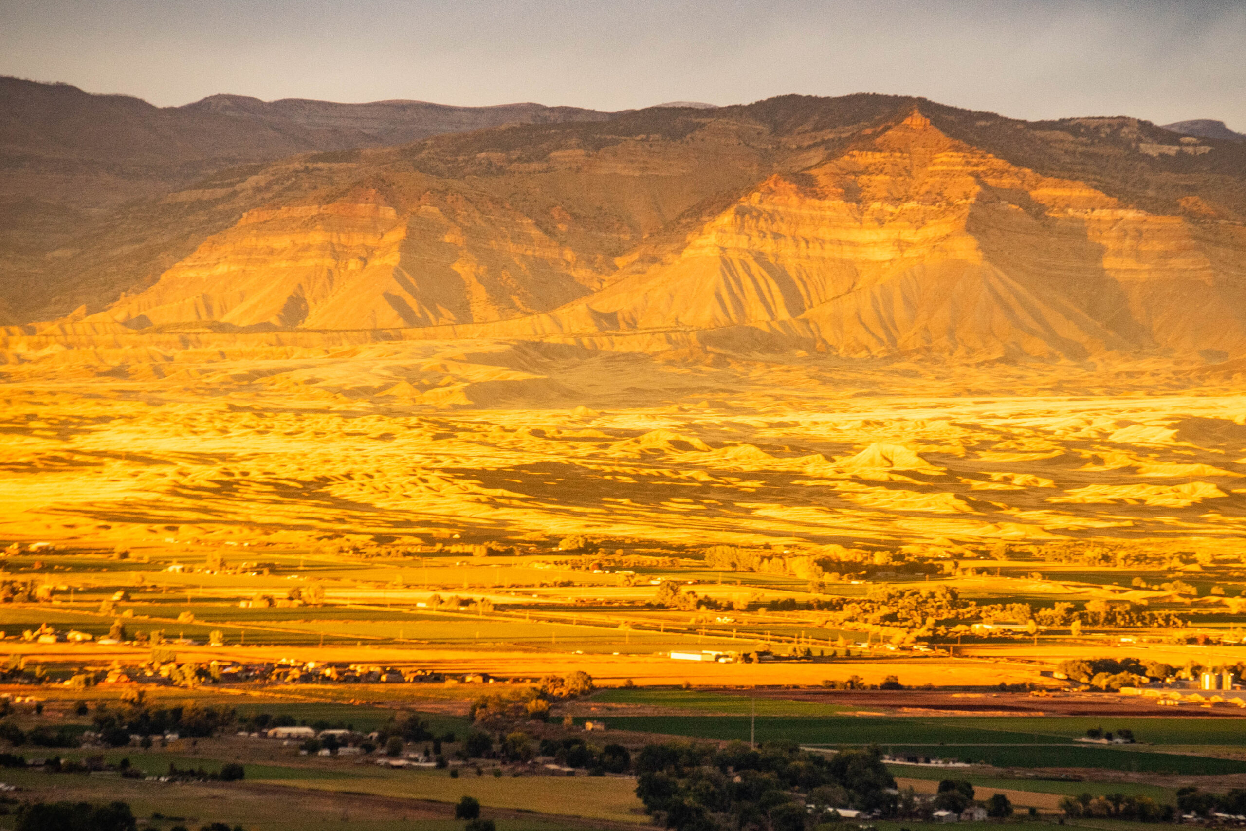
While the view towards the sunset was incredible, I turned around to see the sun glinting off the mesas on the other side of Grand Junction. These mesas are around 30-40 miles away. It is incredible how clear the air is out there.
After the park was created, a road was eventually built and it is one of the most scenic in the country’s western half.
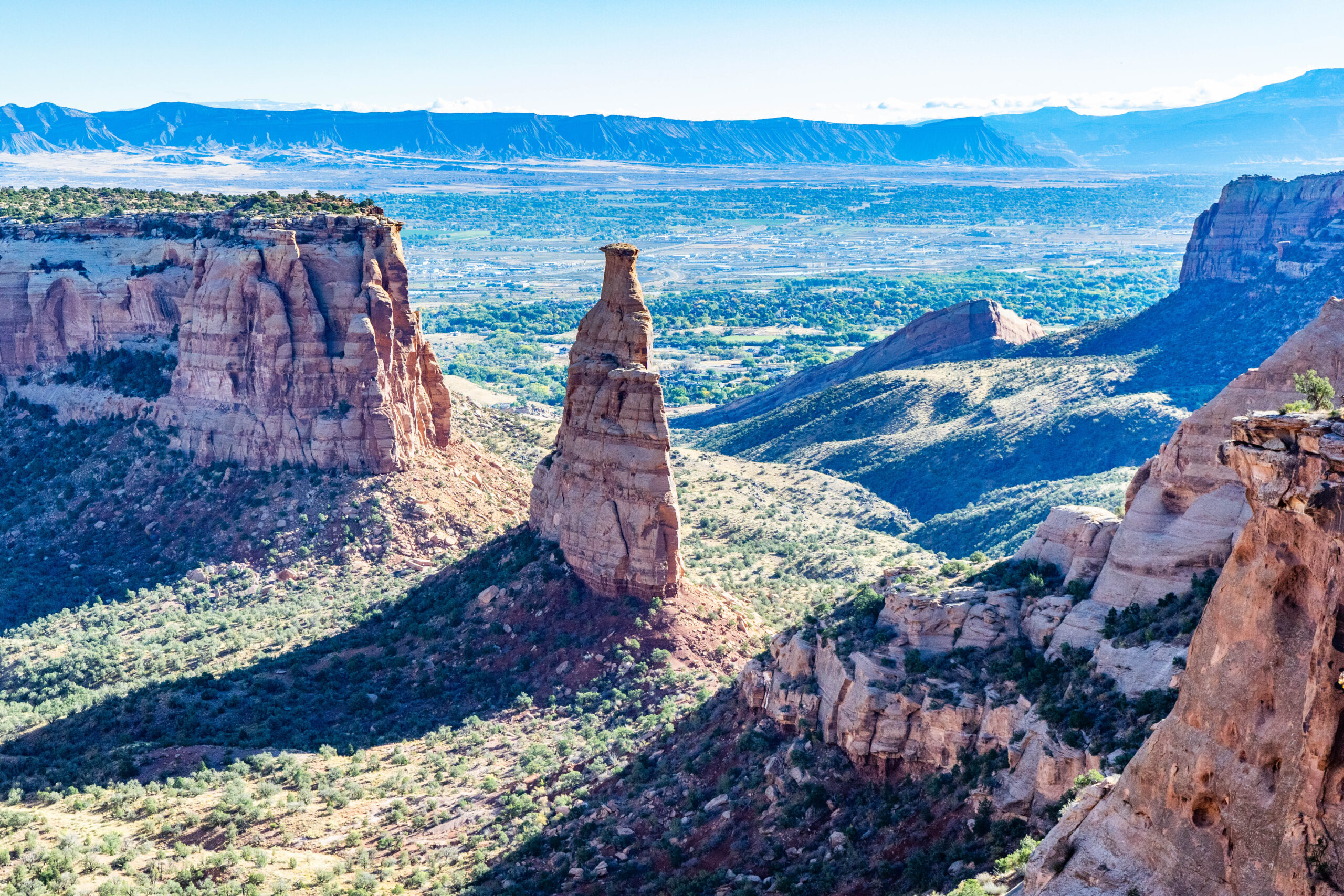
Rim Rock Drive is 23 miles long, and from it, you can see almost all of the monument and access numerous trails. “Otto’s View” is one of those trails, and it is where we watched the sun rise the following day. From here, you get an incredible view of the rock formations below.
We drove the entirety of Rim Rock Drive and made plenty of stops. At one of those stops, my dad happened to notice a lone desert coyote wandering amongst the low growth. After stalking it for a few minutes, I managed to catch it sizing me up in a gap in the shrubs. (I never did see Roadrunner.)

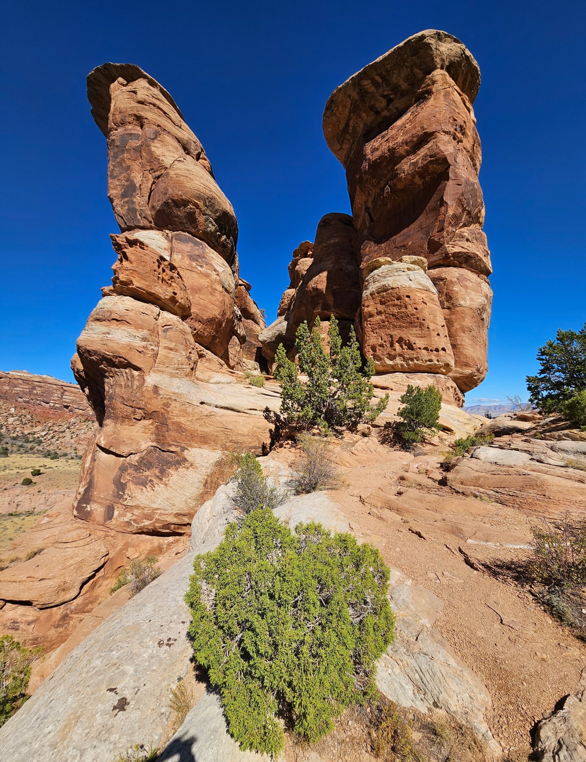
The red stone cliffs and spires of this area are absolutely incredible. The main spire is Independence Rock, visible from many points in the monument. First climbed by Otto himself, a tradition continues to this day of summiting the rock on July 4 and raising an American flag. The bushes and trees beneath give some sense of the scale of this giant rock.
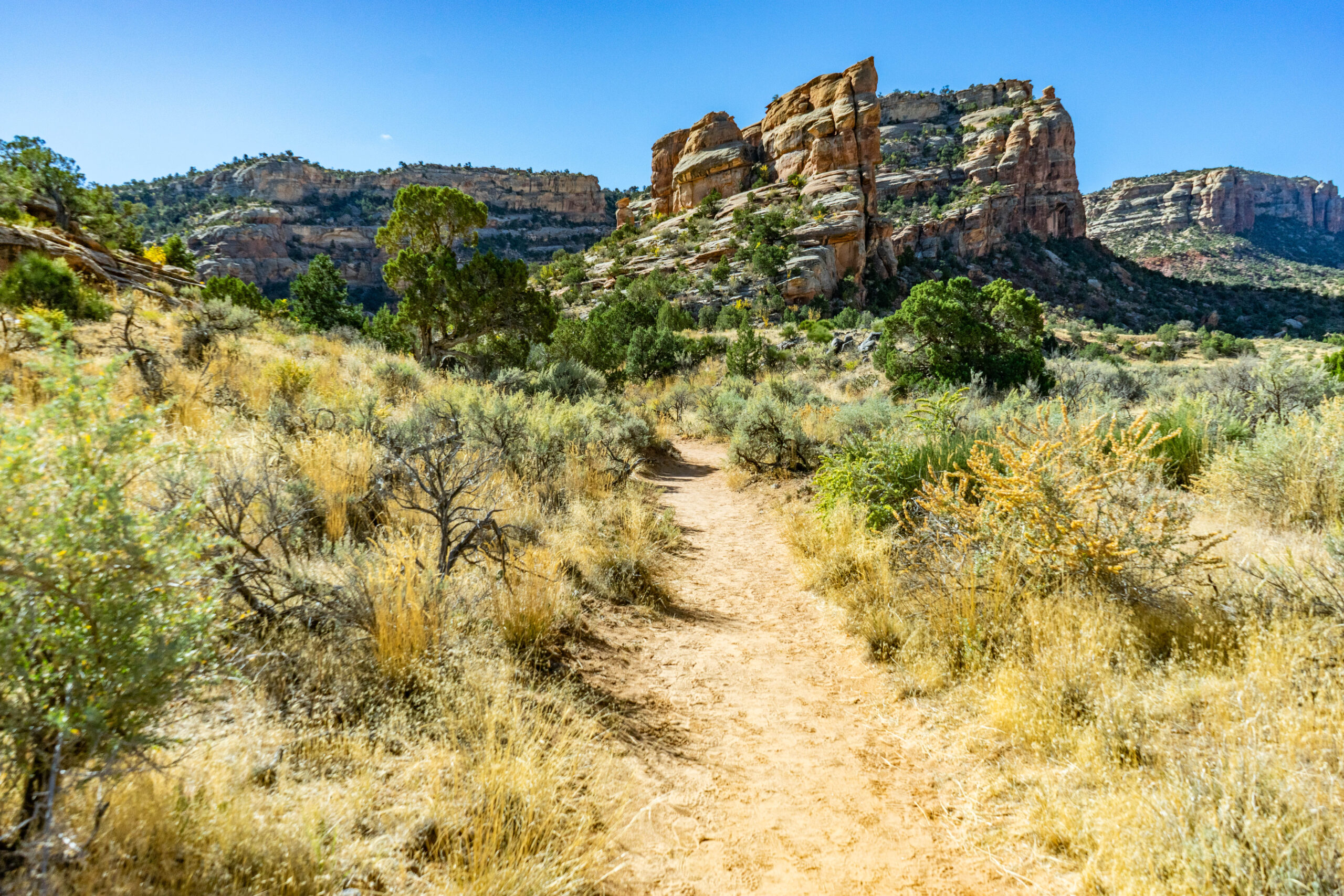
Before we left this amazing area, we had to get one good hike in.
The trails are much different than they are in the Southeast. You are always hiking on soft dirt or rock with no leaf litter or roots to speak of. There’s also no real shade, so you are always out in the sun, which means either a good hat or sunscreen is a must.
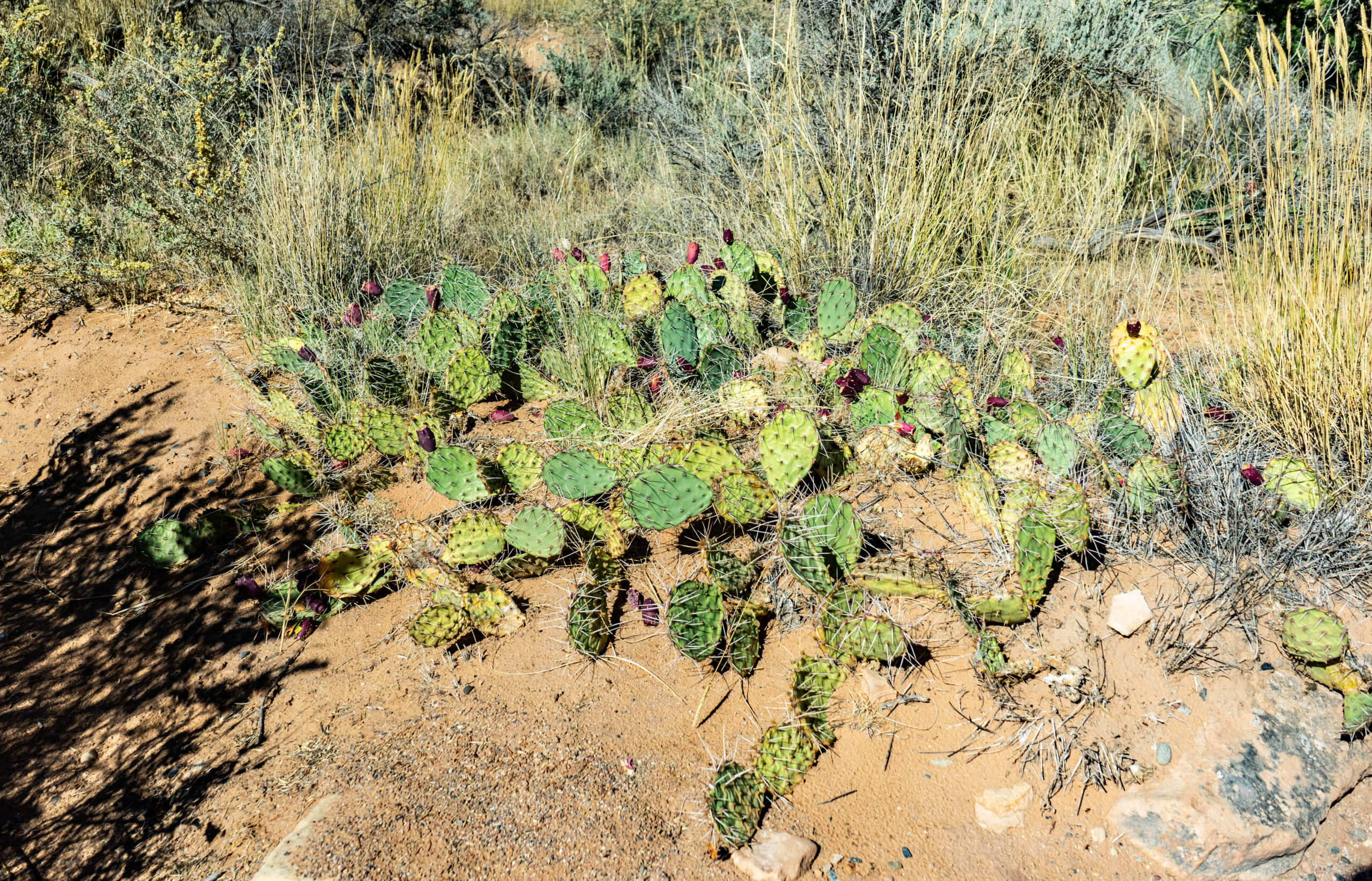
We also got to get up close and personal with the local flora, including something I had only ever seen in the “Jungle Book” – prickly pears! Some of them had small fruits, and others didn’t. We even saw a local squirrel having a quick lunch of these little pods. Don’t get too close, though; they are plenty sharp enough to stick you even through your pants. Ask me how I know.
The destination of our hike was an area known as “Devil’s Kitchen.” After briefly getting a bit lost, we managed to find it up a steep hill. Here, several rock spires create an enclosed area that resembles a room, hence the name.
After seeing all this, we were merely 24 hours into our 5-day trip, and there were still plenty of sights to see…


