
A brief, light wintry mix is possible for portions of far North Georgia on Wednesday.
A Winter Weather Advisory has been issued for Chattooga, Catoosa, Dade, Dawson, Fannin, Floyd, Gilmer, Gordon, Lumpkin, Murray, Pickens, Rabun, Towns, Walker, White, Whitfield, and Union Counties.
The advisory is in effect from 1 AM Wednesday, Feb. 19, through 1 AM Thursday, Feb. 20.
Around 1/2″ of snow accumulation is possible, with isolated higher amounts above 2,500 feet in elevation.
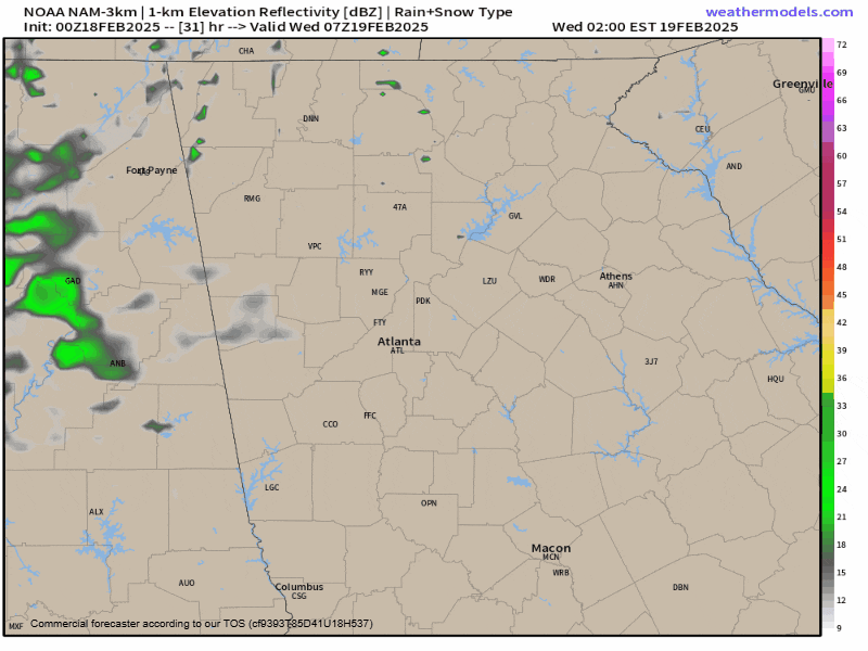
A low pressure system over the southeast will slide east through the overnight hours of Tuesday. This will bring widespread precipitation to the area by 4-6 AM Wednesday morning.
Most of the region could see a brief start as snow or sleet before transitioning to rain. Those at the higher elevations of Rabun, Towns, White, Union, Fannin, Gilmer, Lumpkin and Dawson Counties have the best chance to see the precip stay snow through the event.
Forecast radar below shows this, along with wrap-around snow showers and flurries persisting through early Thursday morning, again mainly across the higher elevations.
Accumulations are expected to be minor, if any, thanks to warm ground and air temperatures. Below 3,00 feet, temperatures are expected to remain above freezing for the duration of the storm, which will inhibit any accumulation.
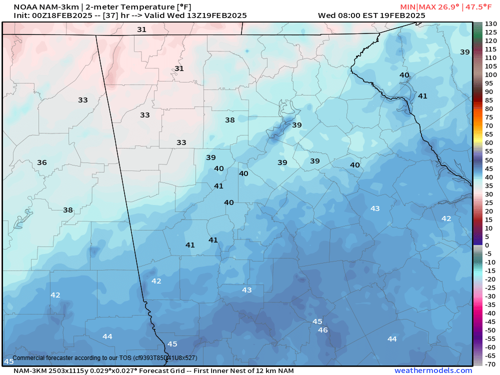
The image below shows a snapshot of surface temperatures on Wednesday morning. The only areas close to freezing locally are in the pink line from North Dawson to Rabun Counties. Farther west over Northwest Georgia, there is potential for an area of cold air to get trapped, resulting in some sleet or freezing rain as far east as Murray County.
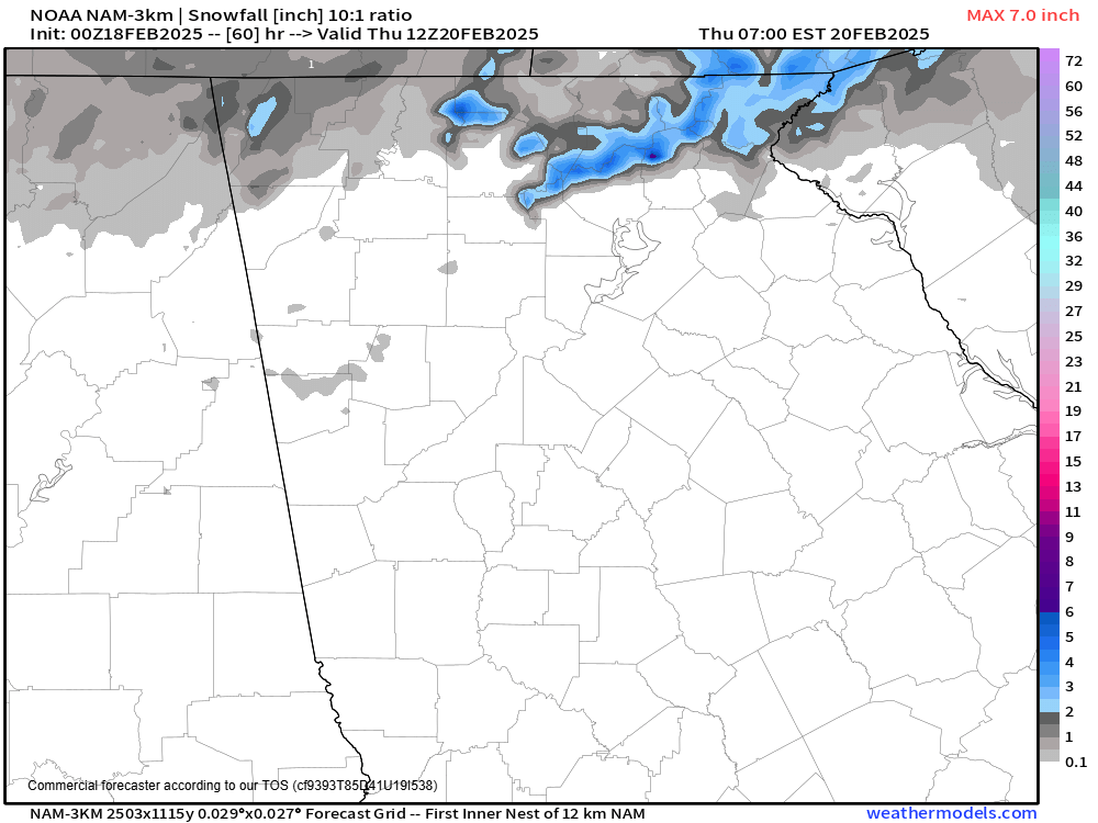
Snowfall totals of a trace of 1″ will be possible above 3,000ft. This area is outlined in blue on the map below, and keep in mind this map does not take into account any melting that will be happening.
The best chance for most of us to see any snowflakes may come Wednesday afternoon as the low pressure system begins to quickly strengthen off the east coast. Some moisture being wrapped around into the low could bring some scattered flurries and snow showers to the region through the first half of Thursday night.
This isn’t expected to be a big event, but stay tuned in case things change. If the low strengthens a bit quicker, our chances of seeing more widespread flakes go up a tad.


