Things are still on track for a major winter storm to impact North Georgia on Friday into Saturday.
A Winter Storm Watch is now in effect across all of North Georgia from Friday morning, January 10th through Saturday morning, January 11th.
Now that the storm is getting closer we are able to start looking at the higher-resolution weather models to nail down better timing and get a better look at precipitation type. Unfortunately, these higher resolution models paint a nasty picture for the region, particularly overnight Friday night.
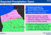
The animation below shows the high-resolution NAM that has just run within the last hour. You can see the entire region begins as snow on Friday afternoon but we see a changeover to a mix of sleet/freezing rain for the entire region by Friday night. The precipitation then ends as snow over the mountains but leaves behind a crippling mess for most of Northeast Georgia.
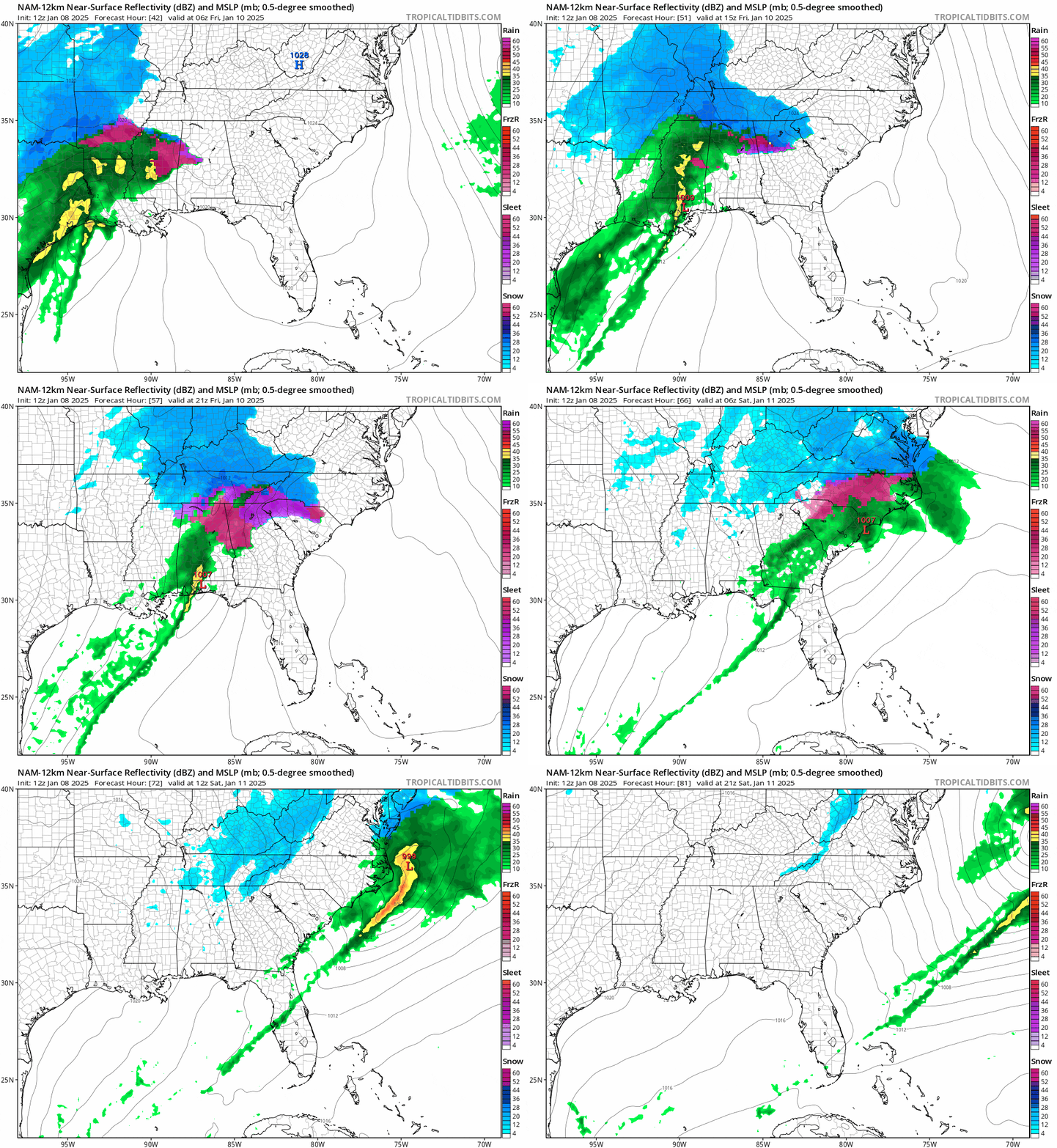
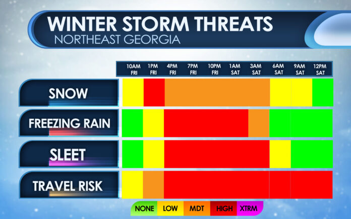
Snow is currently expected to begin between 10AM-12PM on Friday. A changeover to sleet/freezing rain would occur during the evening hours around or after 4-5PM. This change over is due to a layer of warm air that rides up over the cold at the surface. I’ve pointed it out on the image below that shows the freezing line as the thick black one and the sudden jump in temperature.
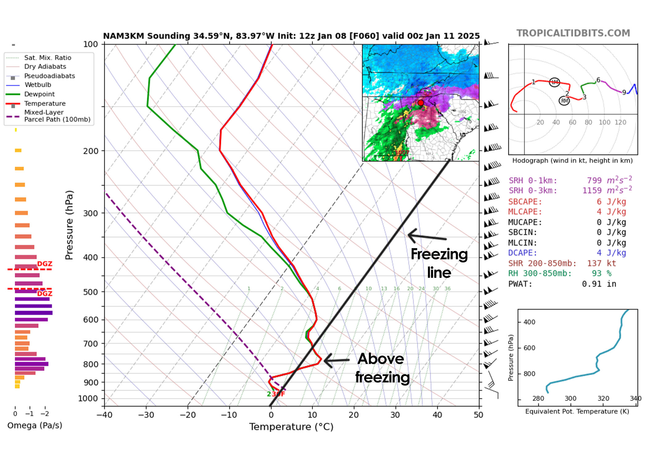
This results in the snowflakes in the clouds melting and falling through the cold layer near the surface to give us sleet or freezing rain depending how thick the cold is. Hopefully we will see this warm layer not be as strong as modeled, but in my experience that rarely happens.
Chances of over 1″ of snowfall remain high, in fact I expect 2-4″ to fall region-wide before we see the changeover begin from south to north. The further south you live the quicker the change will happen resulting in the lower end of totals while the mountains see the highest. Some areas along and north of the higher elevations from Rabun over towards Fannin Counties could see 6-8″ since they will be the most protected from the warm air reaching them from the south.
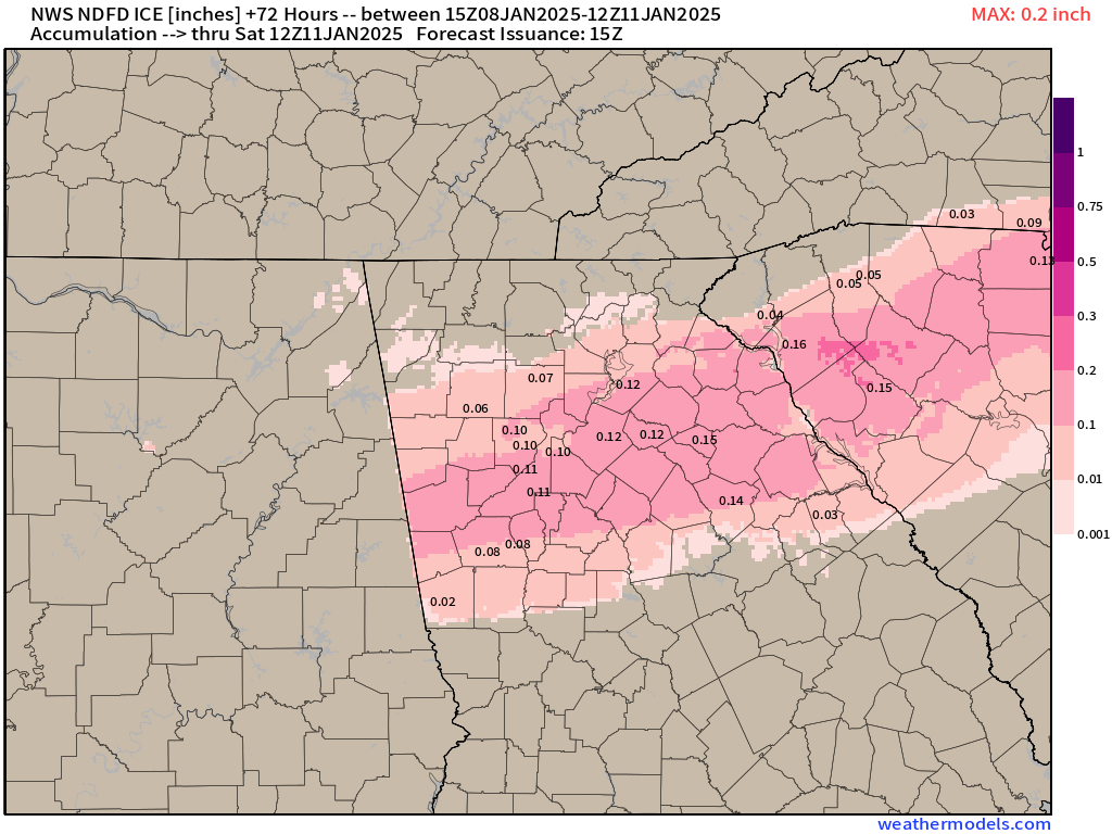
Travel will become incredibly difficult very quickly through the day on Friday. Cold temperatures this week will have roadways primed for quick freezing once the snow starts. If you have plans on Friday do your best to be home before the snow arrives. 1/10″ to 1/4″ of freezing rain will be possible, especially along the I-85 corridor, and accumulation of around 1/2-1″ of sleet is also expected. Sleet is especially difficult for travel since it compacts into a sheet of ice very easily. The official forecast from the National Weather Service for ice totals is below. If trends continue a bit warmer aloft on the models I would expect these numbers to go up a bit.
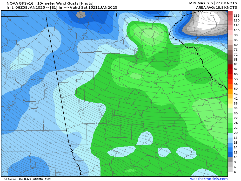
Scattered power outages will also be possible, especially on Saturday, as winds increase behind the low. Wind gusts of 20-25 m.p.h. are expected as the system departs Saturday afternoon. If significant icing occurs this will certainly result in downed trees and scattered power outages.
Stay with Now Habersham for the latest updates on this storm.


