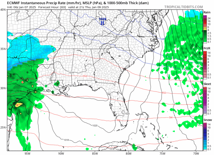
The last time snow fell across a large portion of North Georgia was January 17, 2022. The Cornelia station picked up 4.5″ that day with widespread 4-8″ falling across the region. Since then, 1,086 days have passed with no snow outside of the mountains aside from the occasional flurry. It is looking increasingly likely like that streak will stop at 1,088.
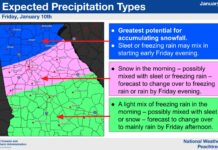
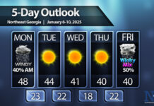
A low-pressure system is expected to develop over Texas on Thursday and push to the east. Precipitation will spread out ahead of the storm bringing the first bit into Georgia sometime around noon on Friday. The precipitation will likely begin as snow across all of North Georgia before the battle of the warm air sets up Friday evening and overnight.
The animation at the top the latest from the European Weather Model, AKA the “Euro”, from Thursday evening through Saturday. You can see the precipitation approach from the west beginning as snow and eventually mixing with a little bit of freezing rain/sleet before ending as snow once again. The latest modeling actually keeps a good chunk of North Georgia as all snow for the event with only those south/east of the 85/985 corridor having to worry about any real sleet/freezing rain issues. This “battleground” area will shift north and south over the coming days but the trend has been our friend recently.
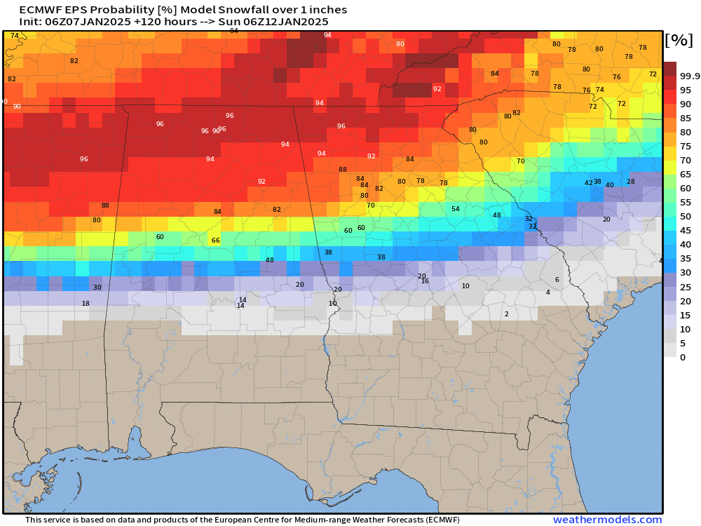
The image below shows the percent chance of at least 1″ of snow falling. If you’ve been keeping up with our updates you will note that this has ballooned to 80-90% for the entire region.
Now that we are getting better chances of 1″ it is time to start looking for more. The chance for 3″ or more has also taken off with much of the region now seeing 50-60+% chances.
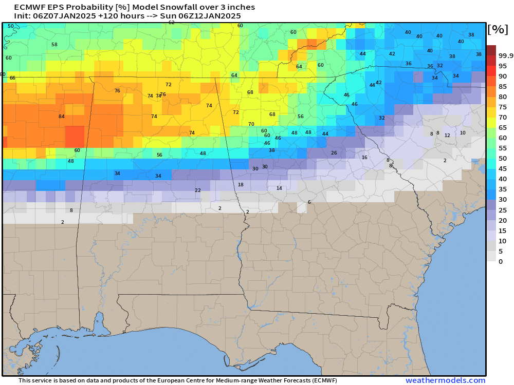
If you are a fan of snow this is definitely good news. There will be a fairly sharp cutoff somewhere in the region or nearby where the battleground area sets up.
Unfortunately, here in Georgia we always have to fight warm air riding up from the south ahead of the system. This almost always causes a period of sleet/freezing rain in the middle of our snowstorms. This is especially true for those south of the higher elevations across Habersham, White, Lumpkin, Dawson, Hall, Banks, Franklin and Elbert Counties. If the low-pressure system manages to pass further south it will send less warm air and we have a better chance at staying snow, and if it passes further north, we will wind up with a freezing rain and sleet mess in the middle.
At three days out, 2-4″ of snow with potentially a period of sleet and freezing rain followed by another 1-2″ of snow seems most likely but that will change.
This is an evolving situation that we will keep updating through the coming days as we try to reel in our first region-wide snow event since January 2022.


