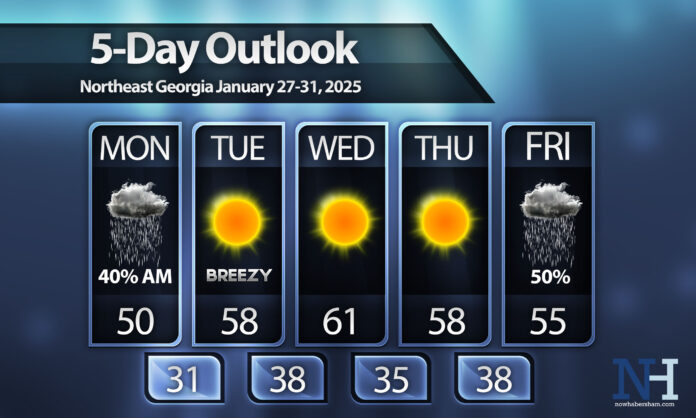
A major pattern change is on the way this week and it will bring a big warm-up to North Georgia.
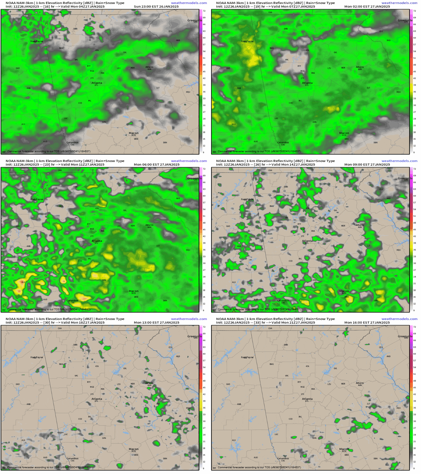
Overnight Sunday a front will spread light rain into the region. These showers will last through the first half of the day on Monday. Rainfall totals will be light with only 1/4-1/2″ of rain expected. Showers should move out by late Monday. The forecast radar from 11PM tonight through 4PM Monday is below.
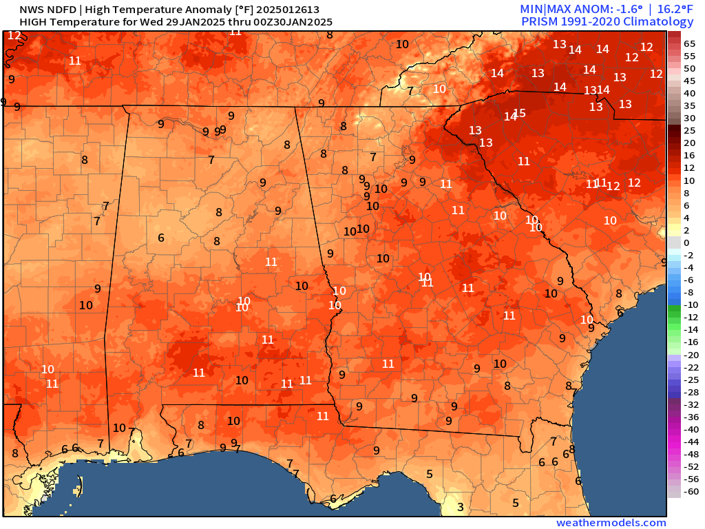
Behind this front we won’t cool off. Instead it will usher in a much warmer pattern behind it as a large area of high pressure builds in over the center and east of the country. Tuesday will see the warmest temperatures in over 2 weeks with highs reaching into the mid and upper-50s region-wide. Wednesday will feature the warmest air with highs into the 60s across much of the region as well. Highs Wednesday afternoon will run 8-12 degrees above normal.
Thursday will see highs pull back just slightly as our next weather system approaches from the west. Showers and possibly thunderstorms will become likely by Friday and Saturday. There is some potential for strong to severe storms during this timeframe but it is far too early to mention any specifics.
Have a great week!


