
It is officially fall across the Northern Hemisphere but that doesn’t mean we are anywhere near done with the summertime-like weather.
The first couple days of your workweek will be very straightforward. Highs in the mid/upper-80s with isolated, pop-up afternoon storms are expected for both Monday and Tuesday. Things get much more murky from Wednesday onward thanks to what will likely be a tropical system in the Gulf.
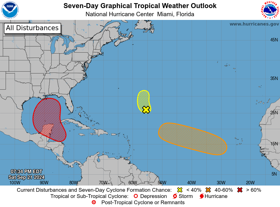
A cold front will be approaching from the west on Wednesday spreading clouds across the region and bringing isolated to scattered showers and storms. At the same time, a tropical system will be getting organized in the southern Gulf of Mexico. After Wednesday, the forecast is about as up-in-the-air as you can get. Models show many different solutions for what happens with the tropical system, but right now all signs point towards some strength Tropical Storm or Hurricane making landfall in the eastern half of the Gulf (New Orleans and east) from Thursday-Saturday. Timing, strength and track are all extremely uncertain, mainly because this storm doesn’t exist yet. In fact, the National Hurricane Center hasn’t even been able to designate an area to watch just yet. However, the southern Gulf is listed in their 7-day outlook as having a high likelihood of storm development.
I am not going to share any models yet since the chances of any being correct are very slim, but stay tuned for a more in-depth update in the next couple days once things hopefully clear up a bit. With the way things stand right now impacts of some kind to our area appear likely, but the extent of any rain or wind is unknown.
Happy fall, y’all, and stay weather aware in the tropics this week.


