
We’re continuing our look into everything you always wanted to know but were too afraid to ask about clouds.
Two weeks ago we took a look at high clouds, and last week we took a peek at traditionally midlevel clouds. This week we’ll be covering another type of cloud that has many different forms: cumulus.
When you think of a cloud, a cumulus cloud is probably what you think of. Puffy and white with perhaps a greyish base, floating through a summer sky. Cumulus clouds are the most common “type” of cloud, in that they exist at all levels of the atmosphere. We already touched on cirrocumulus in week one and altocumulus in week two. Altocumulus are one of the most common cloud types in the world. They account for the majority of heat reflected back away from Earth’s surface and cool the Earth’s surface overall by 22 degrees on average. However cirrus clouds reflect plenty of heat back so our net loss of heat is only around 9 degrees.
Regardless of how much cooler a nice cumulus cloud can make a summer afternoon feel, all cumulus clouds have one thing in common: instability. Cumulus clouds always form due to rising air. As the air rises the temperature goes down, causing the water in the air to condense onto dust and aerosol particles. These condensed water droplets are what make up the cumulus cloud. Eventually a little puffy cumulus cloud can become a thunderstorm.
Aside from sounding like something out of Harry Potter, cumulus humilis clouds are common during the summer months. These clouds are particularly common early in the day when our traditional puffy clouds begin to develop. They are not very tall and develop fairly close to the ground, only about 1500-1000ft above ground. They indicate fair weather, though they may begin to grow taller eventually resulting in precipitation producing clouds.
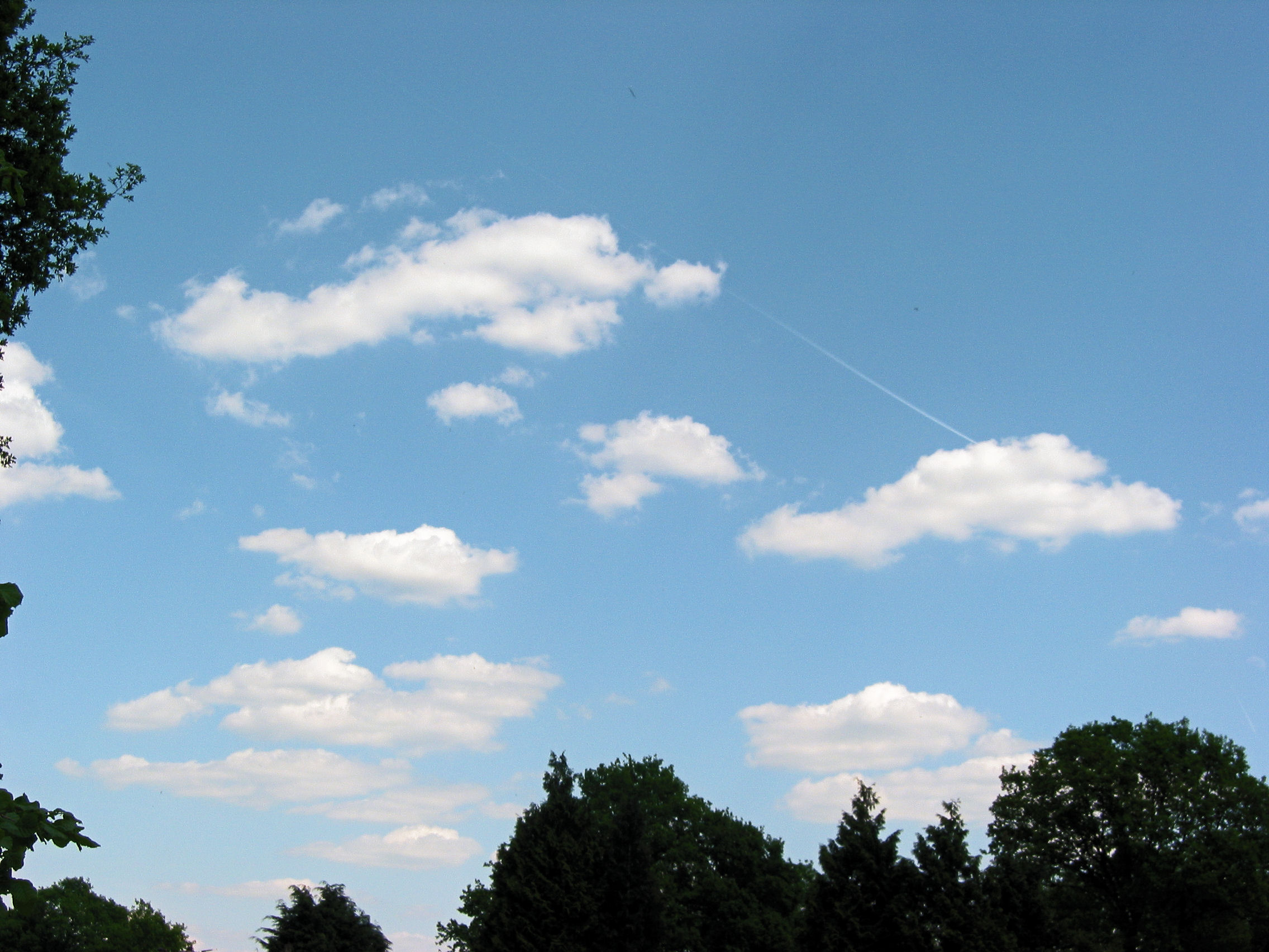
The next phase of a cumulus cloud’s life is generally into cumulus mediocris. This is a cumulus humilis cloud that has begun to gain a little height. These are extremely common across Northeast Georgia during the summertime. They often indicate that storms will develop later on, though not always.

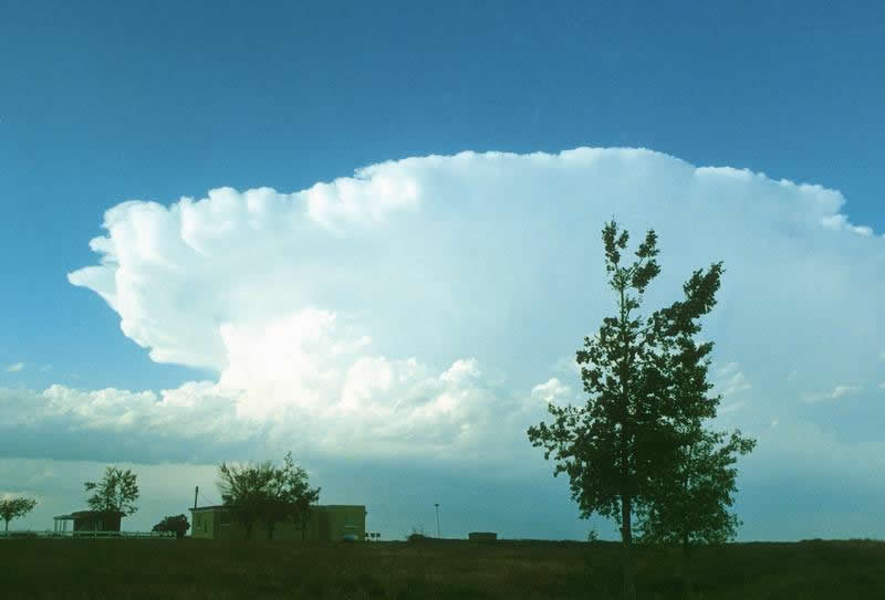
The next phase is called cumulus congestus. This phase is also known as “towering cumulus” and occurs when sufficient instability exists for the cumulus clouds to get significantly taller. These clouds can produce rainfall but generally do not. They are the last step in a cloud’s life before it becomes a storm.

The last step in a growing cumulus cloud is into the cumulonimbus cloud. Cumulonimbus clouds are those that have become thunderstorms. They produce lightning, hail, tornadoes and heavy rainfall. Cumulonimbus clouds themselves come in many varieties, including frontal lines to supercells to pop-up afternoon thunderstorms. Cumulonimbus clouds are the tallest single cloud structures that exist and can reach heights over 50,000ft above ground. They often develop caps of cirrus clouds. They also often develop an anvil or “thunderhead”, caused by wind shear that indicates the direction the storm is likely to move.
Cumulus clouds are the most diverse cloud type, forming at all levels of the atmosphere and resulting in spectacular thunderstorms.
We’ve got one more week of cloud types last week so be sure to join us!
Watch the skies!


