
We have a very wet pattern setting up across the region that is poised to potentially carry over into the weekend.
Showers are likely on Wednesday as an upper level disturbance pushes east. Rainfall totals for Wednesday are expected to be light, only on the order of around a half inch or so.
Thursday we will see additional showers and storms develop, and we may sneak in some brief sunshine during the afternoon. The best chance for showers Thursday will come during the afternoon hours. It will also be the best chance to see some thunder, though no severe is expected.
Friday through Sunday are a much more uncertain forecast. We remain in an unusual “omega block” that you may have seen on social media. By this weekend, this pattern will break down but there is growing potential for another upper level low to strengthen, this time over the mid-south. This is highly unusual for early May, though not unheard of.
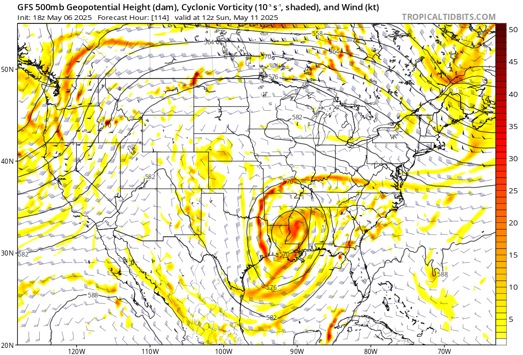
However, models vary quite significantly in the strength and placement of this low, as well as how much rainfall it causes over our area. The GFS is much wetter over the weekend, actually developing a surface low over the Gulf of Mexico on Saturday morning. This would mean a very wet Saturday and Sunday.
Meanwhile the Euro is drier, although it does still show scattered shower activity, particularly in the afternoon. It also develops a Gulf low, but does so on Monday instead. Because of this, and the fact the overall pattern is a pretty big change from just yesterday’s models, there is low confidence in the forecast for the weekend. The phrase “Upper Level Low is a weatherman’s woe” will play out over the next few days.


