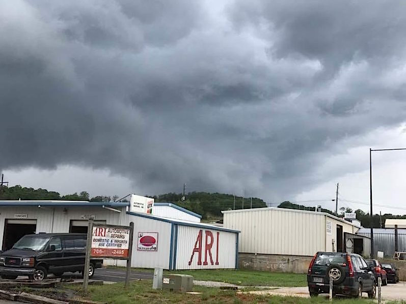
Wall cloud spotted west of Cleveland, GA on May 24, 2017 during tornado watch. (photo/White County Public Safety)
Was Northeast Georgia hit by tornadoes? That’s the question meteorologists are working to answer in the wake of recent storms.
Two severe storms moved across portions of Northeast Georgia Wednesday resulting in numerous reports of trees down across portions of Fannin, Gilmer, Murray and Gordon Counties.
There were two unconfirmed tornado reports in Whitfield and Gilmer Counties that the NWS will be investigating in the coming days.
Elsewhere, a dangerous looking wall cloud was observed in White County.
White County Public Safety Director David Murphy said in an email to WRWH Radio, “This is the same storm that produced the special weather statement and did indicate rotation when in Lumpkin County. The same storm produced tornado warnings in South Carolina.”
Murphy shared pictures that were taken near the Appalachian Parkway on the west side of Cleveland. He told WRWH people reported hearing “train” sounds after the storm cloud passed.
White County Emergency Management Agency Weather Specialist Don Strength has submitted the photo’s to the National Weather Service for review.
Habersham County picked up heavy rainfall but avoided more severe weather.
Now the next question to answer will be, “How much has this rain helped with the drought?” The US Drought Monitor will be releasing their latest update on Thursday. We’ll bring you that information once it becomes available.
Dean Dyer of wrwh.com contributed to this report


