")
A major severe weather outbreak is expected across the southeast US on Saturday and Saturday night, with Georgia feeling the impacts after sunset.
The Storm Prediction Center has issued a Day 2 high risk (level 5/5) for only the 3rd time in history for portions of Alabama and Mississippi. A Moderate Risk (level 4/5) now extends to the western Atlanta metro area and an Enhanced Risk (level 3/5) continues to extend into all of North Georgia.
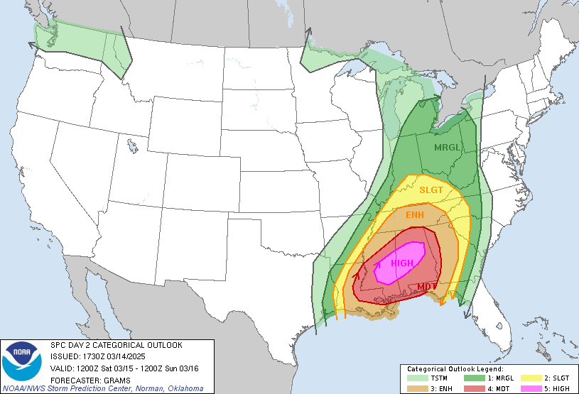
This is a high-end enhanced risk for our region with a “hatched” area noted on both the tornado and wind probabilities. These hatched areas are locations of higher-than-average risk for EF2+ tornadoes and wind gusts over over 70MPH. This is the most dangerous storm system we have seen locally in some time, and it bears extremely close watching.
RELATED: https://nowhabersham.com/severe-weather-preparedness-week-in-georgia-is-back-heres-what-you-need-to-know/
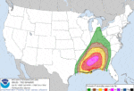
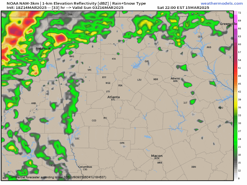
The greatest risk for us here in Northeast Georgia will come overnight making it extra dangerous. The latest models move the worst storms through the region from 11PM-5AM. The latest simulated radar from the high-resolution NAM model is below and shows this area of storms. Note that this is not an organized line of storms like we are used to seeing, but rather a lot of independent storms that are semi-organized into a line. This makes tornado potential extra dangerous since individual supercells will likely be able to maintain their structure through the region. Models have been trending more aggressive with these supercells through the day today.
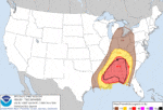
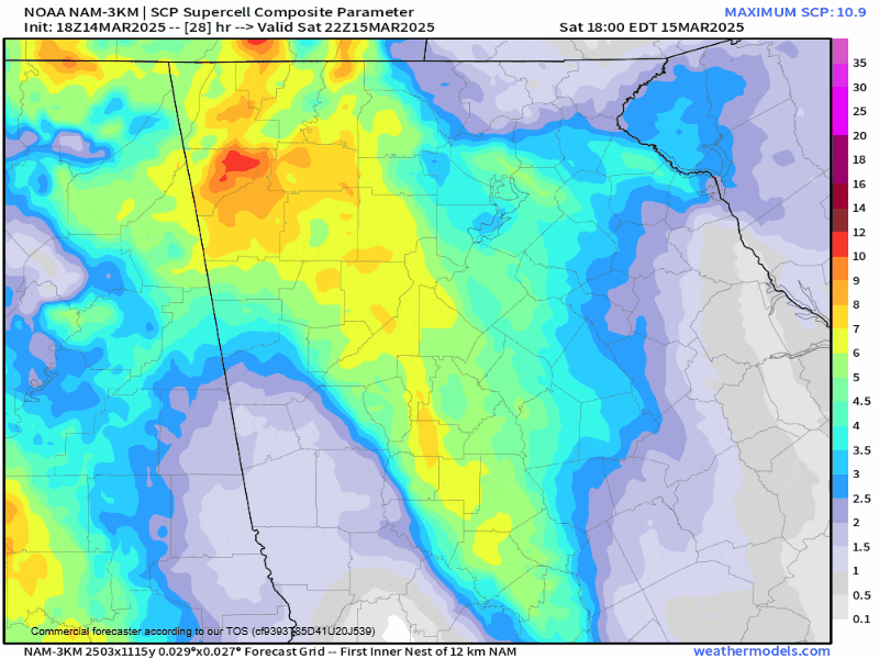
The “supercell composite” which shows the best conditions for supercells is below. While we are not going to see numbers as high as those to our west over Alabama/Mississippi, the threat is still very real here. Strong EF4/5 tornadoes are extremely unlikely, but conditions exist for a few EF2/3 tornadoes across the northern and western parts of the state, including here in Northeast Georgia.
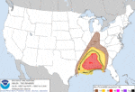
We will certainly see some rotating storms move through the region through the overnight hours. Rotation tracks from the latest HRRR model show numerous areas across North Georgia where tornadoes would be possible. This is just an example and changes from run-to-run, but highlights the potential for these rotation tracks to make it well into Northeast Georgia.
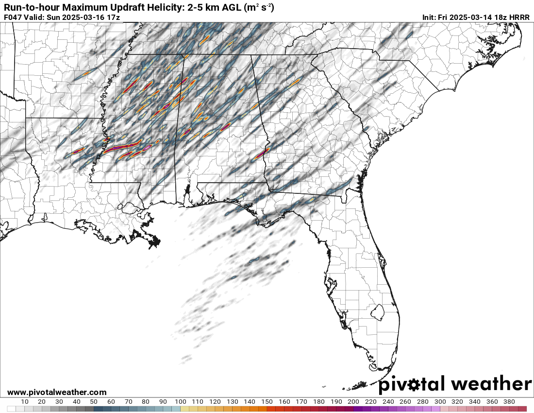
Modeled rotation tracks through Saturday night
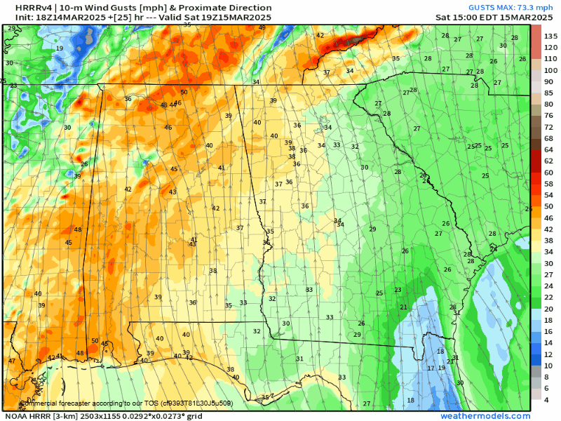
Winds will be very gusty both ahead of and with the storms. Winds will increase on Saturday evening with widespread gusts of 40-45MPH possible in the mountains and 30-35MPH in the rest of the region. Wind gusts inside severe storms could easily exceed 60MPH.
A Flood Watch has been issued for far NW Georgia for the counties of Catoosa, Chattooga, Dade, Fannin, Gilmer, Murray, Walker and Whitfield. The watch is in effect from Saturday morning through Sunday morning. Isolated flooding is possible across the entire region with heavy rain from the storms falling quickly. The scattered nature of the heaviest rain will result in wide swings but an average of 1-2″ is expected.
Stay weather aware and make sure you have a way to receive warnings overnight. If you have friends or family across Alabama and Mississippi make sure they are also prepared and aware.


