
A severe weather outbreak is likely across the southeastern US on Saturday with the storms bringing the potential for damaging winds and tornadoes to North Georgia overnight Saturday night.
The Storm Prediction Center has placed most of North and Central Georgia under an enhanced (level 3/5) risk for severe storms on Saturday into Saturday night, with a high-end moderate risk (level 4/5) to our west over parts of Alabama and Mississippi. The moderate risk area has been expanded to just to the edge of GA/AL border. This will be a wide-reaching risk for severe weather with the slight risk area running all the way to the Great Lakes.
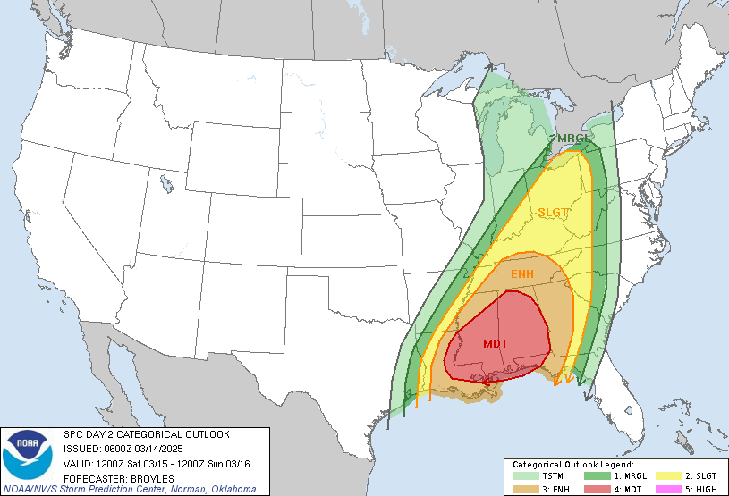
Locally, our main threats are expected to be damaging winds and tornadoes. The threat levels from the SPC broken down have us in a rare “hatched” area, which is a zone of enhanced risk for either strong tornadoes or particularly widespread damaging winds. For the technical, the hatched tornado is a 10% or greater risk of an EF2+ tornado within 25 miles of a point, and the hatched wind is a 10% or greater risk of wind gusts of 70+MPH within 25 miles of a point.
RELATED Northeast Georgia Weekend Forecast
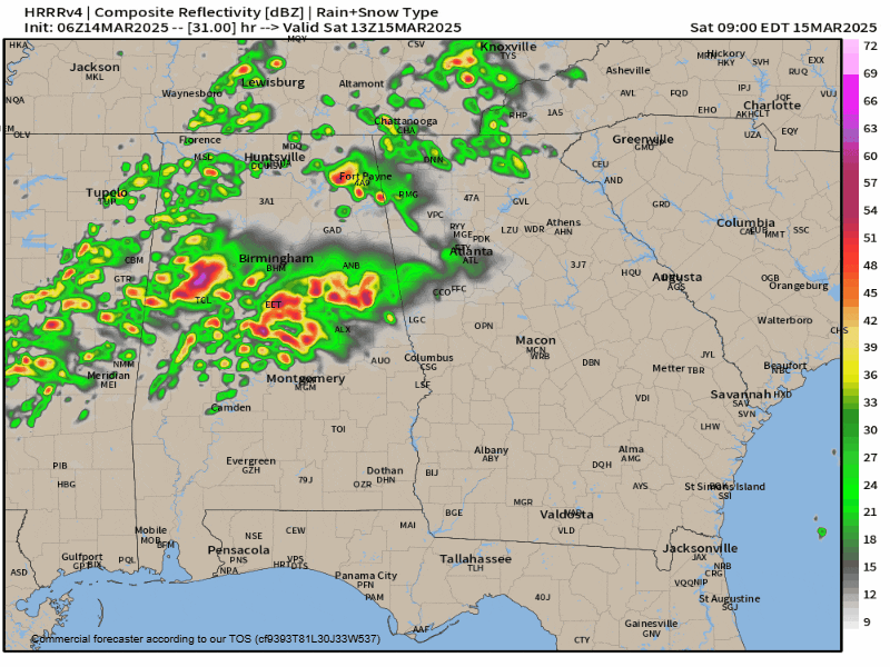
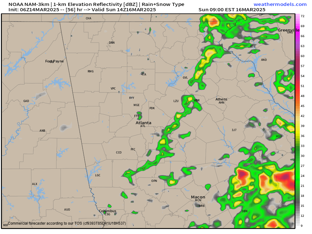
The storms are expected to move through during the overnight hours of Saturday, making this a particularly dangerous storm system. The latest models show the line of storms or broken line of supercells moving through North Georgia from 10PM-5AM. I’ve included two separate model outputs below that show a couple different scenarios. The first is the HRRR which shows widespread showers during the morning hours of Saturday followed by a line of storms/supercells moving through by 2AM. Second is the NAM, which shows the storms arriving a bit later with less early morning rain on Saturday. This is a VERY volatile setup and we likely won’t know exactly what to expect Saturday morning until later today.
Widespread strong wind gusts of 40-50MPH are expected along the line regardless of any actual severe gusts of 58+MPH.
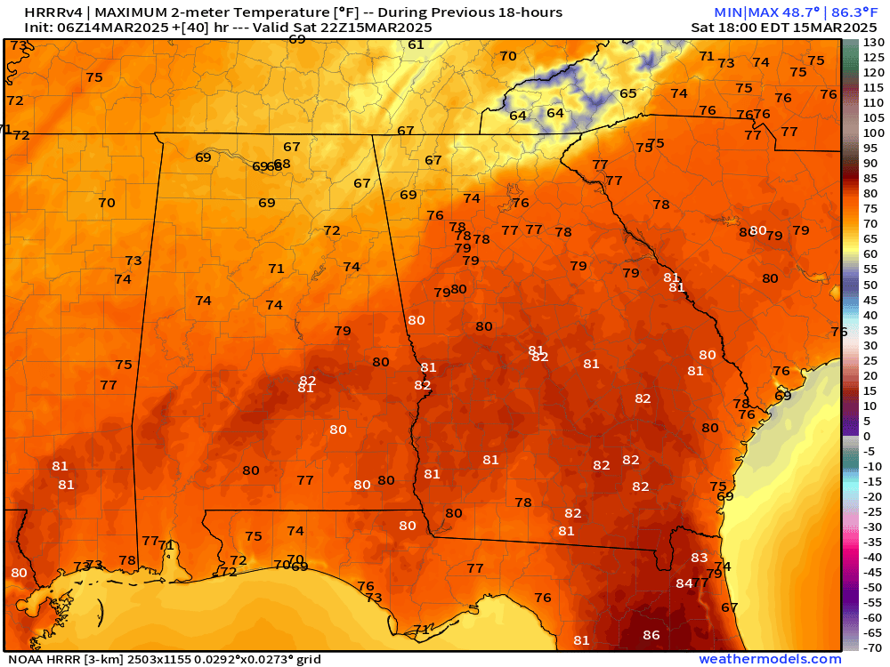
This is a very unusual setup locally for March with no wedge of cooler air in place ahead of the storms. In fact, it will be very warm on Saturday afternoon. Even the HRRR which shows morning rain still gets the region into the mid/upper-70s for most of the region. This will help allow for more instability than we usually see in March.
In addition to the storms, some flooding is possible. Total rainfall amounts of 1-2″ are possible and it will fall very quickly. This could result in some isolated areas of flooding and has prompted the Weather Prediction Center to place the region under a slight risk for flooding.

Stay tuned for the latest on this severe threat.


