
It feels like we can’t go more than a week or two without a round of severe storms, with the latest one coming on Wednesday night.
After a day of hot temps with highs reaching the mid-90s for most outside the mountains, scattered storms developed and took full advantage of the extreme heat and instability.
Damaging winds caused scattered power outages across the region, along with numerous downed trees. The Habersham County Airport reported a maximum gust of 44 MPH with the storm just before 10 PM. The WRWH station near Cleveland recorded a gust of 25.1 MPH, although stronger gusts likely occurred over parts of southwestern White County.
Power outages from HEMC topped out in the 400s, fortunately, much lower than we have seen with previous storms. The most concentrated outages occurred over southwestern White County, where a microburst brought down numerous trees onto roads and power lines.
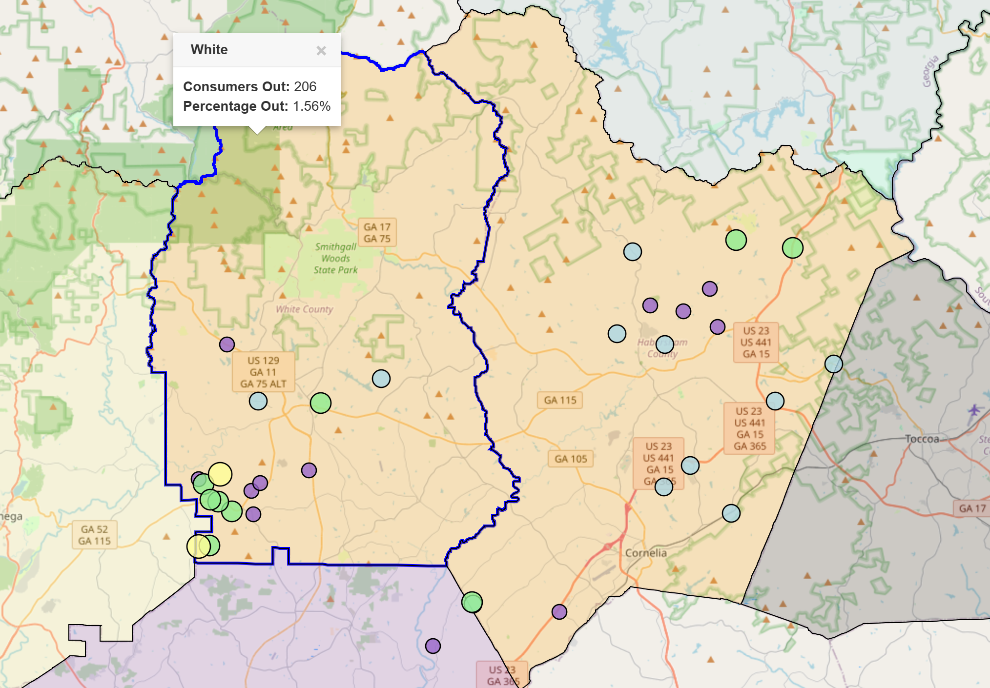
At the height of the storm, more than 112,000 Georgia Power customers were without power statewide, according to FindEnergy.com.
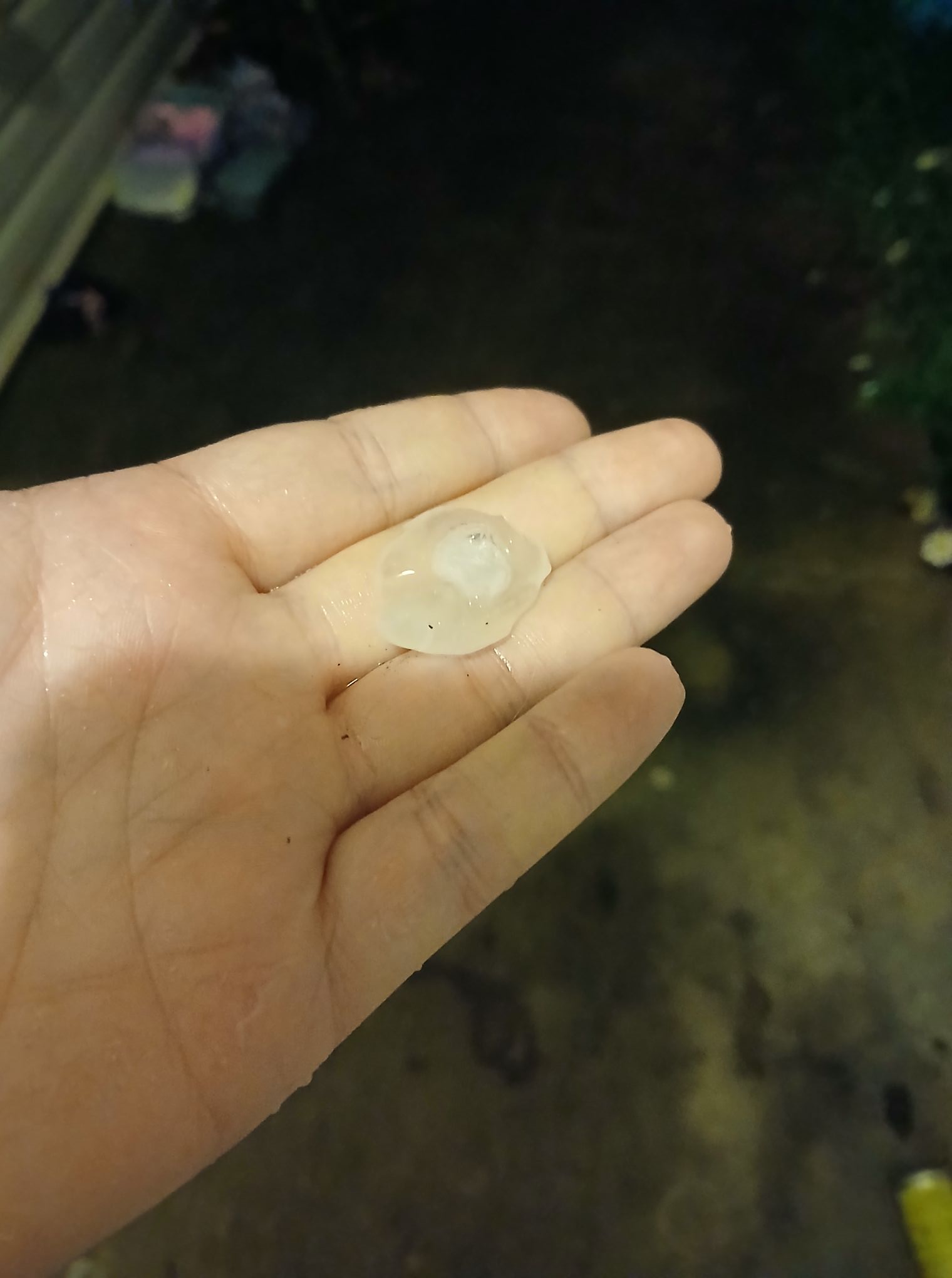
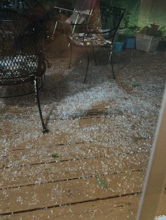
Habersham’s Wendy Hubbard Ferguson described the storm this way: “Lightning looked like a strobe light and we had hail fall for over 15 minutes.”
Hail up to marble-sized was also reported across the region. A large hail core brought mostly pea-sized hail to White County, while a large area from Clarkesville down to Cornelia saw the biggest hail reports.

Even if you didn’t see any hail or winds, you likely experienced the frequent lightning. Bolts struck as far as 4-6 miles outside the storms, with hundreds of cloud-to-ground strikes across the region.
Additional severe storms are possible again Thursday and Friday, so stay weather aware!


