High up in the mountains near the small town of Lebanon, Virginia, lies a unique geological area unlike anything else east of the Mississippi.
The Great Channels State Forest is an unusual place to visit. It is located in what may as well be the middle of nowhere in Southwest Virginia near the small town of Lebanon. Here, a trail leads from Highway 80 up the mountain for about 3.5 miles.
The hike to the top is uneventful, just a non-stop uphill climb from the road that traverses some beautiful, steep forests. A handful of small cabins are located nearby at the start of the trail, and if you pay attention, you may see a bear or two hanging out, especially near the bottom of the trail.
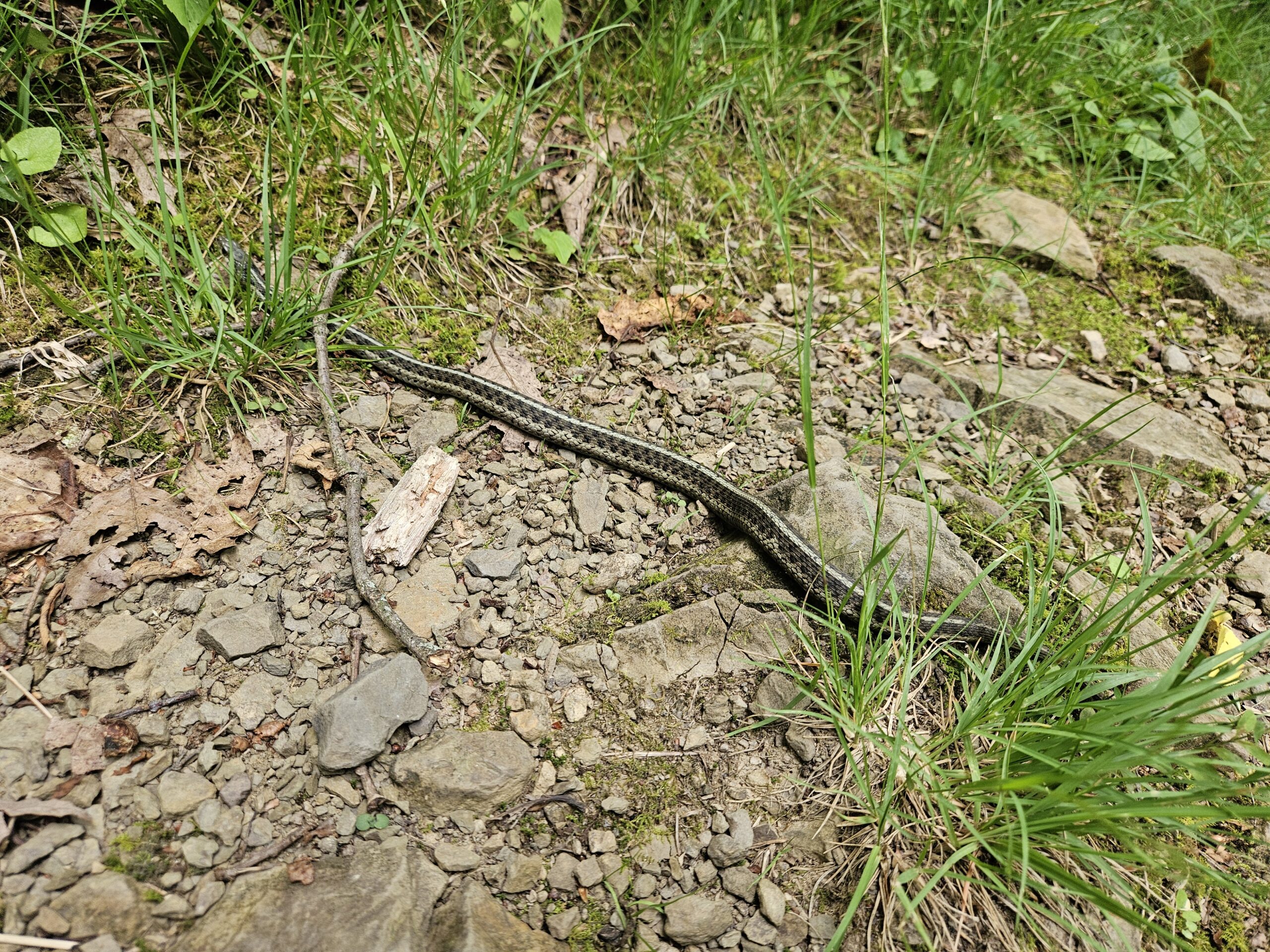
There are many snakes in this area, too. Anything from copperheads to small ground snakes can be found. One of these guys greeted me on my trip.
After the climb, you will be greeted by an old, defunct fire tower atop the mountain. It is illegal to climb, unfortunately, but you can get a wonderful view of the surrounding mountains by just hopping up the large sandstone outcrops that dot this area.
On a clear day in the winter, you can see as far as eastern Tennessee from here. This particular overlook is extremely deceptive of what lies below. The trail drops about 100 feet to the right of this spot, where you enter a very unusual place.

The geology of The Great Channels is somewhat fascinating. The rock here is all sandstone and was deposited around 400 million years ago. Exactly how these giant slot canyons came to be is still up for debate, but the general consensus is that during the last ice age, the sandstone shattered. Over time, the joints expanded to create the corridors located just below the overlook above.
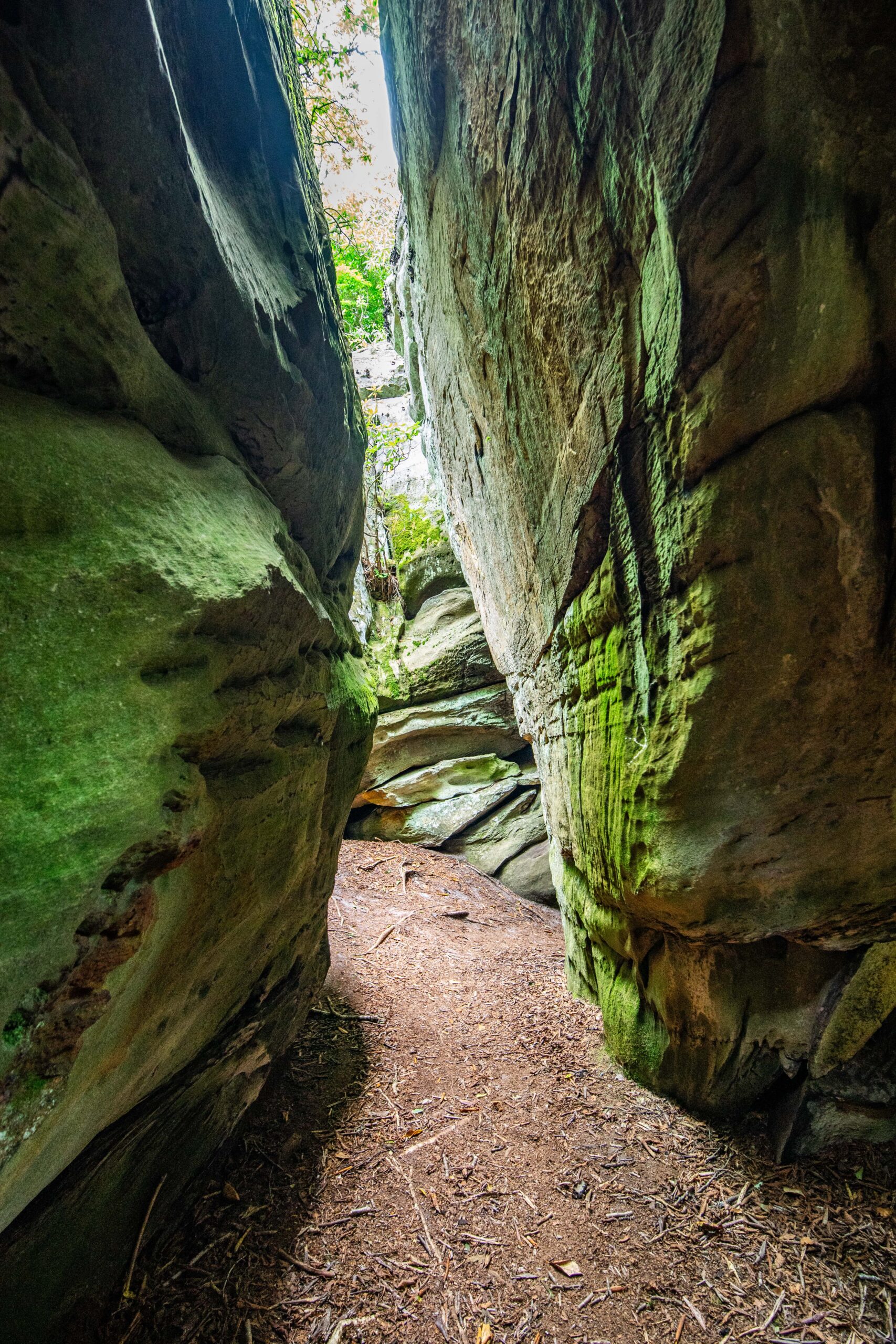
After rounding a corner of the trail, you are greeted by a giant corridor lined with rock on both sides.

From here on out, the trail becomes less formal and runs between these giant sandstone cliffs in many directions. They are laid out in somewhat of a grid pattern and cover about 20 acres on their own. Some of the channels are 10-15 feet wide, and some, like the one below, you have to turn sideways to fit down.

Getting good photographs in this area is hard. It is always somewhat or very dark in the canyons, and many of the rocks are covered in light green moss. It is a truly beautiful place to see, but photos really don’t do it justice.
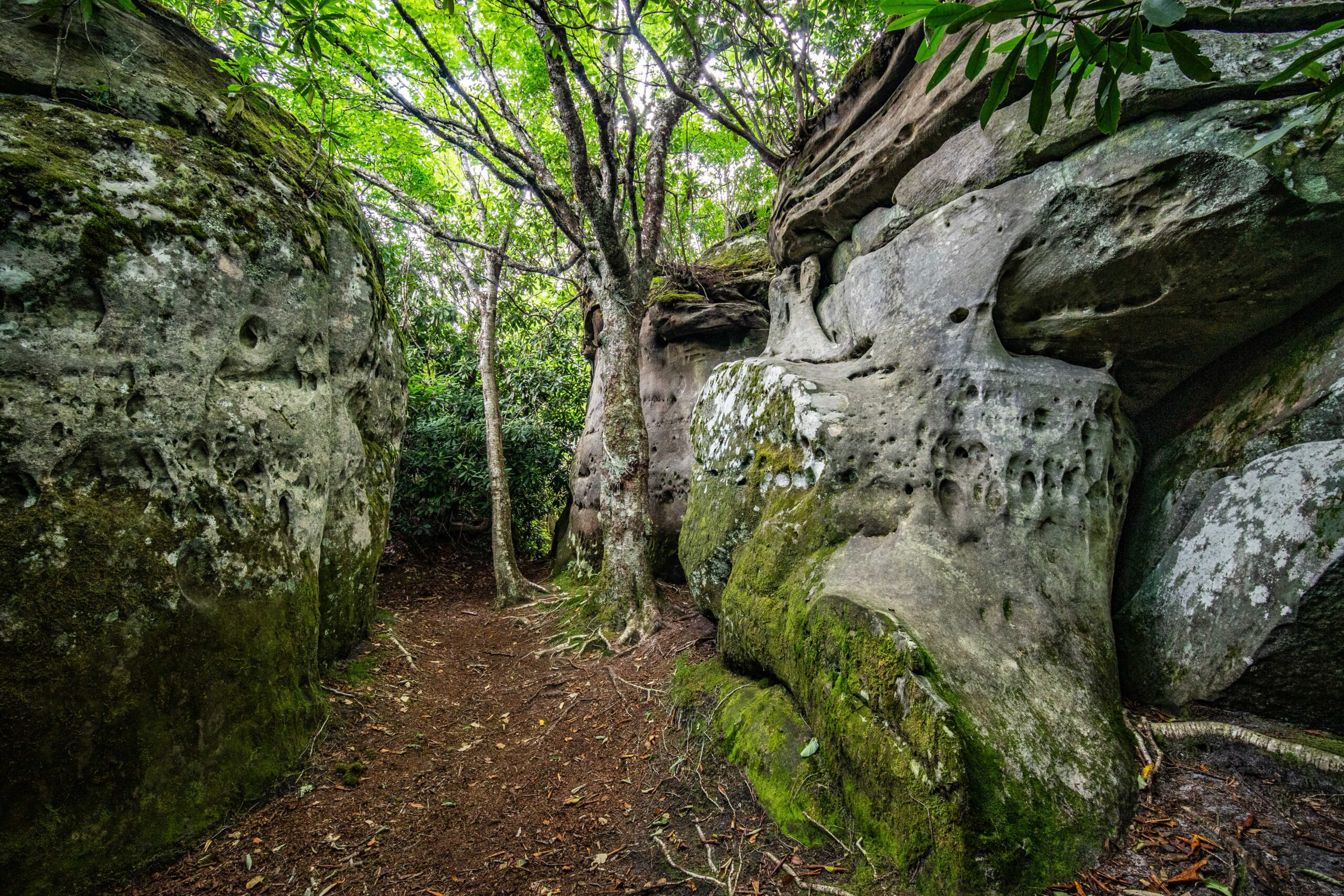
The area is chock full of very cool rock formations, especially near the edges where the forest has crept in. Tens of thousands of years of erosion have resulted in these spots looking extremely weathered, with holes and caves carved into the rock.
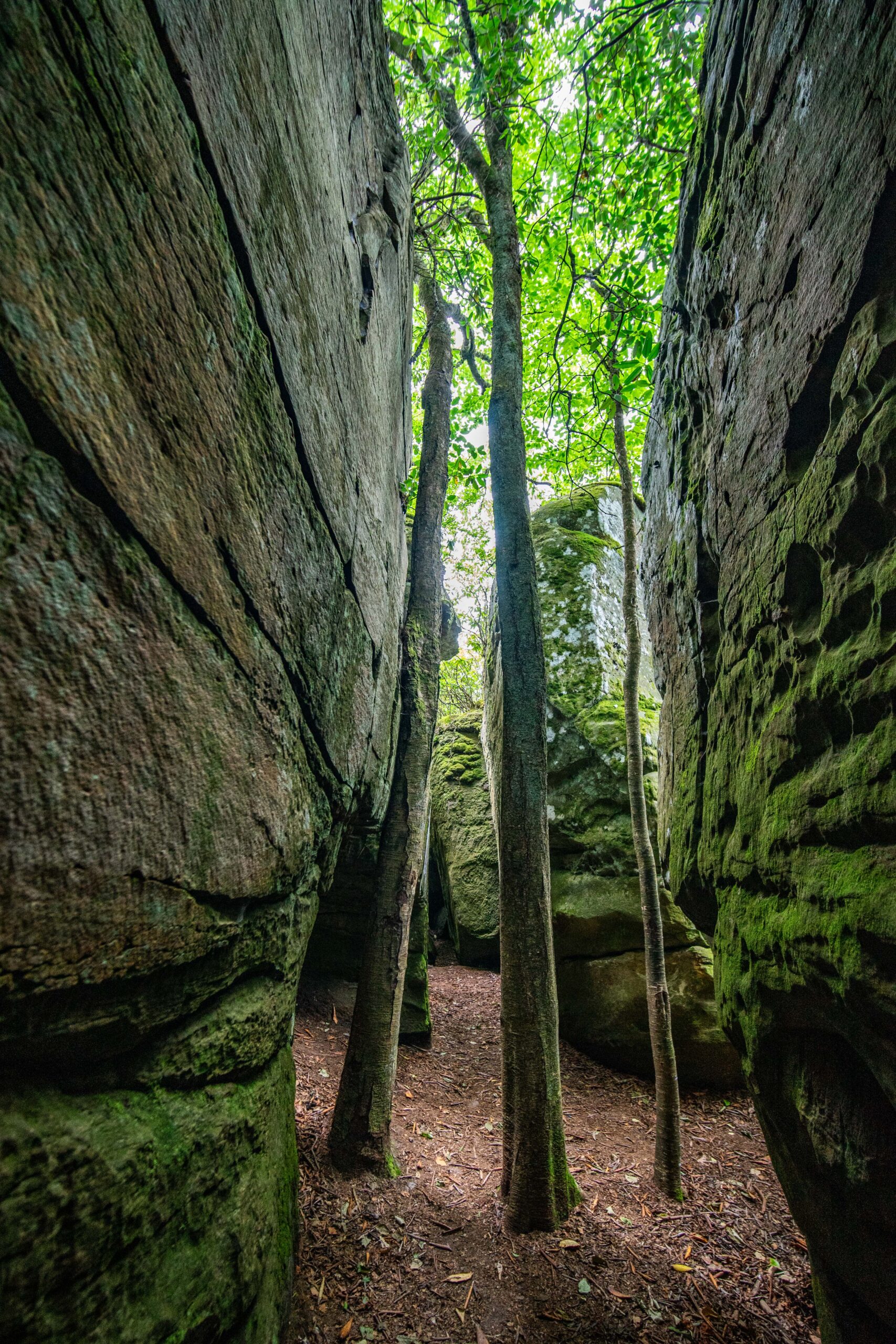
Even deep inside the Channels themselves, life has found a way. These trees have found a way to thrive despite growing at the place where four 100 foot tall corridors meet.

All in all, this is a really, really cool place to visit. The only caveat is there are only ten parking spaces at the trailhead, and anyone not parked in one runs the risk of being towed.
This area fills up on the weekends, but you have a better chance of finding a spot on a weekday. I arrived at 10 a.m. on a hot Wednesday and there were still several spots available. While the climb up was toasty, the air inside the Channels runs about 10-15 degrees cooler, which makes it an enticing spot to explore on hot days.
Next time you find yourself in the middle of southwest Virginia be sure to try and check this area out, you won’t regret it.