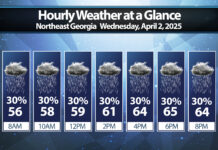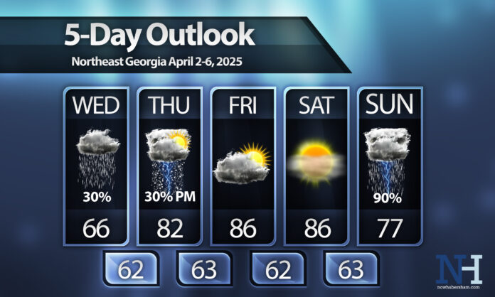
A wedge of cool air will impact the region today keeping us only in the 60s. We’ll warm up VERY quickly through Friday with near-record highs expected both Friday and Saturday. Some spots south of I-85 could reach 90º.
Storms will be possible on Thursday afternoon as well with plentiful daytime heating and moisture resulting in pop-up cells.
We should remain dry on Friday and Saturday but a line of potentially strong to severe storms ahead of our next cold front on Sunday.


