
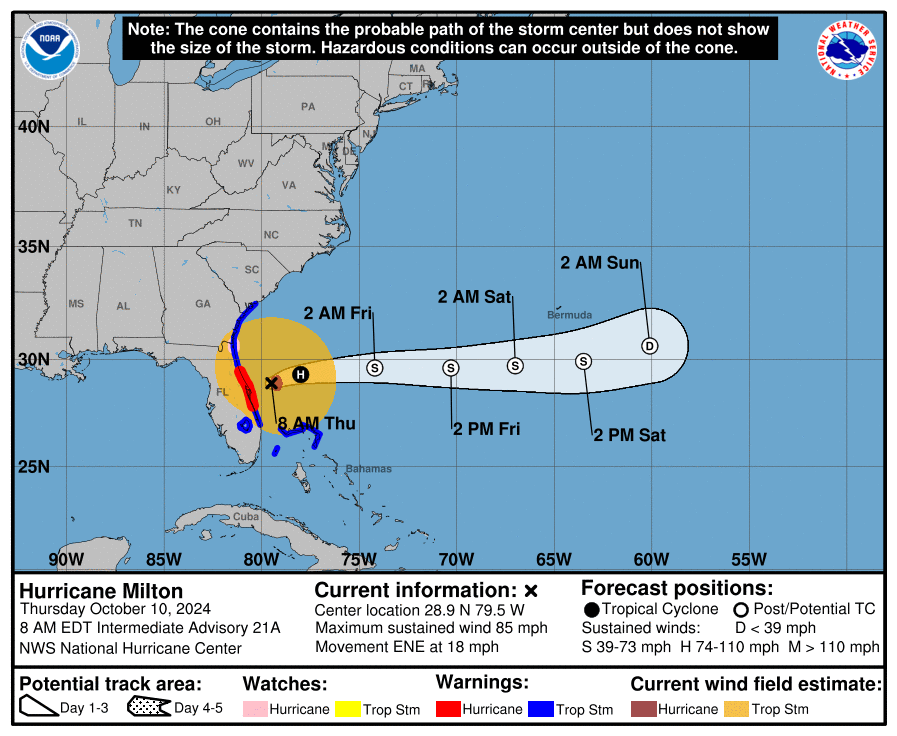
Milton still has winds of 85 mph and is centered 75 miles off of Florida’s Atlantic coast, according to the latest update from the National Hurricane Center.
All storm surge warnings have expired for the Gulf Coast of Florida, but there is a danger of life-threatening storm surge along the coast from east-central Florida northward to southern Georgia, where a Storm Surge Warning remains in effect.
Damaging winds will continue for a few more hours in east-central and northeastern Florida.
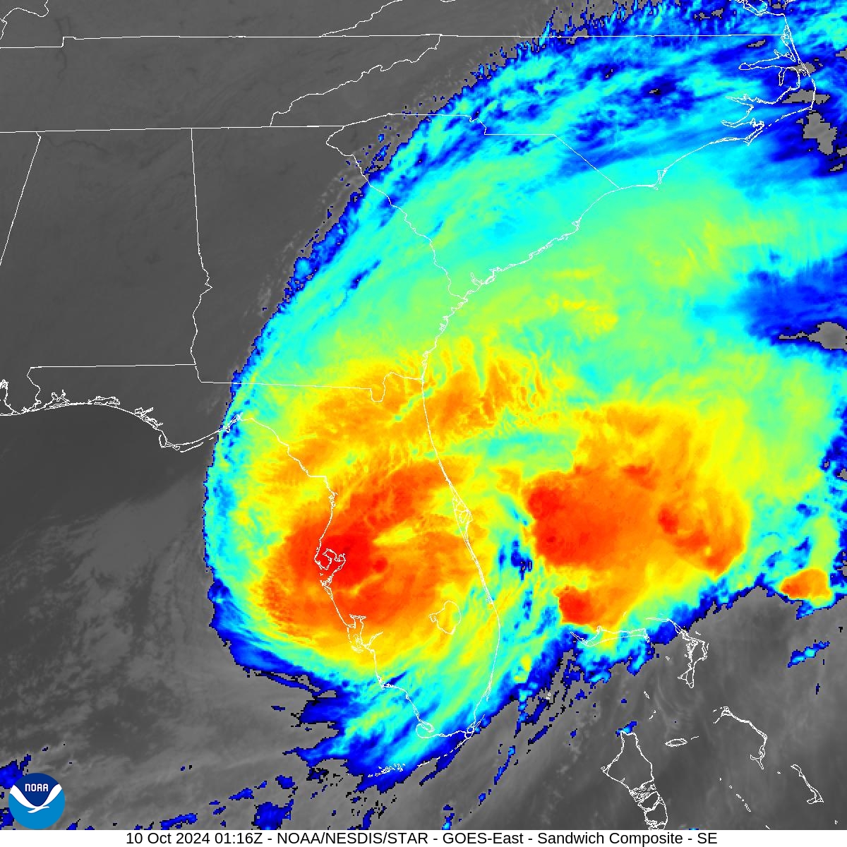
Hurricane Milton was downgraded to a Category 1 storm as it exited the Florida peninsula. The eye of the storm moved off the east Florida coast early Thursday morning after battering the state with high winds, dangerous storm surges, and spawning deadly tornadoes.
Milton made landfall Wednesday night, Oct. 9, near Siesta Key, Florida, as a Category 3 storm. It crashed into Florida, pounding the coast with maximum sustained winds of 120 mph.
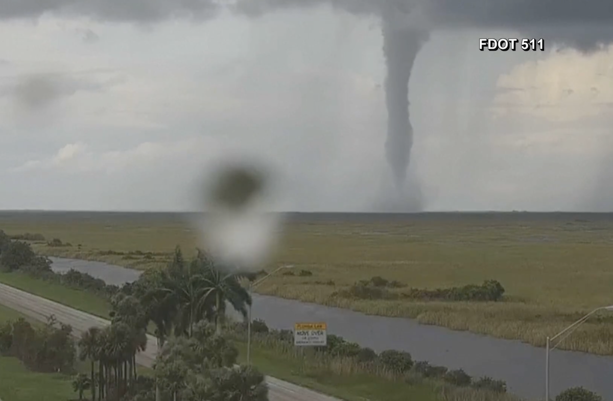
According to the National Weather Service (NWS), at least 27 tornadoes were reported in Florida on Wednesday ahead of landfall. Over 125 tornado warnings were issued by the NWS offices in Tampa Bay, Melbourne, and Miami — the most ever issued in a single day for Florida.
In St. Lucie County, a tornado ripped through a mobile home retirement community, county sheriff Keith Pearson told CNN. He said hundreds of homes were “completely totaled.” At least four people are now confirmed dead, NBC News reports.
The storm began to weaken quickly on Wednesday afternoon after entering a much less favorable environment closer to the Florida coast.
Almost all the rain shifted to the north side of the storm, with nearly a foot-and-a-half of rain reported across certain areas.
The Weather Channel reports that 10 to 17 inches of rain soaked southern Pinellas County, coastal Hillsborough County, and western Manatee County. Parts of downtown Tampa and St. Petersburg flooded due to as much as 17 inches of rain.
Storm surges of 10-12 feet were reported near the landfall location, sparing Tampa Bay the worst effects.
Although Tampa Bay avoided a direct hit, the storm still brought a potentially deadly storm surge to much of Florida’s Gulf Coast, including the densely populated Tampa area, St. Petersburg, Sarasota, and Fort Myers.
Heavy rains also caused flooding inland along rivers and lakes as Milton continued his trek across the peninsula.
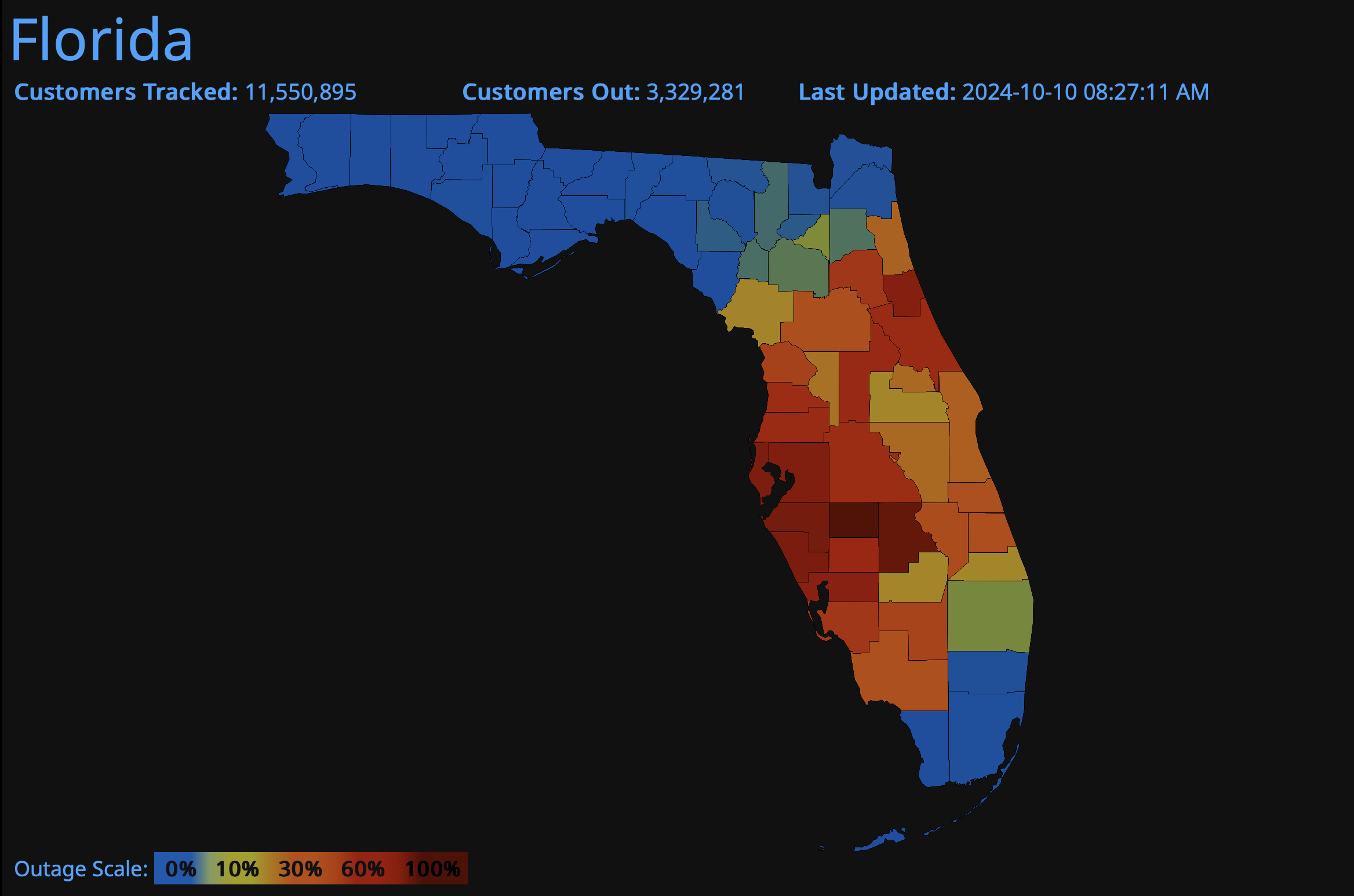
More than three million homes and businesses across Florida were without power early Thursday, Oct. 10.
Milton maintained hurricane status and is expected to exit the east coast of Florida on Thursday morning. Rainfall and strong wind gusts will slowly ease up across the state as the storm heads out to sea.


