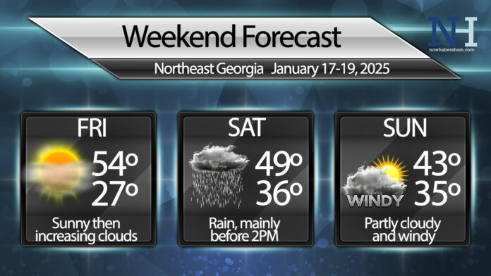
Friday will be the last relatively warm day for at least a week as the rest of the weekend will be impacted by a couple of fronts. These fronts will bring major cold to the region by next week.
After sunshine early on Friday expect a gradual increase in cloud cover across the region ahead of the first front of the weekend. Highs Friday will reach into the 50s, hopefully putting a dent in the continued ice left over from a week ago across the region.
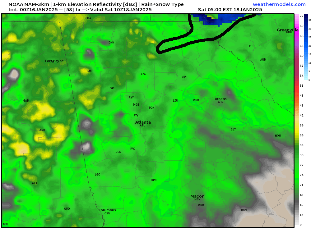
This first front will bring widespread rain showers to the region on Saturday, especially during the morning hours. There is a slight chance the high elevations see this rain actually start off as snow in the wee hours of Saturday morning but it won’t last long. The best window for any snowflakes will be from 4-7AM before the upper level temperatures get too warm. Surface temperatures above freezing will keep anything from sticking. I’ve highlighted the area most likely to see any brief flakes in the image below.
Showers will remain possible through Saturday afternoon although they should decrease in coverage quite a bit. Winds will shift to the northwest late in the day with some clearing overnight.
A second area of low pressure is expected to develop and race north along the front of a large incoming upper level trough. This could kick enough moisture back into the region to result in some isolated rain or snow showers at high elevations on Sunday, but for most of us we can just expect partly cloudy skies with clearing late in the day. Winds will increase dramatically behind the front as very cold air rushes in. Winds Sunday will be gusty from the northwest at 20-30MPH.
RELATED: Bitter cold expected next week
Have a great weekend!


