Hurricane Rafael made landfall over Cuba as a strong Category 3 storm with winds of 115 m.p.h. earlier today.
The storm is now back over water in the southern Gulf of Mexico, however no major impacts to the US are expected.
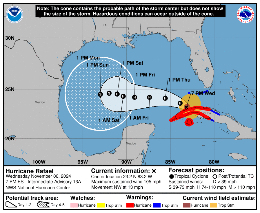
According to the National Hurricane Center Rafael currently has winds of around 105 m.p.h. The storm may strengthen slightly before beginning a gradual weakening trend that will last the rest of the week into the weekend.

Luckily, the latest modeling shows a stronger high pressure system over the center of the country. This high pressure will keep Rafael away from the coast as it weakens. All indications are that it may never even make landfall as an organized storm. There is considerable uncertainty in exactly where it winds up (as you can tell from the large cone), but a dissipating storm is likely no matter what as shear and dry air interrupt the system.
Rough surf is likely along the gulf coast from the storm, and moisture from what is left may get tugged north over the weekend but these will be minimal impacts.


