
Potential Tropical Cyclone #9, soon to be Tropical Storm Helene, is currently located over the western Caribbean Sea. Significant impacts from this storm are possible by late this week across North Georgia.
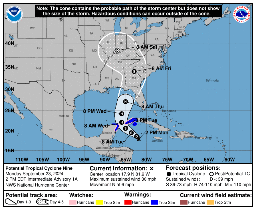
The storm is still widely disorganized but is expected to get its act together and eventually strengthen quickly over very warm waters. It is expected to move generally west/northwest over the 48 hours or so before making a turn to the north. Current forecasts have the center of the storm threading the gap between the Yucatan Peninsula and the western tip of Cuba where Hurricane Watches are currently in effect.
Landfall is eventually expected somewhere in the Big Bend or eastern Panhandle region of Florida on Thursday. The exact landfall location, and particularly movement after landfall, will have a big effect on what impacts we have locally.
The big players in this storm can be seen on the image below that shows energy well up in the atmosphere. A large “cutoff low” is currently developing over the west and will move to the east pushing a cold front towards our region. This front will be bringing rain with it regardless of tropical influence, but it will at some point interact with Helene headed north. The timing of this low and cold front will be essential to what we see here.
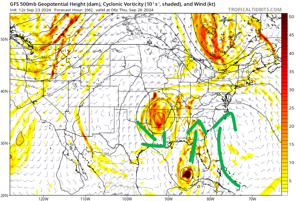
The latest modeling brings a strong Category 2 or 3 storm ashore on Thursday in the Big Bend region. Afterwards the storm is expected to bend back to the NW a bit around the upper level low you can see over Arkansas in the image above. This will bring the center of the storm close by or directly over North Georgia.
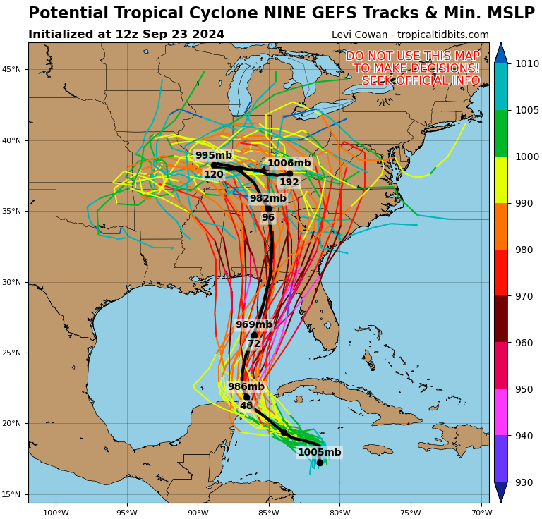
A path to the east of us would have the least effects as the worst of the storm is expected to be to the eastern side of the circulation. However, if the cold front is even slightly slower than expected a slight bend to the west will put us in the middle of the worst. You can see the spread of the potential tracks above, a number of which put us in the worst part of the storm.
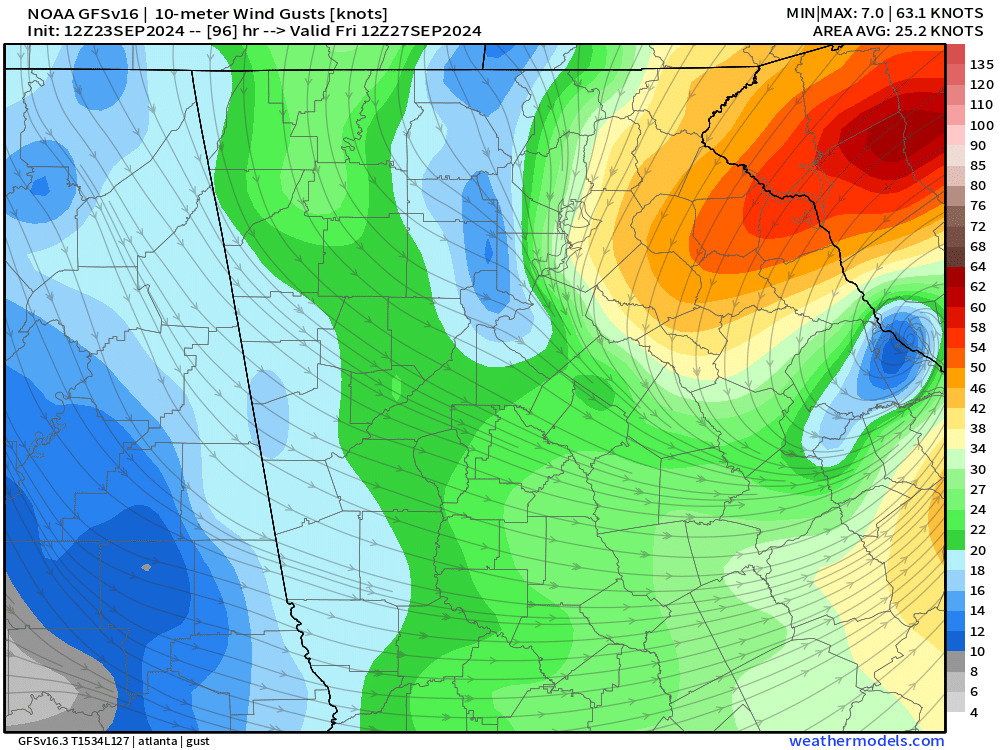
Under most circumstances, the storm would be moving fairly slowly and have plenty of time to weaken before arriving in North Georgia. Unfortunately, this time the storm is likely to be traveling around 20 m.p.h. at landfall. This sounds slow but is actually quite fast for a landfalling hurricane. The strength of the storm at landfall will determine what potential winds we could see, but gusts to 40-60 m.p.h. on Thursday night into Friday currently don’t appear out of the question. Even if the storm passes just to our east strong winds will be possible, particularly along and southeast of the higher elevations where low level winds can get concentrated up against the Appalachians. An example of this can be seen below.
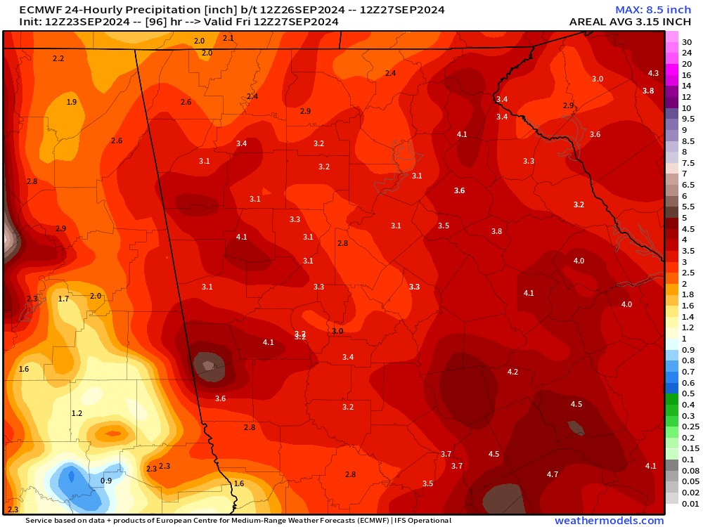
Regardless of the wind potential, heavy rain is likely to occur with 3-5″ falling with the storm. The quick forward motion will likely keep rainfall totals from getting out of hand, but some flooding is possible if these totals go up at all with how quickly the rain will fall.
This storm bears close watching over the next few days with it’s potential impacts over North Georgia. The ceiling for strength at landfall is very high with this storm, and with a path just to our west significant impacts are well within the realm of possibility.
Stay with Now Habersham for the latest.


