A strong cold front that has brought widespread severe weather across much of the eastern Midwest will finally push east Saturday night into Sunday bringing a chance for strong to severe storms to our region.
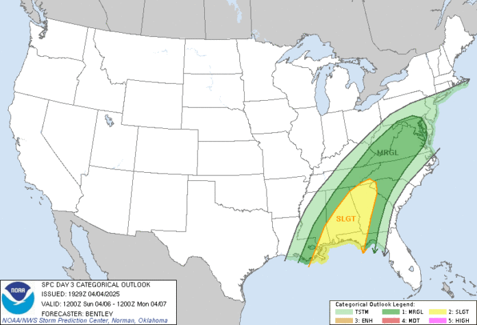
The Storm Prediction Center has placed most of North Georgia under a Slight Risk (level 2/5) for severe storms on Sunday.
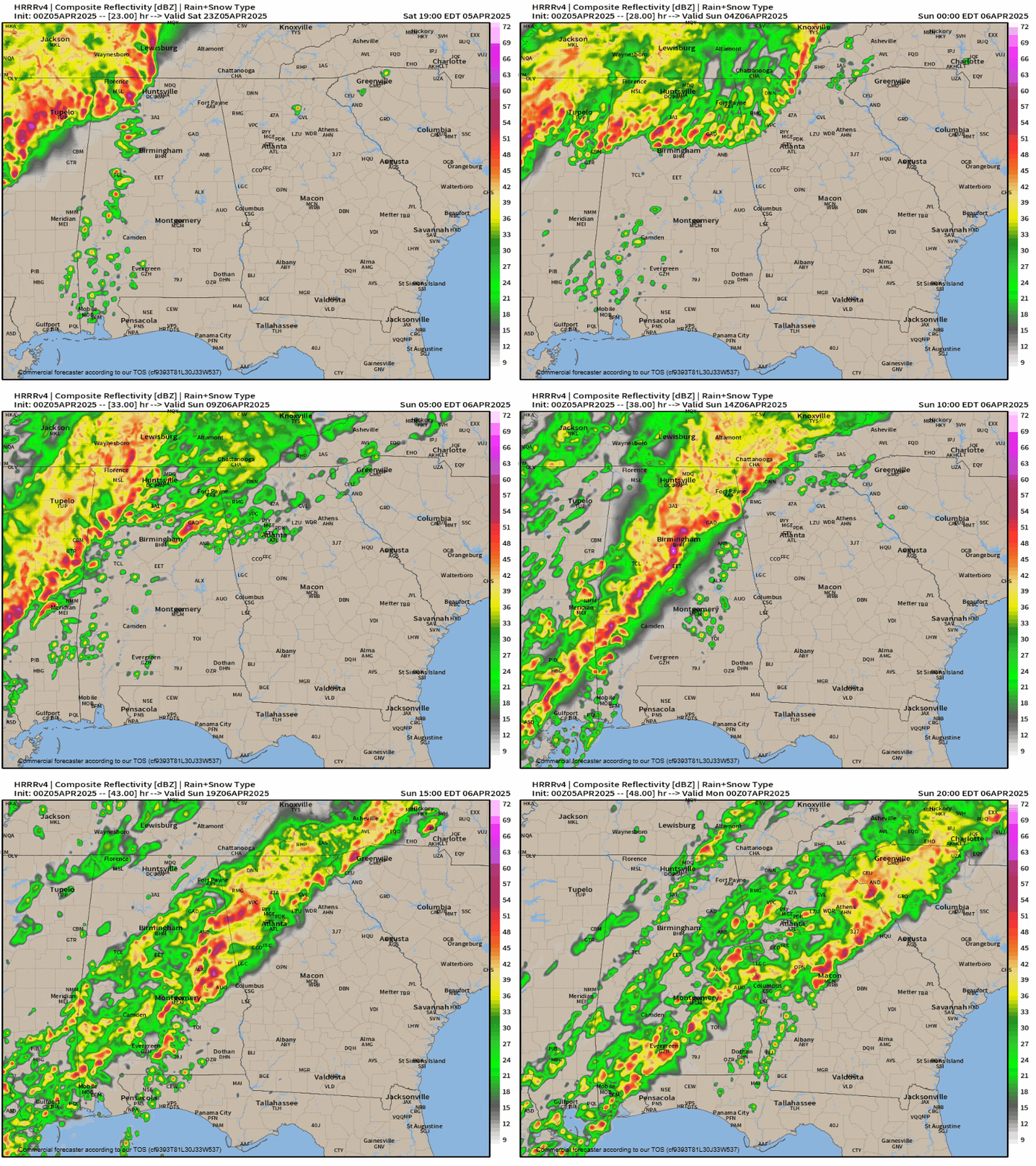
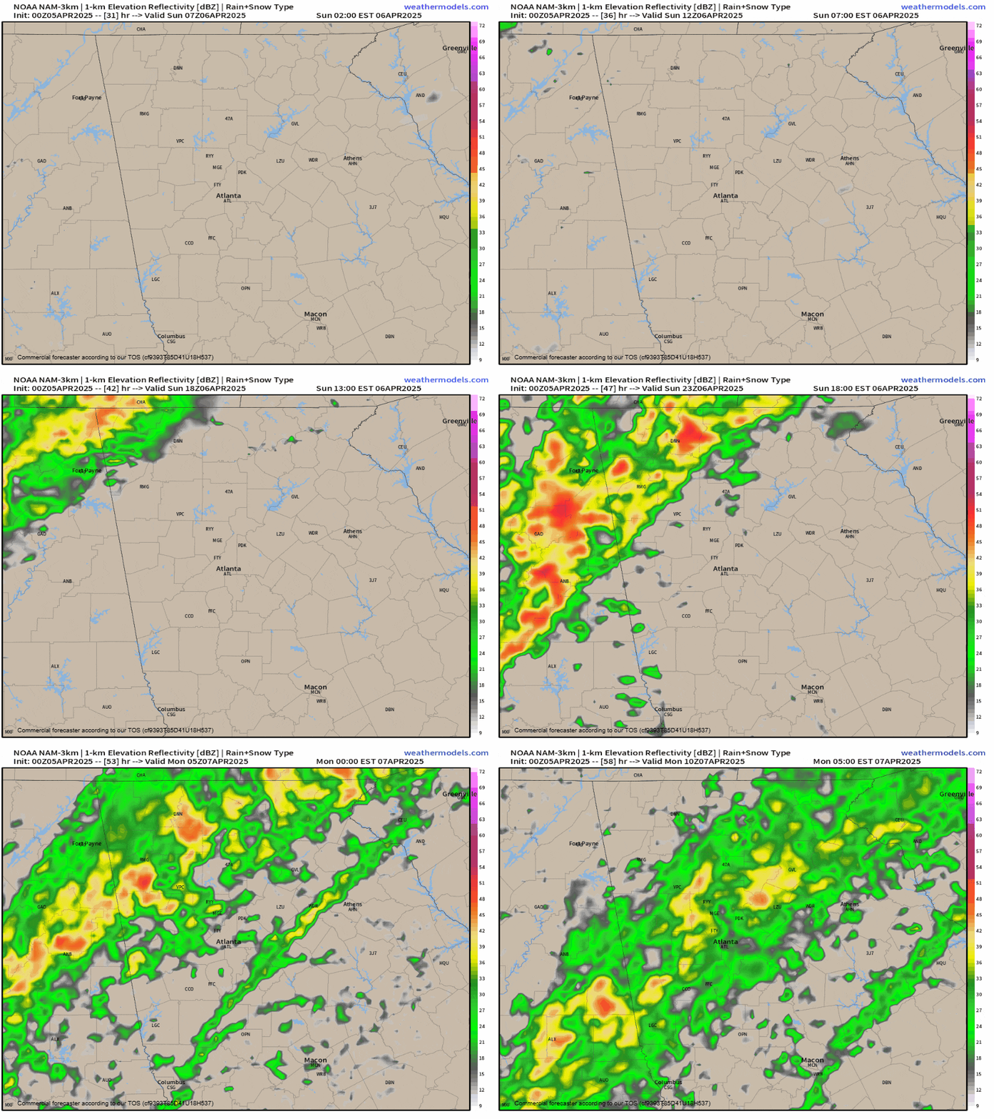
There are some fairly significant discrepancies in the latest runs of short range weather models in terms of timing. The latest HRRR, seen on the top below, shows a line of storms over Alabama actually making it into North Georgia in the wee hours of Sunday morning, with a second line coming through during the afternoon. Meanwhile, the NAM has no initial line and only the line during the afternoon. Overall, the HRRR is much faster with the main afternoon line of storms on Sunday arriving around 2-4PM vs 8-10PM on the NAM.
The biggest threats from this system will be damaging winds and small hail, although an an isolated tornado can’t be ruled out.
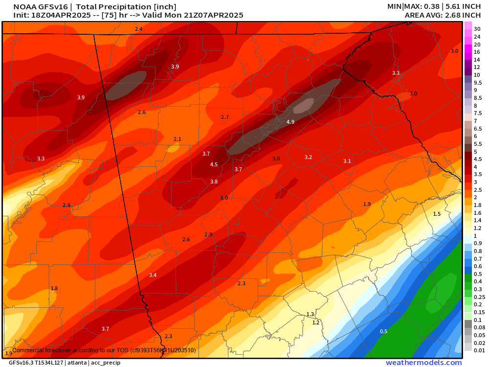
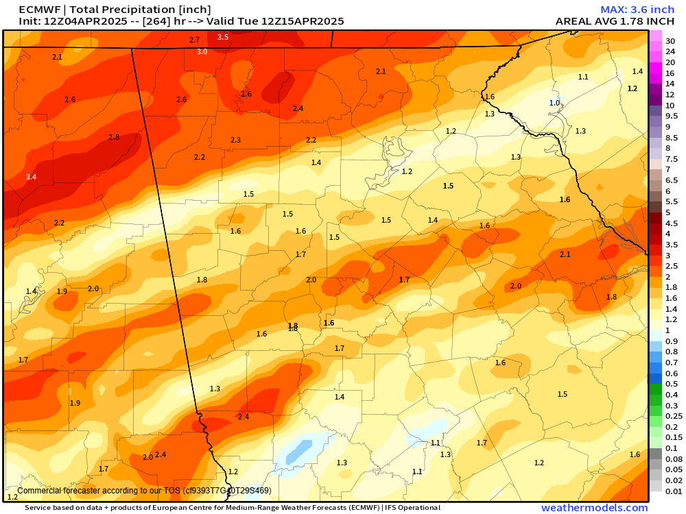
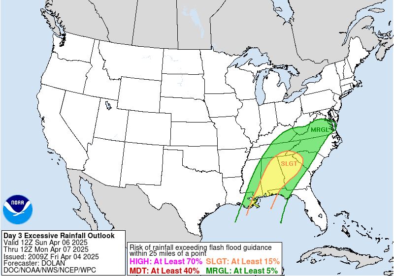
In addition, there is growing concern for heavy rains and flooding with this system as the line of storms briefly stalls out or moves very slowly overhead. The latest models show potential for 2-5″ of rainfall across the region which has prompted the Weather Prediction Center to also place us under a slight risk for excessive rainfall.
However, once again there is considerable differences between weather models. The GFS on the left below shows the higher totals of 3-5″ with the Euro on the right only showing 1-2″.
This is somewhat unusual to see such big model differences less than 48 hours from an event beginning, but this is a very strong system so it isn’t entirely surprising.
Behind the front we will turn much colder with highs on Monday and Tuesday only in the 60s and a chance for some frost/freeze conditions on Tuesday night.
Stay with Now Habersham for the latest on this developing threat.

