
A Flood Watch remains in effect from through Monday evening for Banks, Barrow, Bartow, Butts, Carroll, Catoosa, Chattooga, Chattahoochee, Cherokee, Clarke, Clayton, Cobb, Coweta, Dade, Dawson, DeKalb, Douglas, Fannin, Fayette, Floyd, Forsyth, Franklin, Gilmer, Gordon, Greene, Gwinnett, Hall, Haralson, Harris, Heard, Henry, Jackson, Jasper, Lamar, Lumpkin, Madison, Meriwether, Monroe, Morgan, Murray, Muscogee, Newton, North Fulton, Oconee, Oglethorpe, Paulding, Pickens, Pike, Polk, Putnam, Rockdale, South Fulton, Spalding, Talbot, Towns, Troup, Union, Upson, Walker, Walton, White, and Whitfield Counties.
Despite some strong winds with the initial band of storms early Sunday morning the region came through mostly unscathed by the stronger storms. Heavy rain will continue on and off for much of the region through Monday evening before finally coming to an end sometime around 6-8PM Monday.
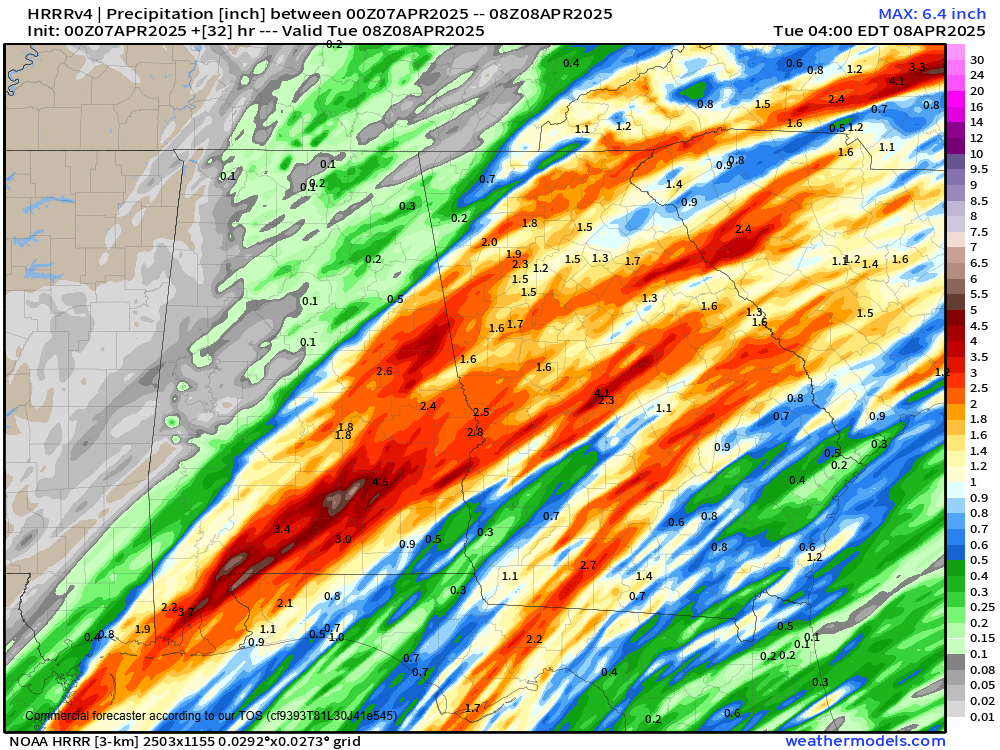
A “hose” of moisture riding up the front from the Gulf of Mexico will allow an additional 1-3″ to fall on the already 1-3″ we have seen already. This could lead to additional flooding concerns before we dry out Monday night.
Winds will turn blustery from the northwest behind the front Monday night with a frost/freeze likely by Wednesday morning.


