")
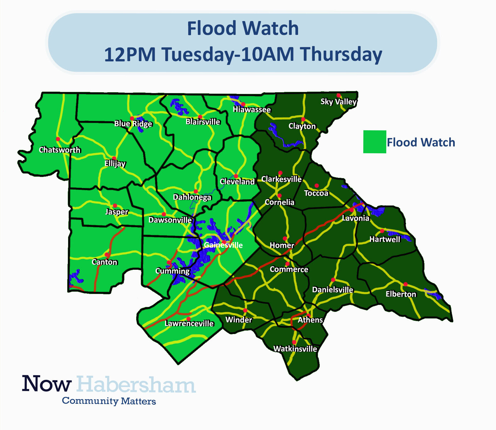
A Flood Watch remains in effect for much of North Georgia as heavy rain continues to fall.
The Flood Watch will run through Thursday morning for Bartow, Catoosa, Chattooga, Cherokee, Cobb, Dade, Dawson, Fannin, Floyd, Forsyth, Gilmer, Gordon, Hall, Haralson, Lumpkin, Murray, North Fulton, Paulding, Pickens, Polk, Walker, White, Whitfield, Union, and Towns Counties.
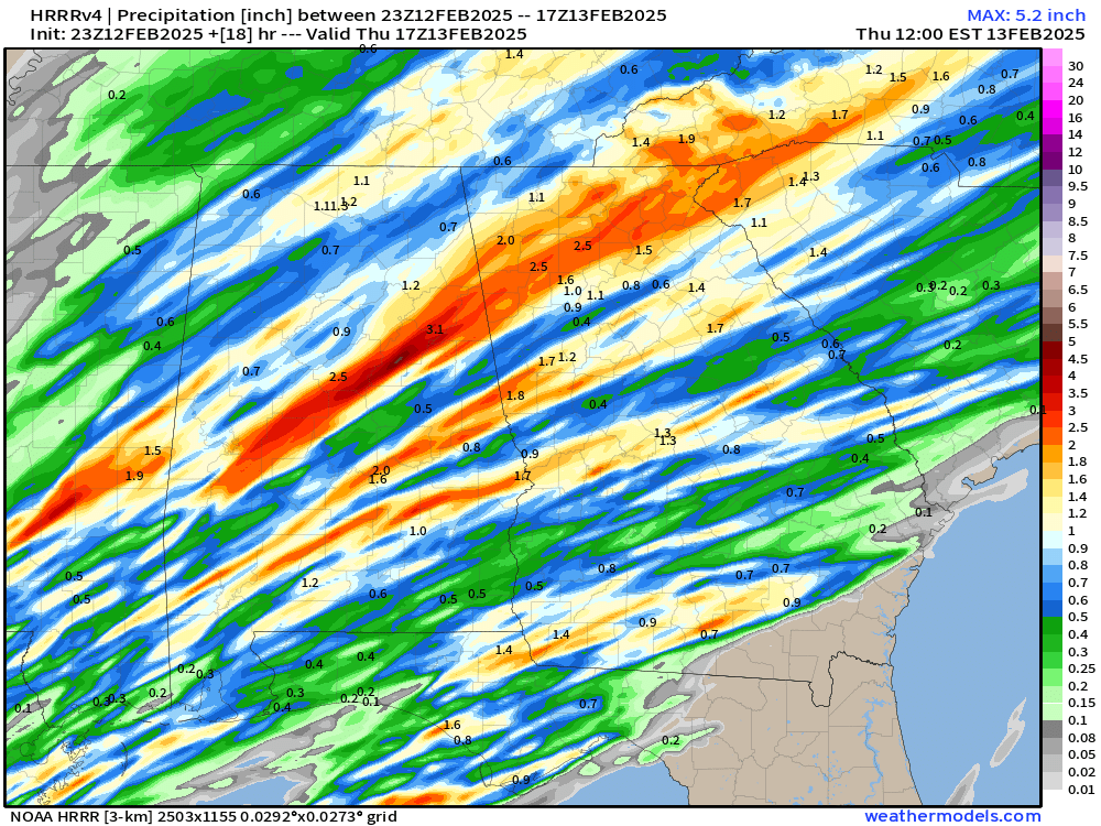
Storm totals of 2-3″ have fallen with some areas receiving as much as 3.5″ already. An additional 1-3″ are likely over the next 6-10 hours. As you can see below the potential for an additional 3″ is highest in a band stretching through Dawson, Lumpkin, White, Forsyth, Hall, Banks and Habersham Counties. Flooding will become a much bigger concern in these areas overnight so stay weather aware. The Soque is expected to peak well into minor flood stage around 6 a.m. Thursday morning. The Chattahoochee and Chestatee are both expected to remain below flood stage.
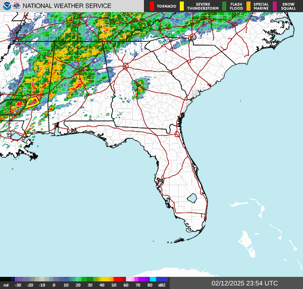
A large area of storms is currently ongoing with numerous tornado and severe storm warnings over parts of Alabama and Mississippi. This area of heavy rainfall will move through North Georgia later tonight. The heaviest rain is expected to come from 10 p.m. tonight through 6 a.m. on Thursday morning. Showers and any rogue thunder should come to an end by 7 a.m. Thursday.
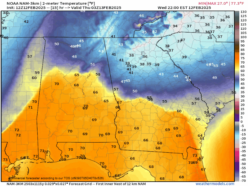
During the overnight hours the wedge of cool air is expected to weaken slightly but likely not entirely before the front arrives early Thursday. That said, highs on Thursday will still be considerably warmer than today with mid-50s expected southeast of the mountains and mid/upper-40s for the NC border counties.
Overnight Thursday we will return to below freezing for the first time in a couple weeks, although we will remain dry through Friday. Another very strong cold front is expected to bring a risk of showers and thunderstorms this weekend. Unfortunately, another wedge of cold air is expected ahead of this system on Saturday with a very similar weather day to today likely. Additional heavy rains are possible Saturday night which could result in more isolated flooding concerns. An isolated strong storm will also be possible, mainly south and west of I-85/I-75.


