")
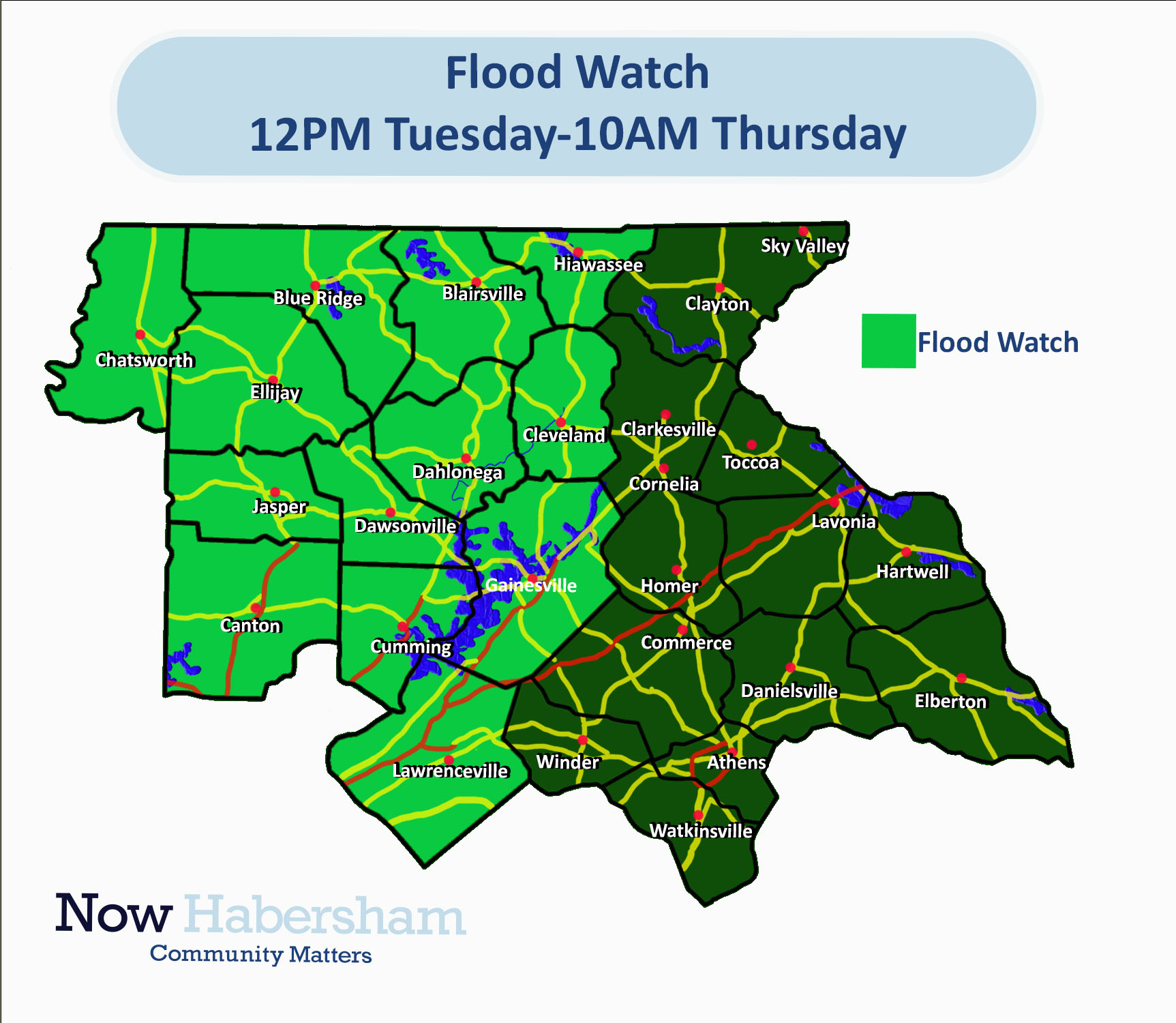
A Flood Watch remains in effect for much of North Georgia.
A Flood Watch is in effect through Thursday morning for Bartow, Catoosa, Chattooga, Cherokee, Cobb, Dade, Dawson, Fannin, Floyd, Forsyth, Gilmer, Gordon, Hall, Haralson, Lumpkin, Murray, North Fulton, Paulding, Pickens, Polk, Walker, White, Whitfield, Union, and Towns Counties.
Wednesday saw 1/4-1/2″ fall across most of the region with a few areas picking up just a bit more than that. Heavier rain is expected on Wednesday as a cold front approaches. A wedge of cool air will continue to keep temperatures only around 40 for most of the day.
Total rainfall from Wednesday night through Thursday morning is expected to fall in the 2-4″ range.
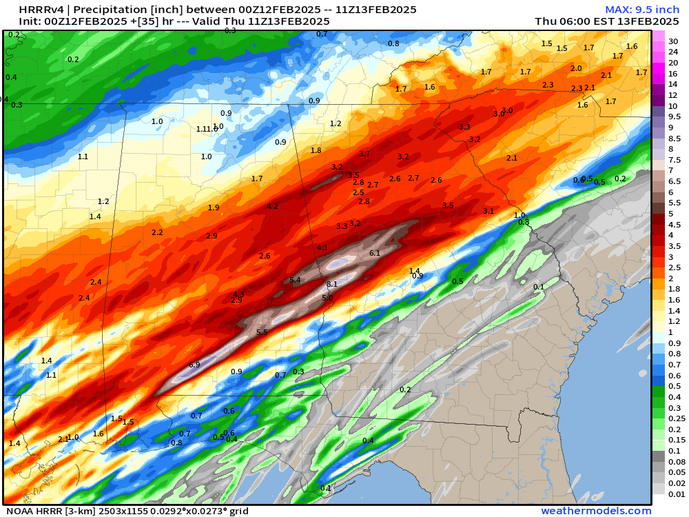
The heaviest rains are expected to come between noon and midnight on Wednesday. Simulated radar at the top of this post shows what you can expect from midnight Wednesday through 8 a.m. Thursday morning.
Stay weather aware and alert for any flood warnings that are issued, particularly though the afternoon and overnight.


