We are in the throes of a long dry pattern with no real end in sight, and this week a much colder airmass will invade bringing us our first frost risk.
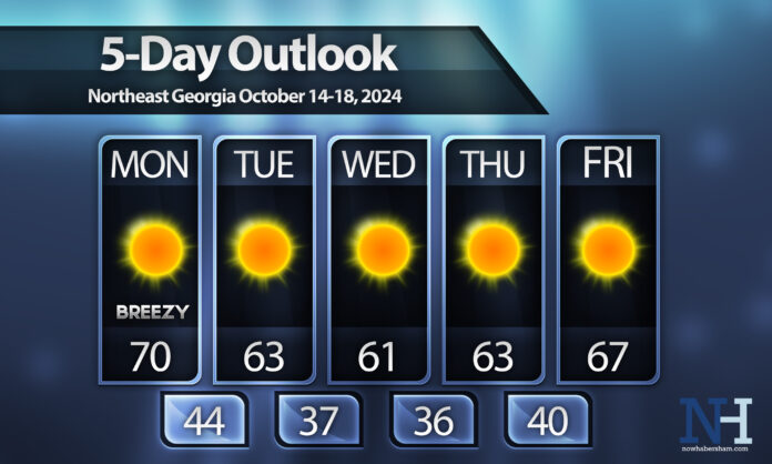
Expect plentiful sunshine for your Columbus Day Monday. A dry front will pass through turning winds to the NW and it will be a bit breezy with winds gusting to 20 m.p.h.
Monday night we will see temperatures plummet well into the 40s region wide.
Tuesday, Wednesday and Thursday will all see extremely nice, seasonal temperatures with highs in the upper-50s in the mountains and low/mid-60s everywhere else. Overnight lows will dip into the 30s each night as well, the coldest we have been so far this season.
The higher elevations will likely see their first freeze on Wednesday night into Thursday morning, with everyone else seeing the first patchy frost of the season.
We’ll begin to moderate on Friday and into next weekend but remain quite seasonal.
Have a great week and stay warm!


