After a phenomenal run from tropical storm to Category 5 hurricane, Erin briefly stabilized Sunday into a formidable Category 3 storm. However, it re-intensified into a Category 4 with 140 mph maximum sustained winds late Monday.
Erin brought tropical storm conditions to the Turks and Caicos Islands on Monday where a Tropical Storm Warning was issued. A Tropical Storm Watch is in effect for the southeastern Bahamas. In addition, a Tropical Storm Watch has been issued for the Outer Banks of North Carolina. The storm has finally made a turn to the NW and will eventually be moving due north by Wednesday.
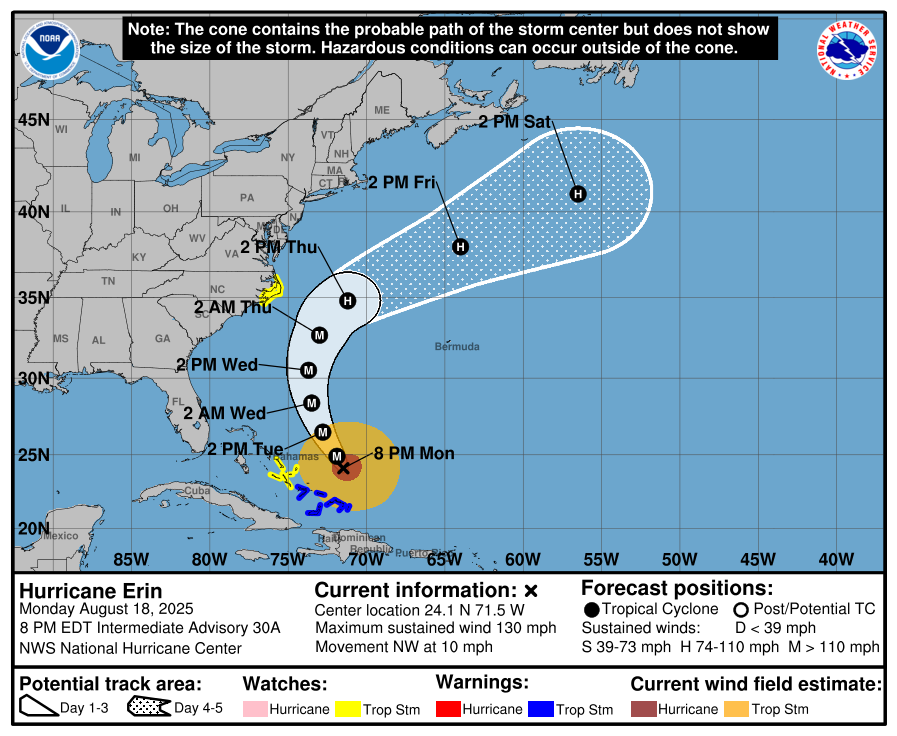
While the US will be spared most major effects, the eastern seaboard is in for a rough week. Waves of 5-10+ft are expected along most of the coast. The Outer Banks of North Carolina are expecting the worst, with some outer band thunderstorms likely by Wednesday, along with waves of 15-20ft possible.
Dare County, NC, has issued a State of Emergency with mandatory evacuations of Zone A of Hatteras Island in effect. This zone includes all of Hatteras Island, including the villages of Rodanthe, Waves, Salvo, Avon, Buxton, Frisco, and Hatteras.
Several days of heavy surf, high winds, and waves could wash out parts of N.C. Highway 12 running along the barrier islands, the National Weather Service said.
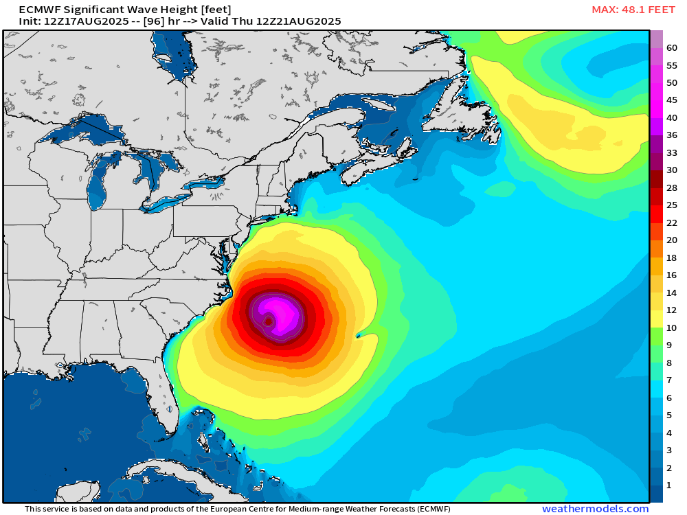
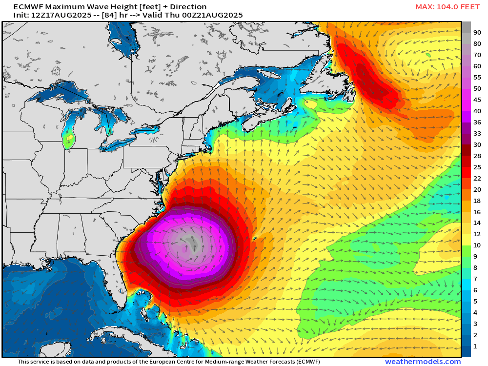
Maximum wave heights over the open Atlantic between the US and Bermuda are expected to be extremely significant. The Euro model is forecasting maximum waves of over 100ft in the northeast quadrant of the storm late Wednesday. Maximum waves in the Outer Banks could exceed 20-25ft on Wednesday night as the storm passes offshore.
If you have plans at beaches along the East Coast this week, pay close attention to forecasts and expect rough surf and plenty of rip currents.


