Unfortunately Francine did not result in any significant rainfall over the region although many people did see up to a half inch.
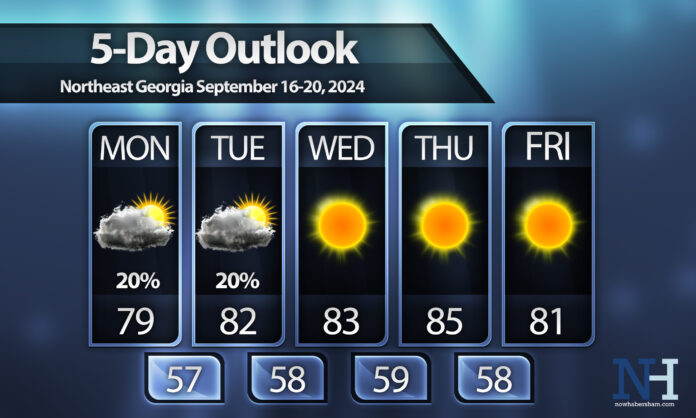
This week will also be unfortunate with limited rainfall in the forecast for the next 5-7 days at least. A weak tropical or subtropical system is expected to quickly develop off the coast today and make landfall on Monday. It is unlikely to reach even depression status, but regardless will bring some beneficial rain to places that are not North Georgia. It will push inland bringing rain to North Carolina and points north but right now is appears we will see only an extremely isolated shower as the circulation moves northeast on Monday into early Tuesday. We will see partly to mostly cloudy skies as it moves nearby, though, which will help to keep highs in the 70s on Monday.
Starting Tuesday a much warmer airmass is expected to work in in the wake of this system. Temperatures will return to the 80s with sunshine dominating through the end of the week. By Friday a wedge of cooler air may move down the Appalachians helping cool us off just a tad but it is too early to say for sure.
Have a great week and everybody do their rain dance!


