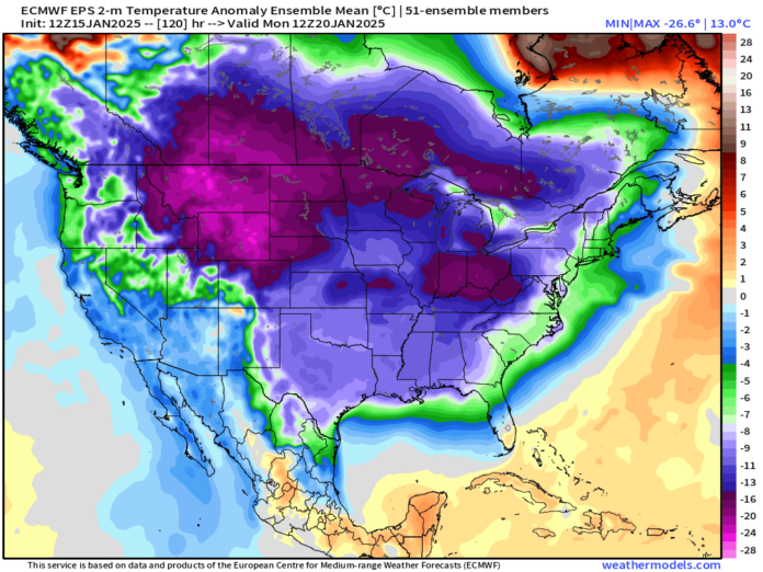
As Marty said in Back to the Future: “Hey! I’ve seen this one!” Another round of cold and potential snow lurks just past this weekend.
We remain in a very active pattern, although it will warm up just a tad over the next few days. Highs are expected to reach back into the low/mid-50s on Thursday and Friday afternoon. A major cold front will move through this weekend, ushering in another round of cold air, this time likely even colder than the last.
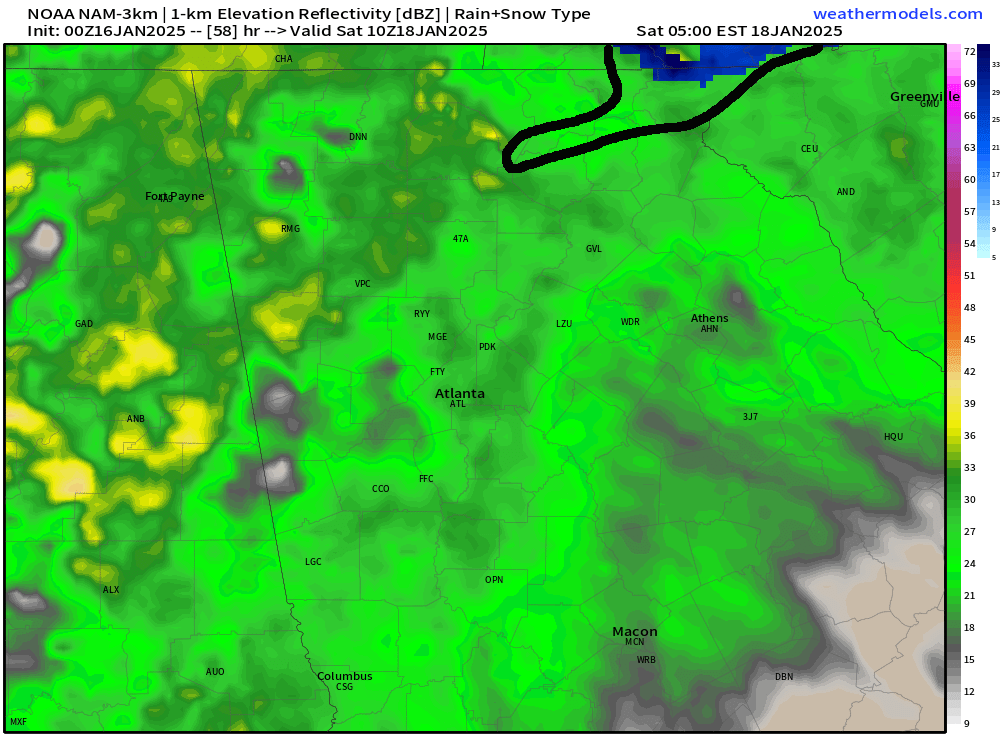
This weekend’s cold front actually brings a risk for some brief snow at the higher elevations of the mountains. Upper level temperatures will be below freezing as precipitation begins early Saturday morning. There will be a brief window where some of the precip could begin as snow, particularly across the northern reaches of Rabun County into southwest NC.
Some snowflakes could fall farther south, possibly even over Towns, Habersham, and White Counties, but it would most likely be brief, and no accumulation is expected with surface temperatures in the upper 30s.
The best chance will be from 4 to 7 a.m. in the area circled below.
Otherwise, this weekend looks fairly miserable, with occasional rain and highs only in the 40s. By Tuesday, 40 would feel like a warm summer’s day.
The image below shows what is happening next week.
You’ve probably heard talk of the “strong polar vortex” visiting the U.S. next week, but that is not the case. The polar vortex stays locked up near the Arctic Circle. It only “visits” us when it weakens and allows cold air to drop south.
The animation below shows a piece of the “polar vortex” breaking off over Hudson Bay, Canada and it allows the big U-shaped trough to drop into the U.S.
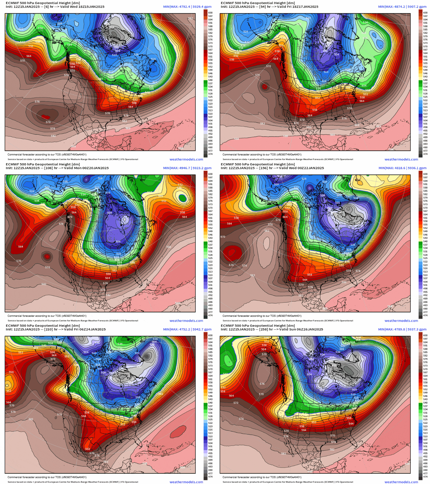
If it looks like a lot is going on in that map it’s because there is. Regardless of any snow potential, which we will get to momentarily, it will be cold.
Below is the animation of temperature departures from the average on Friday to Friday week. Most of our region gets as much as 15-25 degrees below normal, particularly Monday through Wednesday. It will be a cold start to the week.
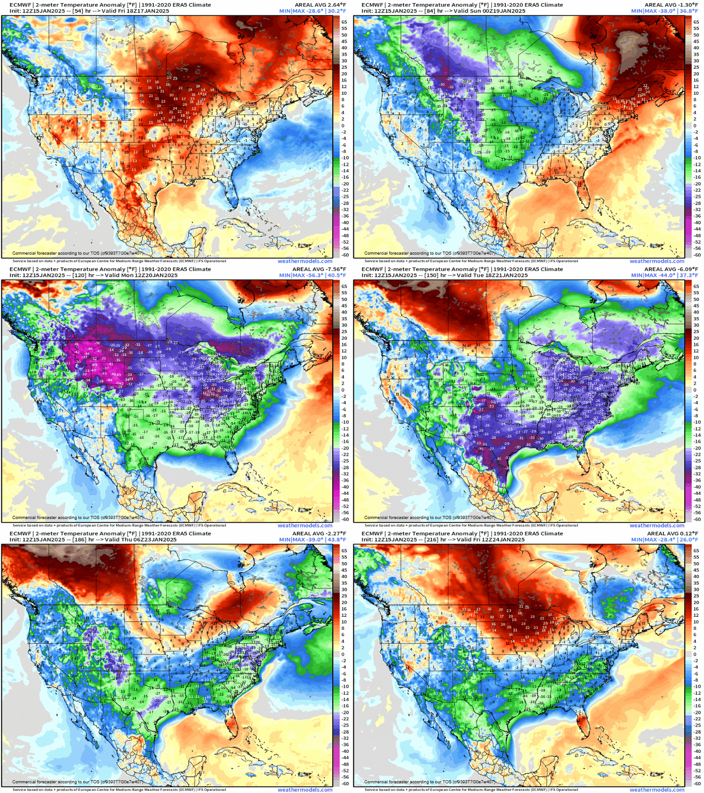
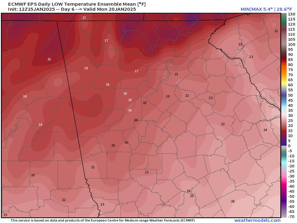
Lows Monday morning behind the front are expected to drop well into the low teens or single digits for the mountains, with everyone else in the mid-10s to low-20s.
More impressively, highs likely will not rise above freezing for much of Northeast Georgia from Monday through at least Wednesday.
The image below shows lows on Monday morning from the Euro Ensemble model.
The cold air will really settle in on Tuesday, but the big trough I talked about at the beginning will begin to weaken/pull away ever so slightly. This is the time when we could see our next winter storm.
If you recall from our last storm, anything past 5 days is a bit of a blindfolded darts game, but there are things we can look at to get an idea. The ensembles, or the many different solutions each weather model produces, are the best places to start.
The image below shows the chances of 1″ of snow between now and next Friday. As you can see, there is a pretty high chance for the mountains and a very large area where roughly 50% of the potential outcomes include 1″ of snow. That is a pretty impressive agreement at this stage.
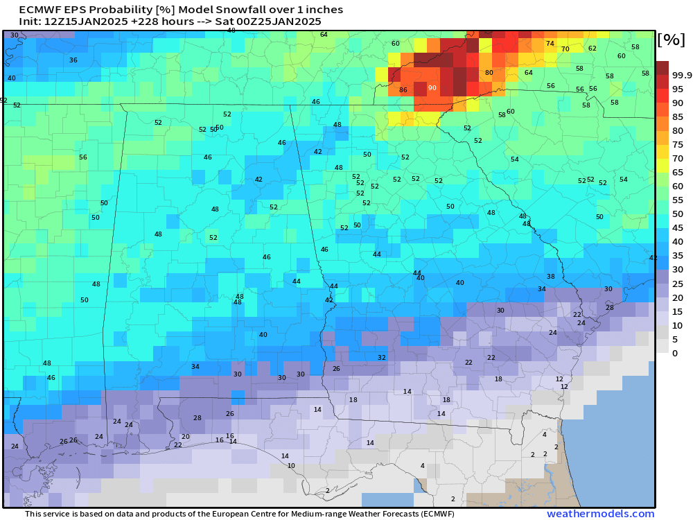
That said, while the agreement is impressive, it doesn’t mean anything if it doesn’t continue. Timing is still very much up in the air as well. These same ensembles have the highest chance of that 1″ coming on Tuesday night into Wednesday morning, but that could very easily adjust to anytime from Wednesday through Friday.
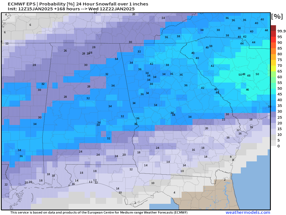
So, while it will almost certainly be cold, winter weather remains impossible to predict this far out.
Stay away from social media “forecasters” just looking for attention, and stick with Now Habersham for the latest realistic look at the upcoming weather pattern.


