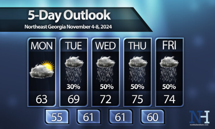
After an extended dry period a much more complicated forecast lies ahead for the first full week of November.
Expect Monday to remain dry although a stiff east wind of 10-20 m.p.h. will continue as we remain thoroughly in the clutches of a strong wedge. This high pressure to our northeast will scoot out to sea by Tuesday shifting our wind direction to the south/southeast and sending more moisture into the region.
An approaching front from the west will also play a roll in getting more moisture here so expect some isolated showers on Tuesday and a bit more widespread stuff by Wednesday.
The forecast from Wednesday night onward is heavily dependent on what happens with a tropical system currently sitting over the extreme southern Caribbean Sea. Models keep the storm generally weak, reaching low-end hurricane at most, before it begins interacting with the front. That interaction will determine how much rain we see on Thursday and Friday. If the storm makes it a little further north we will see more rain, but if it gets trapped further south whatever remains of it will likely push back towards Texas on Thursday/Friday.
Stay tuned for the latest!


