An active weather pattern will result in bitter cold temperatures invading the southeastern US early next week.
First up, we have a pair of cold fronts expected to impact the region over the weekend. The first will come as a low pressure system develops over the far southeast or just out in the Atlantic. This will bring widespread showers to the region on Saturday, especially during the first half of the day.
RELATED:
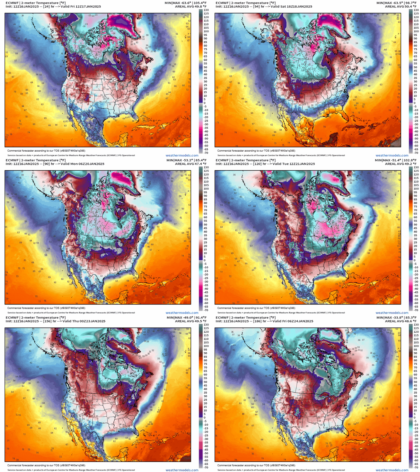
A second low pressure system will get going along the edge of an approaching trough. This is all thanks to the dreaded “polar vortex” weakening and allowing some cold air to spill south. The animation below shows this as the cold temperatures in Canada stretch south through next week.
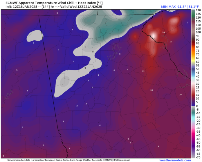
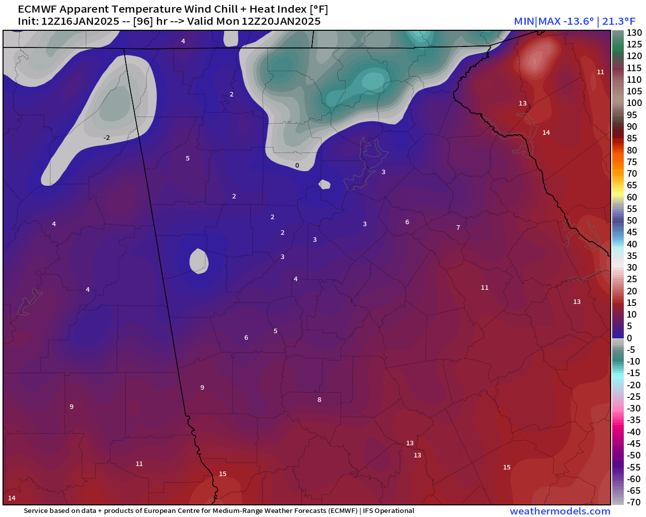
Bitterly cold air will move into our area beginning Sunday night. Overnight lows on Monday morning are expected to reach well into the teens. The mountains could dip into the single digits. Wind chill values will reach at least single digits if not zero or below over a big portion of the region as well as seen below. Parts of Fannin, Towns, Union and Rabun could see wind chill values dip as low as 10 to 15 below zero by sunrise Monday.
Highs on Monday will barely break the freezing mark (if we even get there) before plunging again. Tuesday morning will be a tad warmer with lows only in the upper teens for most of the region. The only exception will be the higher elevations where low to mid teens are likely. However, Tuesday afternoon won’t be any warmer with highs likely reaching only freezing.
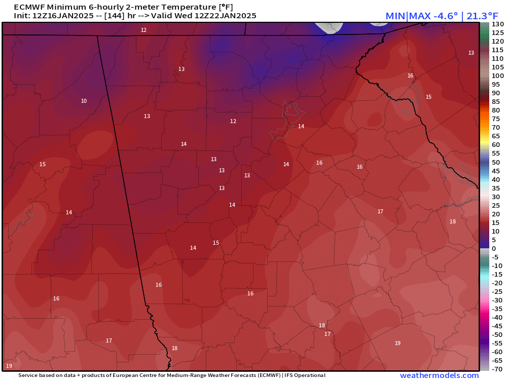
A reinforcing shot of cold air will arrive by Wednesday morning dropping us to perhaps the coldest morning of the week. This time widespread upper single digits or low teens are likely. There is a chance this will moderate some with time, but models have been pretty well set on this cold blast being quite a bit stronger than the last.
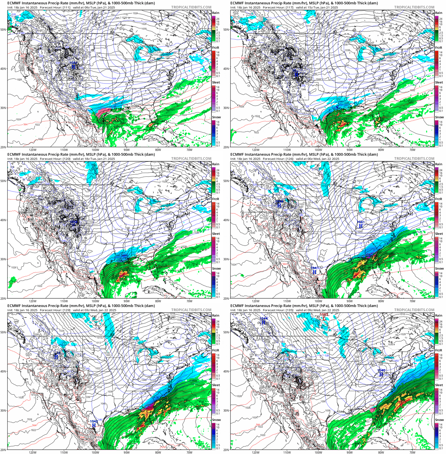
Unfortunately this extreme cold blast could result in a bit of an oxymoron for us: too cold to snow. The trend on the models today has been much less agreement on any potential storm for next week, and the ones that do have moved it south a little. This press of cold air is so strong it may force any storm that develops to remain down over Florida or well out to sea. I’ve included an animation that shows the further south storm track below. If this comes to fruition any snowfall would come well to our south over areas that are certainly not used to it.
However as I have said many times before, anything past 5 days is a blind-folded darts game. The ensembles are where I put my trust, although they also paint a less prettier picture than we saw yesterday. The percentage of ensemble members with 1″ of snow through next Friday is below. Ignore the large area of high percentages over far North Georgia, this is due to the model probably handling the Saturday morning snow potential poorly. Outside of that, the percent of members in our favor has dropped from the 50% range yesterday to only 25%.
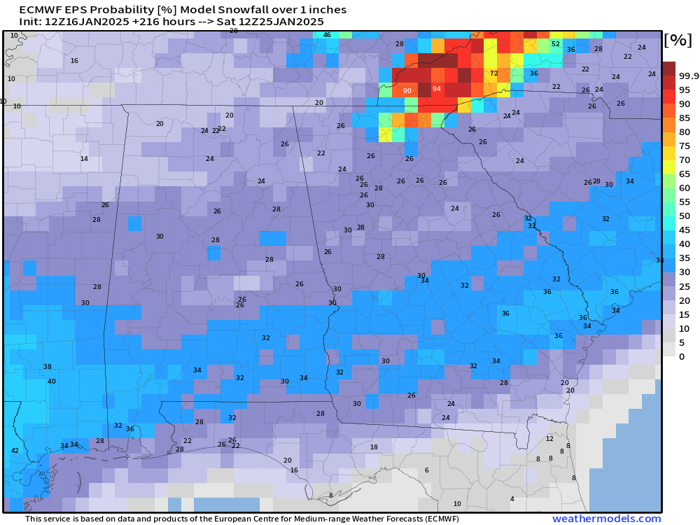
This certainly doesn’t mean things can’t swing our way, but it is just the trend we have seen recently. Generally, storms tend to drift northwest with time on weather models so we will have to see if that trend holds true this time. If so, we could be in a much better spot. Timing has been a bit better nailed down with the majority of models keying in on the Tuesday/Wednesday timeframe.
Stick with Now Habersham for the latest on the bitter cold and any potential snow or wintry weather!


