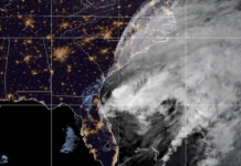
A hung up front will dominate our weather for the first half of this week.
Several small disturbances will ride across the northern part of the country Monday-Wednesday as a series of fronts get hung up to our north. We should remain dry on Monday but plentiful clouds will stick around. The remnants of Sunday’s wedge will keep highs down into the 50s for most of the region.
Tuesday and Wednesday will see a stark warm-up with widespread 60s returning. Isolated showers are possible on Tuesday but more widespread showers are likely on Wednesday as a front is finally pushed through thanks to a low pressure system over the Great Lakes. Heavy rain is not a concern with this front. In fact, rain totals should be largely very light.
The front will clear the clouds out and drop our temperatures closer to normal for almost-Christmas with highs in the 50s and overnight lows dipping back to near freezing.
A reinforcing shot of cooler air may bring some very isolated showers overnight Thursday but they would be in and out before daybreak on Friday.
Also, despite all the talk on social media this week there are currently no weather models showing any snow between now and the holiday.
Have a great week!


