Everything remains on track for a significant winter storm to impact North Georgia on Friday and Friday night.
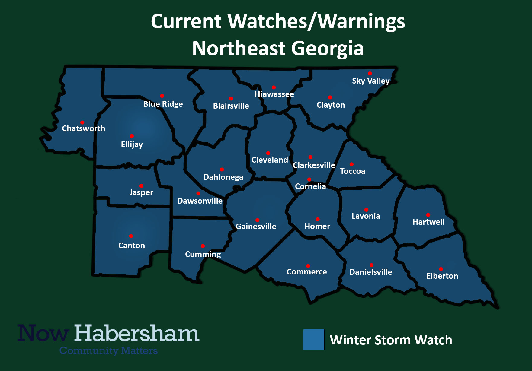
A Winter Storm Watch is now in effect for all of North Georgia from 7 a.m. Friday through 7 a.m. Saturday. The watch area is expecting a variety of conditions depending on where you live. Those further north are expecting more snow while further south a mix of sleet and freezing rain are likely.
We are a little under 48 hours from the onset of precipitation and there are still many questions that likely won’t be answered until tomorrow (or even Friday). The biggest question mark lies in how much precipitation falls as snow versus sleet or freezing rain. The animation below shows the most recent from the high-resolution North American Model (NAM). We are expecting to see precipitation begin as snow across all of North Georgia including the Atlanta Metro area before the transition begins. Snow is still on track to start between 9 a.m. to 12 p.m. with a gradual increase in intensity from the west.
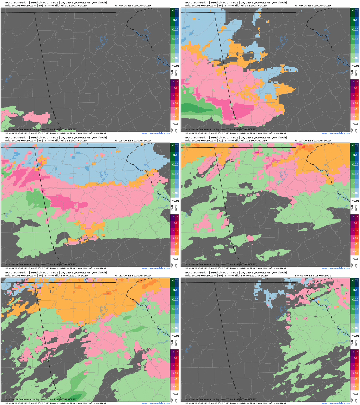
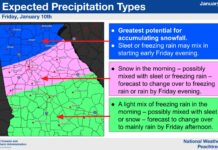
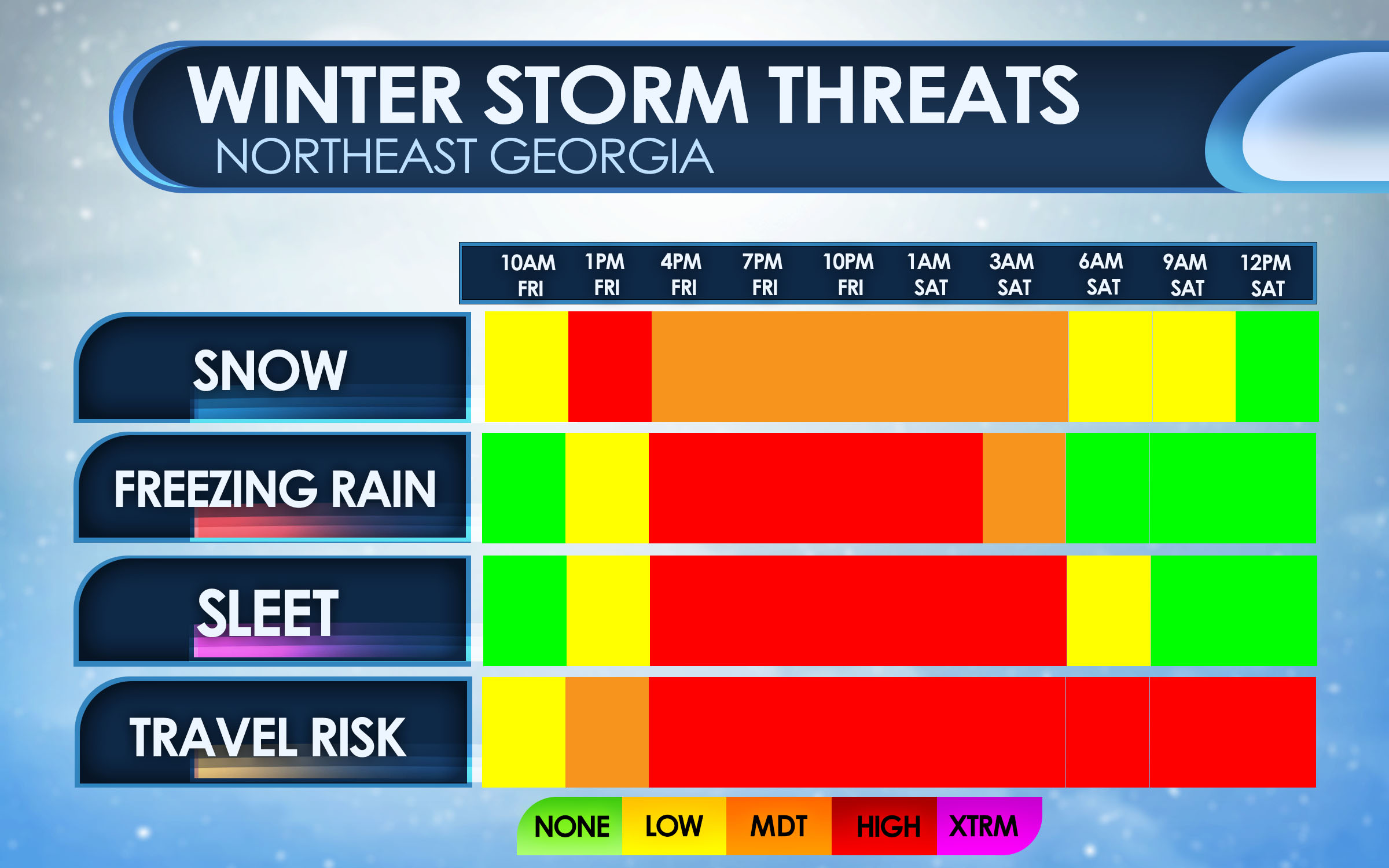
Later on, as warm air above the surface moves in from the south a changeover to a sleet/snow and eventually sleet/freezing rain mix are likely to occur across a big portion of the region. There is still considerable uncertainty in exactly where or when this change will take place, but I am hedging my bets towards the change taking place during the evening hours between 4-8 p.m. Precipitation will continue overnight before gradually tapering off. The latest threat levels and timing are below. These will likely change tomorrow as confidence in any potential switch grows.
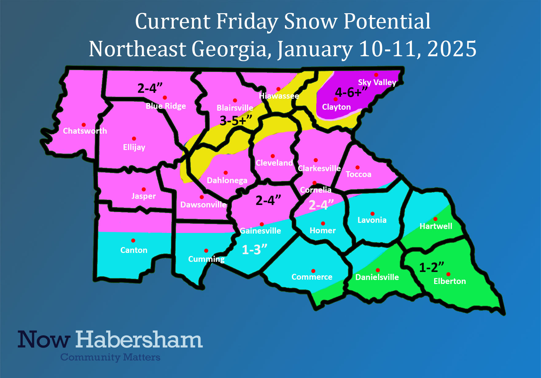
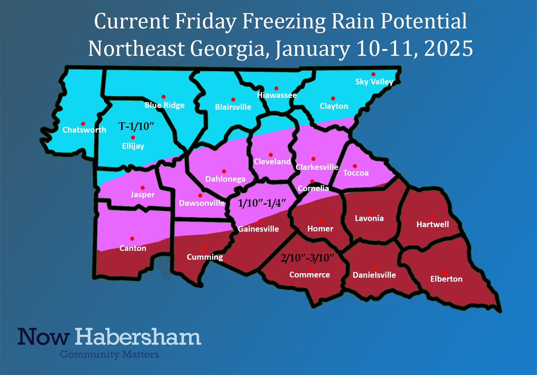
As far as expected accumulations go I have included forecast maps below. A large portion of the area should receive 2-4″ of snowfall before the precip changes over. After that, 1/2-1″ of sleet and anywhere from a trace to 3/10″ of freezing rain are possible.
This remains a fluid situation. For more information check out the video posted to Facebook earlier today.
Stay with Now Habersham for the latest on this storm!


