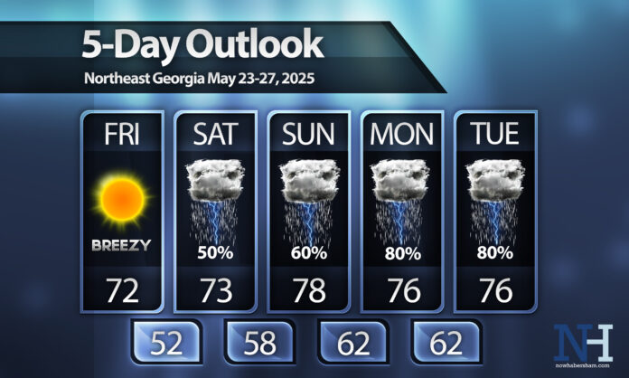
Despite the models consistently showing these dry spells, we can’t quite seem to get them to last as long as they appear early on. Unfortunately, there is growing confidence that showers and storms will return in force earlier than we originally expected.
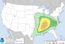
Saturday and Sunday will depend heavily on the development of mesoscale-convective-systems, or MCS, back to our west. The latest high resolution models have the first of these lines moving through the region around lunch on Saturday, with an additional line in the evening and another early Sunday. There will likely be a small severe risk with these cells, although there is currently no specific risk area for us currently.
The wet pattern looks to continue into the first of next week with widespread showers and storms expected both Monday and Tuesday. The only good news is the rain and clouds will keep us fairly cool only in the 70s each afternoon.


