
Hurricane Francine is currently making landfall over the central Louisiana coastline.
Francine strengthened quite a bit before landfall with current winds of around 100 m.p.h. and higher gusts. This makes it a Category 2 storm. Landfall is occurring between Dulac and Morgan City, LA. Deadly storm surge of up to 10 feet is ongoing in addition to the heavy rains and strong winds.
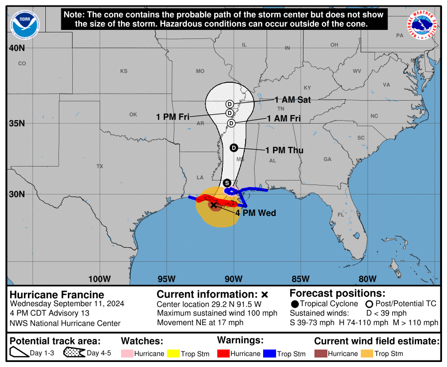
The center of the storm will move inland tonight and turn north where it will fizzle out near St. Louis. Heavy rainfall will occur in a corridor from the Gulf Coast north roughly over the Mississippi river.
Total rainfall amounts of 8-12″ are expected along the coast with widespread 4-8″ further inland. A large area of 2-4″ is likely over most of Mississippi and Alabama and into parts of Georgia. The latest models have backed off totals for us here in Northeast Georgia with only 1-2″ currently expected through Saturday.
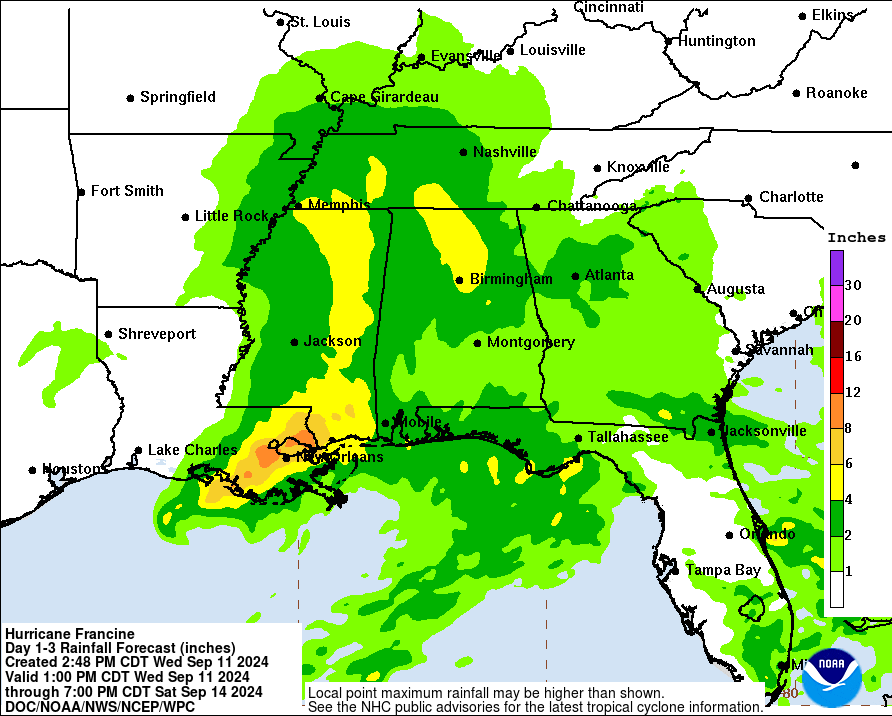
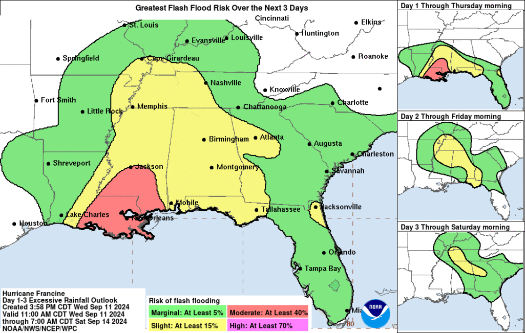
Because of this heavy rain threat the Weather Prediction Center has extended the slight risk for flash flooding into parts of Georgia but stays just to our south/west here in the mountains. This could change so stay tuned for any adjustments.
Stay with Now Habersham for the latest on any impacts we will see from Francine later in the week.


