
Dangerous heat will continue through Tuesday and into Wednesday across the region.
Beyond Wednesday we’ll begin to see a pattern shift that will eventually allow a significant cold front to move through by the weekend.
Widespread showers and storms, mainly during the afternoon, are likely from Wednesday through Saturday. A weak low pressure system is expected to develop over SC/NC on Friday and push to the east. In its wake this will allow a strong cold front to move in from the northeast putting us into a “wedge” pattern once again for the weekend.
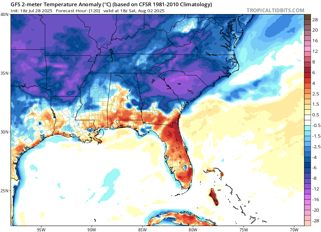
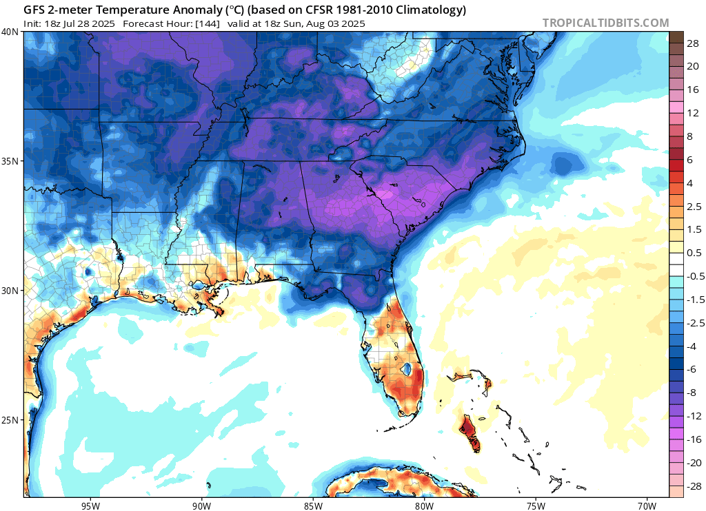
While widespread shower and storm activity is expected on Saturday as this wedge pushes into the state, temperatures will drop significantly. Both Saturday and Sunday are expected to see highs 10-20º below normal. You can see the departure from average on the images below for both Saturday and Sunday.
Winds will also turn breezy behind the front with a stiff east wind both days at 10-20MPH.
SEE ALSO
Dangerous heat continues Tuesday and Wednesday


